
1968 Map of Marland
USGS Topo · Published 1969About this map
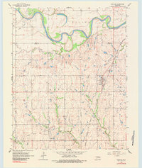
Marland and the nearby site of Old Bliss anchor this northern Oklahoma landscape during a period of active resource extraction. The region is defined by its energy infrastructure, notably the Three Sands Oil Field in the northwest and the South Ceres Oil Field to the southwest, punctuated by scattered gas wells and gravel pits. The Salt Fork Arkansas River meanders across the upper half of the sheet, creating prominent oxbows such as Horseshoe Lake as it flows through the Miller and Carson townships. Local transport and geography are dominated by the Atchison Topeka and Santa Fe railroad line, which runs north-south through the center of the survey. Significant local landmarks for genealogists include Cowboy Hill Cem and the distinctive Spindle Top Hill located just north of the Marland townsite.
Find a feature on this map
21 named features on this map. Tap any name to fly to it.
Don’t see what you’re looking for? This feature index may not catch every label — zoom into the map to look around manually.
Map Details
Editions of this 1968 Marland Map
2 editions found
Other maps of this area

1955 · Enid
USGS Topo · 1:250,000

1958 · Enid
USGS Topo · 1:250,000

1968 · Tonkawa SE
USGS Topo · 1:24,000

1968 · Ponca City NW
USGS Topo · 1:24,000

1968 · Ponca City SE
USGS Topo · 1:24,000

1968 · Tonkawa
USGS Topo · 1:24,000
1968 · Ponca City
USGS Topo · 1:24,000

1972 · Morrison NE
USGS Topo · 1:24,000

1972 · Red Rock
USGS Topo · 1:24,000

1972 · Ceres
USGS Topo · 1:24,000