2020s Maps of Nowata County, Oklahoma
Explore 16 historic maps of Nowata County from the 2020s. These maps offer a rare glimpse into what life looked like during the 2020s — showing old roads, neighborhoods, homes, and landmarks that have changed or disappeared over time.
Whether you're researching your family's past, planning a metal detecting trip, or studying how Nowata County's landscape evolved across the 2020s, these high-resolution maps are a powerful tool for exploring the history of this region.
- Focus on a specific era: All maps on this page are from the 2020s, giving you a focused view of this time period.
- See what’s changed: Compare century-old streets, trails, and buildings to today's modern landscape using overlays and satellite layers.
- Research with precision: Use these maps for genealogy, historical research, land use analysis, or educational projects.
- View, download, or print: Maps are fully viewable online in high resolution, and can be downloaded or printed for your own records.
Start exploring Nowata County's history through authentic maps from the 2020s. This is your window into the past.
Nowata County, OK maps
(16)- 2022 Map of Sanders, 2022 Print
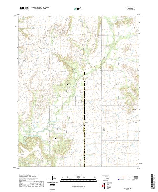 2022 Sanders2022 Print · USGSNortheastern Oklahoma land patterns are captured here in the early twenty-first century, showing the rural communities along the Nowata and Craig county line. Researchers can locate family burial sites at Sanders Cem and Martin Cem or trace the winding path of Big Creek through Blue Canyon.
 - 2022 Map of Oglesby, 2022 Print
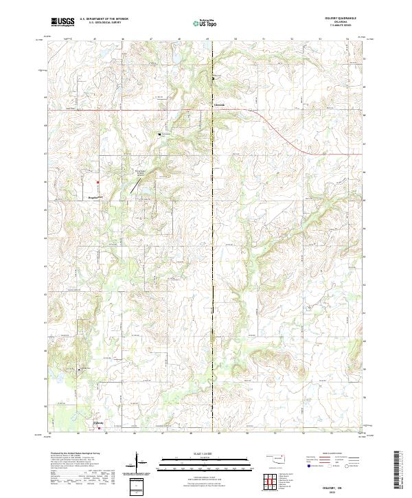 2022 Oglesby2022 Print · USGSThe borderlands of Washington and Nowata counties are shown here in the modern era, where rural life centers on the crossroads of Oglesby and Glenoak. Genealogists and historians can trace family ties at the Curleyhead Cem and Willey Cem or follow the paths of OILWELL ROADS through the hills.
 - 2022 Map of South Coffeyville, 2022 Print
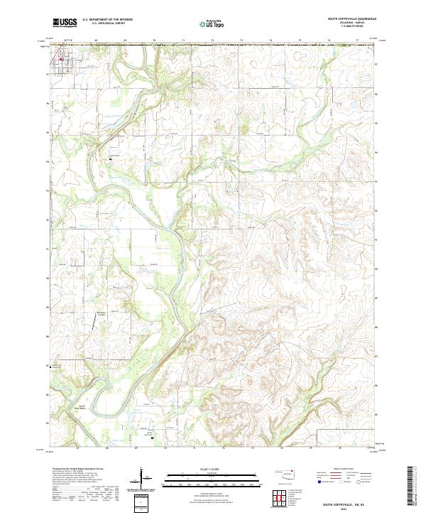 2022 South Coffeyville2022 Print · USGSNowata County’s river-bottom lands are documented here in the early twenty-first century, centered on the winding path of the Verdigris River. Genealogists and local researchers can locate rural landmarks like Melton Cem, Belleview Landing, and Goose Neck Cem.
 - 2022 Map of Chelsea, 2022 Print
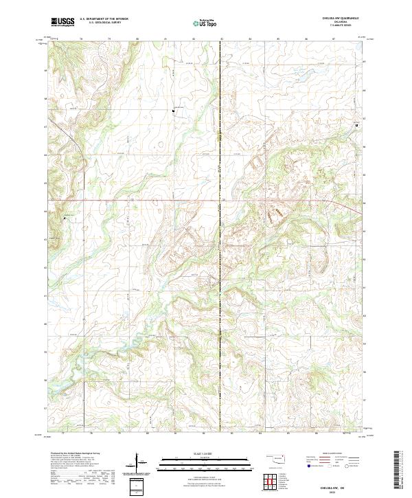
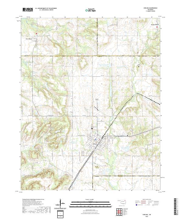 2022 Chelsea2022 Print · USGSNortheast Oklahoma in the early 2020s shows a landscape of established towns and managed water resources. Family historians and local researchers can trace the roads between Chelsea and New Alluwe, finding cemeteries like Shady Grove Cem and Snider Cem along the way.
 - 2022 Map of Nowata West, 2022 Print
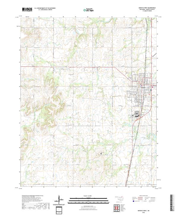 2022 Nowata West2022 Print · USGSThe town of Nowata and its surrounding rural sections are documented here during the early 2020s. Researchers can locate numerous historical burial sites, including the Armstrong - Journeycake Cem and the Nowata Memorial Cem.
 - 2022 Map of Childers, 2022 Print
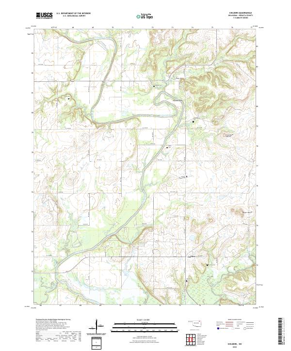 2022 Childers2022 Print · USGSNowata County’s river-carved landscape is documented here in the early twenty-first century, centered on the Verdigris River valley. Genealogists can locate several family burial sites including Goodtraveler Cem and Ball Cem near the community of Childers.
 - 2022 Map of Wann, 2022 Print
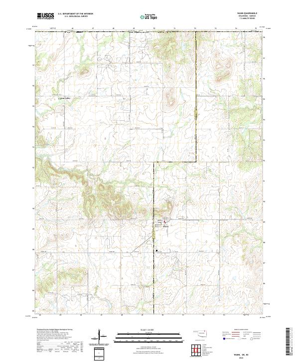 2022 Wann2022 Print · USGSOklahoma's northern borderlands come into focus in this recent survey of the region surrounding the Wann settlement. Researchers can trace local landmarks and family connections at Patrick Cem or explore the rural routes through Cotton Valley.
 - 2022 Map of Bartlesville SE, 2022 Print
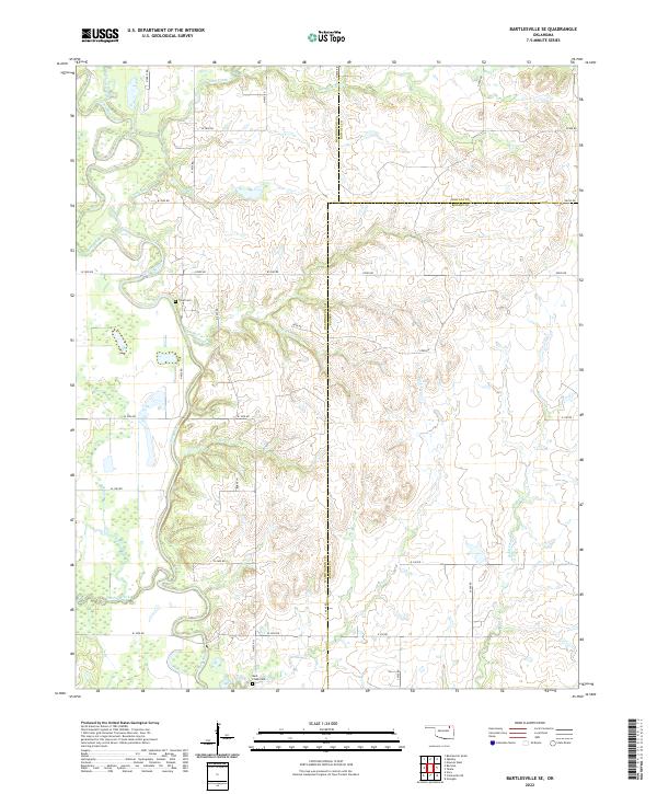 2022 Bartlesville SE2022 Print · USGSThe rural borders of Washington, Nowata, and Rogers counties are captured here in the early twenty-first century. Genealogists and local researchers can locate family-named sites like Tyner Cem and Buck Creek Cem along the Caney River valley.
 - 2022 Map of Chelsea NW, 2022 Print
 2022 Chelsea NW2022 Print · USGSThe Nowata and Craig county line comes alive in the early twenty-first century, showing a landscape of rural family homesteads and prairie creeks. Researchers can locate ancestral burial sites like McMains Cem and Nix Cem or trace the winding course of Lightning Creek.
 - 2022 Map of Talala, 2022 Print
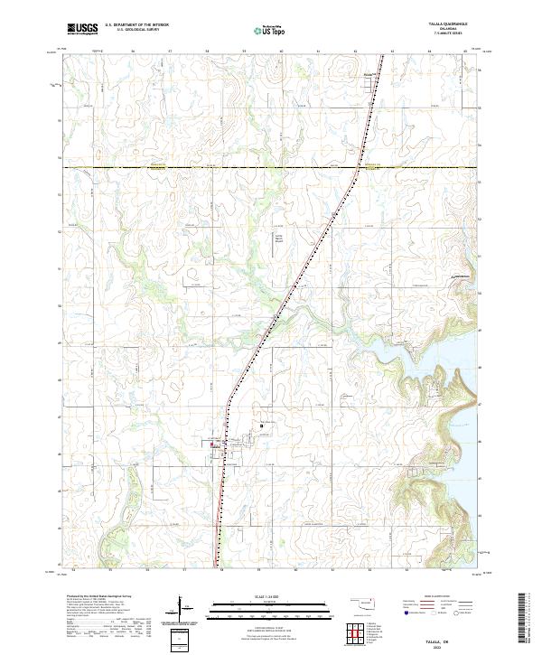 2022 Talala2022 Print · USGSThe borderlands of Rogers and Nowata counties come into focus in the early twenty-first century, showing a landscape shaped by local creeks and lakeside developments. Genealogists and local historians can trace family sites near Talala, the Fair View Cem, and the shores of Oologah Lake.
 - 2022 Map of Elliott, 2022 Print
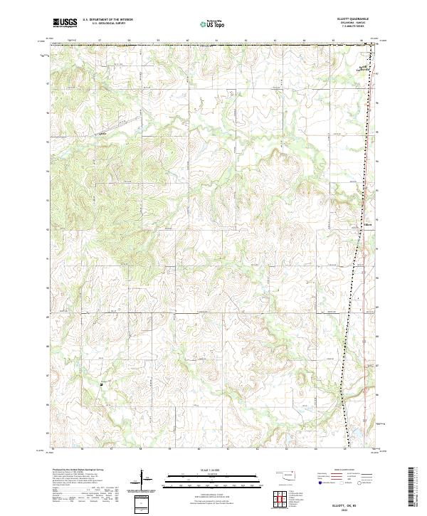 2022 Elliott2022 Print · USGSNorthern Oklahoma's borderlands come into focus in this contemporary survey of the area around South Coffeyville. Researchers can trace the path of Hickory Creek and locate family landmarks like Calvary Cemetery and Steward Cemetery.
 - 2022 Map of Delaware, 2022 Print
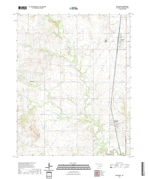 2022 Delaware2022 Print · USGSThe Oklahoma prairie surrounding Delaware and Lenapah is captured here in the early twenty-first century, showing a landscape defined by ranch roads and winding creeks. Researchers can locate family sites near Mount Washington Cemetery or trace the drainage of California Creek.
 - 2022 Map of Blue Mound, 2022 Print
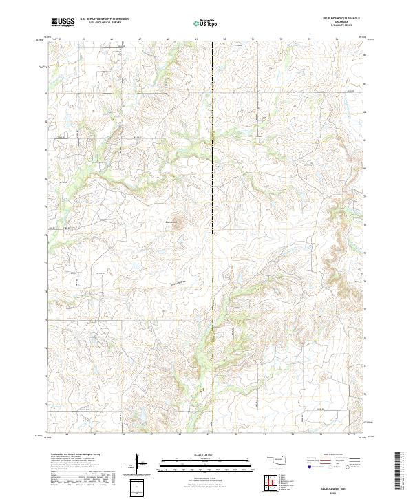 2022 Blue Mound2022 Print · USGSThe rural borderlands between Washington and Nowata counties are mapped here in the early twenty-first century, showing a landscape defined by ranch roads and prairie streams. Researchers can trace the drainages of Hogshooter Cr and Coon Cr or locate the landmark Blue Mound.
 - 2022 Map of Hayrick Mound, 2022 Print
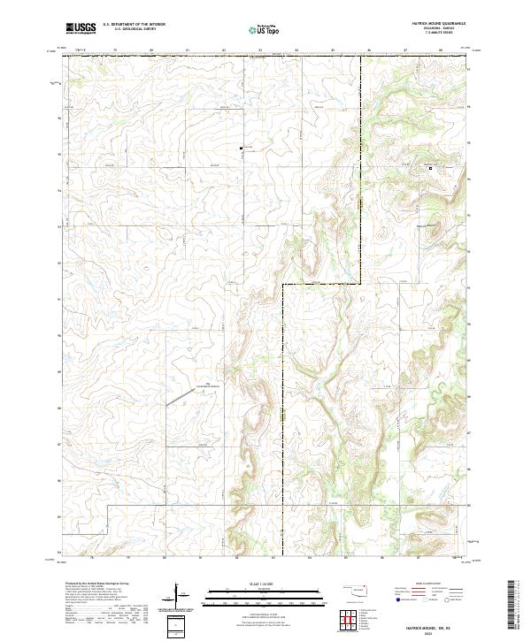 2022 Hayrick Mound2022 Print · USGSNorthern Oklahoma and the Kansas border are captured here in a period of quiet agricultural continuity. Local historians can locate early burial sites like Lain Cem and Plainview Cem or trace the drainage of Crow Hollow Cr.
 - 2022 Map of Nowata East, 2022 Print
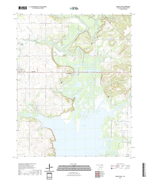 2022 Nowata East2022 Print · USGSThe Verdigris River valley near Nowata is documented here in the early twenty-first century as it flows into the Oologah Lake basin. Researchers can trace several family-named burial sites including Riley Cem and Coker Cem, or locate the historic site of Coodys Bluff.
 - 2022 Map of Winganon, 2022 Print
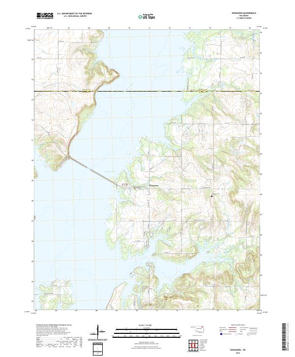 2022 Winganon2022 Print · USGSThe rural landscapes of Rogers and Nowata counties appear here in the early twenty-first century, centered on the waters of Oologah Lake. Researchers can trace local roots at the Winganon Cem and explore the small community of Winganon.
End of results
Showing maps 1-16 of 16
Top cities of Nowata County
- Nowata historical maps
- South Coffeyville historical maps
- Delaware historical maps
- Lenapah historical maps
- Wann historical maps
Frequently asked questions
- What are the different types of historical maps available for Nowata County?
- What is the oldest map of Nowata County?
- Where can I purchase historical maps of Nowata County for my home or office?
- Where can I download high-res historical maps of Nowata County?
- Are there historical topographic maps available for Nowata County?
- Is there historical aerial imagery available for Nowata County?
- Where are historical maps of Nowata County sourced from?