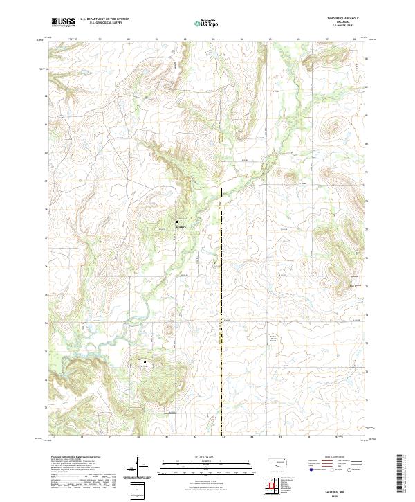
2022 Map of Sanders
USGS Topo · Published 2022About this map
The Sanders settlement and its rural environs in Nowata County and Craig County are defined by a network of drainage systems feeding into Big Creek. This part of Oklahoma maintains a quiet agricultural character, with long section-line roads like E 150 Rd and N4230 Rd connecting family farms and historical landmarks. Genealogists will find the locations of the Sanders Cem and Martin Cem essential for tracing local lineage in this corner of the state.
Find a feature on this map
37 named features on this map. Tap any name to fly to it.
Don’t see what you’re looking for? This feature index may not catch every label — zoom into the map to look around manually.
Map Details
Editions of this 2022 Sanders Map
This is the sole edition of this map. No revisions or reprints were ever made.
Other maps of this area

1901 · Nowata
USGS Topo · 1:125,000

1901 · Vinita
USGS Topo · 1:125,000

1913 · Vinita
USGS Topo · 1:125,000

1914 · Nowata
USGS Topo · 1:125,000

1954 · Tulsa
USGS Topo · 1:250,000

1958 · Tulsa
USGS Topo · 1:250,000

1963 · Tulsa
USGS Topo · 1:250,000
1972 · Estella
USGS Topo · 1:24,000
1972 · Sanders
USGS Topo · 1:24,000
1972 · Chelsea NW
USGS Topo · 1:24,000