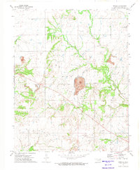
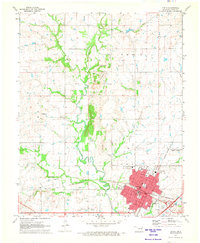
1972 Map of Estella
USGS Topo · Published 1974About this map
Estella serves as the focal point of this northeastern Oklahoma survey, situated amidst a landscape defined by its network of winding waterways. The drainage patterns of Thompson Creek, Pawpaw Creek, and White Creek dictate the terrain, while the S L S F RR tracks cross the southeastern corner, reflecting the importance of rail transport for this rural community.
Find a feature on this map
24 named features on this map. Tap any name to fly to it.
Don’t see what you’re looking for? This feature index may not catch every label — zoom into the map to look around manually.
Map Details
Editions of this 1972 Estella Map
2 editions found
Other maps of this area

1901 · Vinita
USGS Topo · 1:125,000

1913 · Vinita
USGS Topo · 1:125,000

1954 · Tulsa
USGS Topo · 1:250,000

1958 · Tulsa
USGS Topo · 1:250,000

1963 · Tulsa
USGS Topo · 1:250,000

1970 · Chelsea
USGS Topo · 1:24,000

1970 · White Oak
USGS Topo · 1:24,000
1971 · Pyramid Corners
USGS Topo · 1:24,000
1971 · Big Cabin
USGS Topo · 1:24,000
1971 · Vinita
USGS Topo · 1:24,000