Old Maps of Nowata County, Oklahoma for Genealogy
Trace your family roots with 104 historic maps of Nowata County. These high-res maps reveal old neighborhoods, homesites, landmarks, and streets — helping you uncover where your ancestors lived and how the area evolved over time.
- Explore historic neighborhoods: Identify where your relatives may have lived in the 1800s or 1900s.
- Compare maps over time: Trace the changes in streets, buildings, and landmarks for multi-generational research.
- Perfect for genealogy & ancestry research: Used by family historians and researchers to map out lineage and migration.
These maps are an incredible resource for exploring your personal connection to Nowata County's past.
Nowata County, OK maps
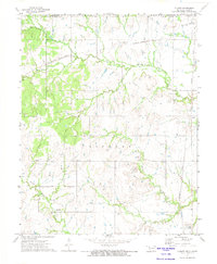
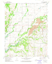
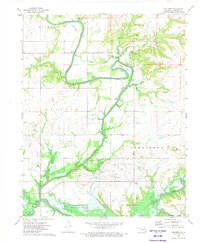
(104)- 1901 Map of Nowata
 1901 Nowata1901 Print · USGSThe Cherokee Nation in Indian Territory is captured here at the start of the twentieth century, showing the lands that would soon become northeast Oklahoma. Researchers can trace early rail-town growth in Nowata and Bartlesville or locate smaller settlements like Alluwe and Coodys Bluff.2 unique versions available
 - 1901 Map of Vinita
 1901 Vinita1901 Print · USGSIndian Territory at the turn of the century shows a landscape of burgeoning railroad towns and Cherokee Nation settlements. Genealogists can trace family roots in early townsites like Vinita, Bluejacket, and Chelsea or locate rural homesteads near Cabin Creek.2 unique versions available
 - 1913 Map of Vinita
 1913 Vinita1913 Print · USGSNortheast Oklahoma at the height of its rail-and-ranch era is meticulously detailed here just as the state was entering its second decade. Genealogists can trace family roots through dozens of local landmarks like W H School, Big Cabin, and the Blue Hawk School.3 unique versions available
 - 1914 Map of Nowata
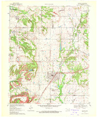
 1914 Nowata1914 Print · USGSNortheastern Oklahoma at the height of its early statehood growth is documented here as the railroad network expanded across the Verdigris River valley. Genealogists can locate dozens of country schools like Go-back School and vanished post offices such as Avelia Wayside PO.5 unique versions available
 - 1954 Map of Tulsa
 1954 Tulsa1954 Print · USGSNortheast Oklahoma and the Ozark border are shown here during a period of massive industrial and infrastructure growth. Researchers can trace the legacy of the Tri-State Mining District and the development of major reservoirs like Grand Lake O' The Cherokees.2 unique versions available
 - 1958 Map of Tulsa, 1968 Print
 1958 Tulsa1968 Print · USGSNortheast Oklahoma and the Ozark borderlands are captured here during a massive era of reservoir construction and highway expansion. Researchers can trace the mid-century footprints of Tulsa, the sprawling Lake O' the Cherokees, and historical sites like Pea Ridge National Military Park.3 unique versions available
 - 1963 Map of Tulsa
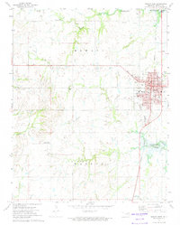
 1963 Tulsa1963 Print · USGSThe Oklahoma and Arkansas borderlands are shown here in the early sixties, a time of massive reservoir construction and heavy mining. Genealogists can trace family roots through settlements like Nowata, Pryor, and Jay, or locate historical zinc and lead mines and coal mines.
 - 1970 Map of Chelsea, 1972 Print
 1970 Chelsea1972 Print · USGSNortheast Oklahoma's extraction landscape is on full display during the early 1970s, as coal and oil operations surround the town of Chelsea. Researchers can trace family history at Shady Grove Cem and Snider Cem or locate industrial sites like the many Strip Mines and the St Louis - San Francisco rail line.3 unique versions available
 - 1970 Map of Bartlesville SE, 1972 Print
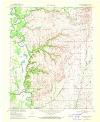 1970 Bartlesville SE1972 Print · USGSThe tri-county borderlands of northeastern Oklahoma are captured here in the early 1970s, showcasing a landscape of winding river bends and prairie creeks. Researchers can locate infrastructure of the local economy, including the Tyner Dam, a riverside Oil Well, and the Gravel Pit.2 unique versions available
 - 1970 Map of Talala, 1972 Print
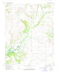
 1970 Talala1972 Print · USGSRogers County at the start of the 1970s shows a landscape in transition as the Oologah Reservoir expands. Genealogists and local historians can trace the town of Talala, find the Fair View Cem, and follow the Missouri Pacific railroad.
 - 1970 Map of Winganon, 1972 Print
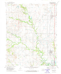
 1970 Winganon1972 Print · USGSRogers County is caught in a period of industrial and hydrologic change in the early 1970s as the Oologah Reservoir fills. Genealogists and local historians can locate Winganon, trace the Old RR Grade, and find many Oil Wells.
 - 1972 Map of Blue Mound, 1974 Print
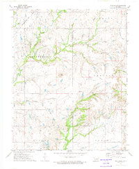 1972 Blue Mound1974 Print · USGSThe northern Oklahoma countryside near the Nowata county line is shown in the early 1970s as an active corridor of extraction and transport. Researchers can trace the extensive Oil Fields and follow the path of the Missouri - Kansas - Texas railroad past landmarks like Blue Mound.2 unique versions available
 - 1972 Map of Elliott, 1974 Print
 1972 Elliott1974 Print · USGSThe Oklahoma-Kansas borderlands near the start of the seventies show a landscape of active resource extraction and rural settlement. Researchers can trace the rail lines of the Missouri Pacific and locate family landmarks like Steward Cem and Pleasant Valley Ch.
 - 1972 Map of Nowata West, 1974 Print
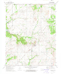
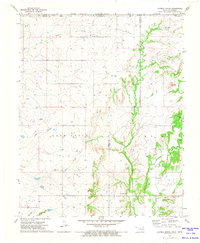
 1972 Nowata West1974 Print · USGSNowata and its western rural reaches are captured in the early seventies, showing a landscape defined by the Missouri Pacific railroad and early petroleum work. Genealogists and local researchers can locate Mennonite Cem, Taylor Cem, and the Diamond Point Community Hall.2 unique versions available
 - 1972 Map of Sanders, 1974 Print
 1972 Sanders1974 Print · USGSNortheastern Oklahoma's creek valleys and the rising waters of the Verdigris River basin define this landscape in the early seventies. Genealogists and local historians can locate Martin Cem, the Halsell Ranch, and the Twin Bridges Community Center along the banks of Big Creek.
 - 1972 Map of Delaware, 1974 Print
 1972 Delaware1974 Print · USGSNortheastern Oklahoma’s oil-producing landscape is caught in detail during the early seventies, centered on the towns along the Missouri Pacific rail line. Researchers can trace family history at Mt Washington Cem and explore the industrial footprint of the Lenapah Oil Field and Delaware.2 unique versions available
 - 1972 Map of Chelsea NW, 1974 Print
 1972 Chelsea NW1974 Print · USGSNortheastern Oklahoma in the early seventies shows a landscape where industrial extraction meets rural life along the Nowata and Craig County line. Researchers can trace family history at Mc Mains Cem or locate the old Lightning Creek Ch near extensive Oil Field sites.2 unique versions available
 - 1972 Map of Oglesby, 1974 Print
 1972 Oglesby1974 Print · USGSThe rolling oil fields along the border of Washington and Nowata Counties are captured here in the early seventies. Genealogists and historians can locate remote family sites like Willey Cem and the small settlements of Oglesby and Glenoak.
 - 1972 Map of Wann, 1974 Print
 1972 Wann1974 Print · USGSNortheastern Oklahoma and the Kansas borderlands appear in the early seventies during the development of a major reservoir project. Genealogists and historians can locate family landmarks like the Patrick Cem and trace former rail lines like the Missouri - Kansas - Texas Railroad Grade.
 - 1972 Map of Nowata East, 1974 Print
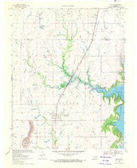
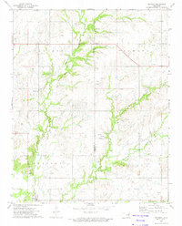
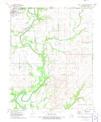
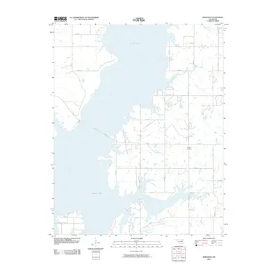
 1972 Nowata East1974 Print · USGSNowata County’s landscape undergoes a massive transformation in the early seventies as the Verdigris River valley is reshaped by Oologah Lake. Genealogists and local historians can trace family burial sites at Secondine Cem and Brown Cem, or locate the historic Old RR Grade and the settlement at Coodys Bluff.
 - 1972 Map of South Coffeyville, 1974 Print
 1972 South Coffeyville1974 Print · USGSSouth Coffeyville and the Verdigris River valley are shown here in the early seventies as the river winds toward the Oologah Lake reservoir. Researchers can trace rural lineages at Melton Cem and Hickory Creek Cem or locate old industrial sites like the Gravel Pits and Oil Wells.2 unique versions available
 - 1972 Map of Hayrick Mound, 1974 Print
 1972 Hayrick Mound1974 Print · USGSThe Oklahoma-Kansas borderlands in the early seventies reveal a rural landscape of winding creeks and community anchors. Researchers can trace family history through sites like Lain Cem, Plainview Cem, and Rock Creek Ch.
 - 1972 Map of Childers, 1974 Print
 1972 Childers1974 Print · USGSNowata County’s river valley is shown here in the early seventies as the waters of the Verdigris were being reshaped by modern reservoir projects. Genealogists can trace family heritage at several local burial sites including Goodtraveler Cem, Wolfe Cem, and Childers Cem.2 unique versions available
 - 1985 Map of Bartlesville
 1985 Bartlesville1985 Print · USGSNortheastern Oklahoma in the mid-eighties shows a landscape defined by the Verdigris River and a complex rail network. Researchers can trace the industrial footprint of Strip Mines and find old rail hubs in Nowata and Vinita.2 unique versions available
 - 2010 Map of Winganon, 2010 Print
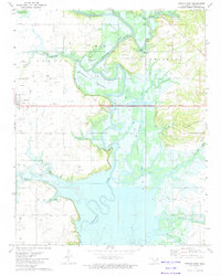
 2010 Winganon2010 Print · USGSCovers Nowata County, including Winganon, Rogers County, and other nearby areas
Showing maps 1-25 of 104
Top cities of Nowata County
- Nowata historical maps
- South Coffeyville historical maps
- Delaware historical maps
- Lenapah historical maps
- Wann historical maps
Frequently asked questions
- What are the different types of historical maps available for Nowata County?
- What is the oldest map of Nowata County?
- Where can I purchase historical maps of Nowata County for my home or office?
- Where can I download high-res historical maps of Nowata County?
- Are there historical topographic maps available for Nowata County?
- Is there historical aerial imagery available for Nowata County?
- Where are historical maps of Nowata County sourced from?