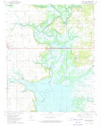
1972 Map of Nowata East
USGS Topo · Published 1974About this map
Oologah Lake dominates the landscape of eastern Nowata County, where the impounded waters of the Verdigris River have transformed the river valley. The topography reveals the transition from the Coker Hills in the east down to the Overcup Bottoms, now largely submerged or influenced by the lake's reach. Evidence of the region's industrial foundations is visible through numerous labeled gravel pits, quarries, and the widespread footprint of the Oil Field that spans much of the northern terrain. The settlement of Coodys Bluff remains a central point near the water's edge, while the remnants of earlier transportation networks are preserved in the tracing of the Old RR Grade. Genealogists will find significant value in the mapped locations of family and community burial grounds, including the Riley Cem, Armstrong Cem, and Secondine Cem, which are documented alongside local landmarks like Mt Zion Ch and the Community Hall.
Find a feature on this map
36 named features on this map. Tap any name to fly to it.
Don’t see what you’re looking for? This feature index may not catch every label — zoom into the map to look around manually.
Map Details
Editions of this 1972 Nowata East Map
This is the sole edition of this map. No revisions or reprints were ever made.
Other maps of this area

1901 · Nowata
USGS Topo · 1:125,000

1901 · Vinita
USGS Topo · 1:125,000

1913 · Vinita
USGS Topo · 1:125,000

1914 · Nowata
USGS Topo · 1:125,000

1954 · Tulsa
USGS Topo · 1:250,000

1958 · Tulsa
USGS Topo · 1:250,000

1963 · Tulsa
USGS Topo · 1:250,000

1970 · Chelsea
USGS Topo · 1:24,000
1970 · Talala
USGS Topo · 1:24,000
1970 · Winganon
USGS Topo · 1:24,000