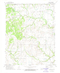
1972 Map of Elliott
USGS Topo · Published 1974About this map
Noxie sits along the Missouri - Kansas - Texas line in this early 1970s survey of the Oklahoma-Kansas borderlands. The landscape is defined by the extensive Oil Field operations scattered across the Hickory terrain, marked by numerous Drill Holes and Oil Wells. This industrial character is balanced by established community landmarks such as Steward Cem and Pleasant Valley Ch, which serve the rural population near California Creek.
Find a feature on this map
20 named features on this map. Tap any name to fly to it.
Don’t see what you’re looking for? This feature index may not catch every label — zoom into the map to look around manually.
Map Details
Editions of this 1972 Elliott Map
This is the sole edition of this map. No revisions or reprints were ever made.
Other maps of this area

1886 · Independence
USGS Topo · 1:125,000

1894 · Independence
USGS Topo · 1:125,000

1901 · Nowata
USGS Topo · 1:125,000

1905 · Independence
USGS Topo · 1:125,000

1914 · Nowata
USGS Topo · 1:125,000

1947 · Joplin
USGS Topo · 1:250,000

1949 · Joplin
USGS Topo · 1:250,000

1954 · Tulsa
USGS Topo · 1:250,000

1954 · Joplin
USGS Topo · 1:250,000

1958 · Joplin
USGS Topo · 1:250,000