Old Maps of Sequoyah County, Oklahoma for Academic Research
Study the evolution of Sequoyah County with 190 high-resolution historic maps. Whether you're teaching, researching, or modeling changes in land use, these maps provide essential visual documentation of urban, environmental, and geographic change.
- Analyze long-term change: Track patterns in development, transportation, and natural features.
- Ideal for environmental or urban studies: Support academic projects with primary historical map data.
- Use in the classroom or lab: Educators and researchers rely on these maps to bring historical context to life.
These maps are a powerful tool for teaching, research, and visualizing how Sequoyah County has changed over the decades.
Sequoyah County, OK maps
(190)- 1879 Map of Fort Smith
 1879 Fort Smith1879 Print · USGSFort Smith and Van Buren stand at the edge of the frontier in the late eighteen-seventies, just as the railroads began to reshape the Arkansas River valley. Trace the early town plats and find rural community anchors like Zenobia P.O., Lillie, and the Ferry crossings.
 - 1887 Map of Van Buren
 1887 Van Buren1887 Print · USGSThe Arkansas frontier meets the Indian Territory in the late nineteenth century, centered on the growing river hubs of Fort Smith and Van Buren. Genealogists and researchers can locate old post offices like Cavanaugh P.O. and trace the early routes of the Ft. Smith & Southern R. R.
 - 1890 Map of Fort Smith
 1890 Fort Smith1890 Print · USGSThe Arkansas-Indian Territory border was a landscape of rapid transition in the late nineteenth century. Genealogists and historians can trace early post offices like Jenny Lind P.O. and Oak Bower (Lavaca P.O.) or follow the path of the St. Louis and San Francisco Railroad.7 unique versions available
 - 1898 Map of Winslow #3
 1898 Winslow #31898 Print · USGSCrawford County's rugged upland terrain is captured in the late 1890s just as the railroad began to transform the local economy. Researchers can trace early rural settlements like Uniontown and Cedarville or follow the St. L. & S. F. R. R. along Frog Bayou.
 - 1898 Map of Tahlequah, 1954 Print
 1898 Tahlequah1954 Print · USGSThe Cherokee Nation capital and the surrounding Indian Territory come to life in this survey conducted before Oklahoma statehood. Genealogists can trace family-named landmarks and early institutions like the Female Seminary, Salem Springs, and the Cherokee Insane Asylum.
 - 1898 Map of Winslow, 1954 Print
 1898 Winslow1954 Print · USGSNorthwest Arkansas and the adjacent Indian Territory are captured here in the late nineteenth century as the railroad began to transform the high Ozarks. Genealogists can trace early homesteads and transport routes like the Quesenbury Road, Rheas Mill, and the mountain town of Winslow.
 - 1900 Map of Sansbois
 1900 Sansbois1900 Print · USGSIndian Territory in the late nineteenth century is documented here through its tribal boundaries and early river settlements. Genealogists can trace family roots near Stigler, Porum, and Whitefield, or locate the isolated station at Sandtown along the St L & S F R R.2 unique versions available
 - 1900 Map of Sallisaw
 1900 Sallisaw1900 Print · USGSThe Cherokee and Choctaw Nations are divided by the winding Arkansas River at the turn of the century. Genealogists can trace early tribal-era settlements like Bokoshe, Tamaha, and Oak Lodge along the routes of the Kansas City Southern R. R.2 unique versions available
 - 1901 Map of Muscogee
 1901 Muscogee1901 Print · USGSIndian Territory at the turn of the century shows a landscape shaped by river commerce and the coming of the railroads. Genealogists can trace family roots through early settlements like Tullahassee and Webbers Falls, or locate historic river crossings such as Whisky Ford.6 unique versions available
 - 1901 Map of Winslow
 1901 Winslow1901 Print · USGSThe Boston Mountains and the Arkansas border are captured here at the close of the nineteenth century, documenting the critical rail passage through the Ozarks. Genealogists and historians can trace the Frisco Line, the historic Old Wire Road, and early settlements like Cove City and Cane Hill.5 unique versions available
 - 1901 Map of Tahlequah
 1901 Tahlequah1901 Print · USGSTahlequah and the Cherokee Nation are captured here during the final years of the Indian Territory era. Genealogists can locate family landmarks such as the Female Seminary, Elm Springs Mission, and the rail-stop settlements of Stilwell and Wauhillau.8 unique versions available
 - 1905 Map of Muscogee
 1905 Muscogee1905 Print · USGSIndian Territory at the turn of the century shows a landscape transitioning from tribal nations to a rail-centered economy. Researchers can trace ancestral river crossings and early settlements like Fort Gibson, Tenkillers Ferry, and Gibson Sta.
 - 1905 Map of Tahlequah
 1905 Tahlequah1905 Print · USGSTahlequah and the surrounding Cherokee Nation are captured here in the years before Oklahoma statehood. Researchers can trace the early rail routes and find historic sites like the Female Seminary, the Cherokee Orphan Asylum, and Elm Springs Mission.
 - 1909 Map of Sans Bois, 1954 Print
 1909 Sans Bois1954 Print · USGSHaskell and Muskogee counties are seen here in the decade following statehood, when rail lines and river crossings dictated the pulse of rural life. Genealogists can trace family roots through numerous local landmarks like Kanima P O, Belle Starr School, and the Sansbois Sta.
 - 1911 Map of Sallisaw
 1911 Sallisaw1911 Print · USGSEastern Oklahoma at the turn of the century was a land of expanding railroads and ancient river crossings along the Arkansas River. Genealogists and historians can trace the early settlement of the region through dozens of landmarks like Foreman Ferry, McCurtain, and the Badger Lee School.3 unique versions available
 - 1911 Map of Sansbois
 1911 Sansbois1911 Print · USGSEastern Oklahoma's river valleys and rugged hills come alive in this early twentieth-century survey of the Choctaw Nation's western reaches. Researchers can locate rural landmarks like Sansbois Station, the Belle Starr School, and early river crossings such as the Thornton Ferry.3 unique versions available
 - 1943 Map of Fort Smith
 1943 Fort Smith1943 Print · USGSFort Smith and the Arkansas River valley are shown here during the height of the Second World War as the region became a major military hub. Genealogists and researchers can locate several rural schools and churches, such as St Marys School and Pleasant Ridge Church and Cem, alongside industrial sites like the Strip Mine and Smelter.
 - 1946 Map of Fort Smith
 1946 Fort Smith1946 Print · USGSThe Arkansas-Oklahoma borderlands appear here in the mid-forties, as new reservoirs began to transform the river valleys. Genealogists and historians can trace rail-served towns from Muskogee to Fort Smith and locate landmarks like Camp Chaffee.
 - 1947 Map of Van Buren, 1954 Print
 1947 Van Buren1954 Print · USGSThe riverfront cities of Fort Smith and Van Buren are shown in the late 1940s, just as the regional industrial footprint was expanding. Researchers can trace the rail lines of the Missouri Pacific or locate local landmarks like St Scholastica Academy and the Zinc Smelter.
 - 1947 Map of Fort Smith, 1966 Print
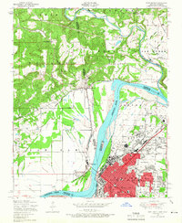 1947 Fort Smith1966 Print · USGSPost-war Arkansas and Oklahoma meet at the river bend during this era of urban expansion and rail dominance. Researchers can trace the development of FORT SMITH neighborhoods and identify local landmarks like St Boniface Church and School and Twin City Hospital.4 unique versions available
 - 1948 Map of Webbers Falls, 1966 Print
 1948 Webbers Falls1966 Print · USGSThe Arkansas River valley at the close of the 1940s reveals a mix of wartime military expansion and traditional river settlements. Genealogists can locate family-named landmarks and rural institutions like South Bethel Cem, Howard Chapel, and Liberty Sch.2 unique versions available
 - 1948 Map of South Fort Smith, 1967 Print
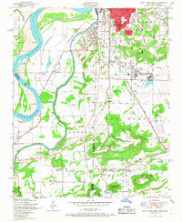 1948 South Fort Smith1967 Print · USGSThe borderlands of the Arkansas-Oklahoma line are captured here in the late 1940s as industry and recreation expanded beyond the city limits. Genealogists and historians can locate family landmarks such as St Scholastica Academy, Oak Cemetery, and the Dunbar School.3 unique versions available
 - 1950 Map of Webbers Falls
 1950 Webbers Falls1950 Print · USGSMid-century Muskogee County is captured here as a landscape of military readiness and Cherokee heritage. Researchers can trace the infrastructure of Camp Gruber or locate local landmarks like the Sour John Indian Sch and Howard Chapel.2 unique versions available
 - 1951 Map of Fort Smith
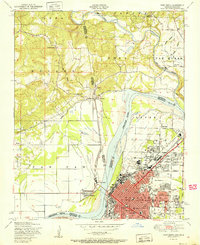 1951 Fort Smith1951 Print · USGSFort Smith and its neighboring Oklahoma borderlands are captured here during a period of significant mid-century growth and industrial connectivity. Researchers can trace the development of urban neighborhoods and rural outposts like Moffett, Dora, and Bluemouse School.2 unique versions available
 - 1951 Map of South Fort Smith
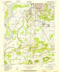 1951 South Fort Smith1951 Print · USGSThe Arkansas-Oklahoma borderlands in the early fifties show a landscape of river-bend farming and industrial growth. Genealogists can trace family roots through several rural schools like Pocola School, old burial grounds at Oak Cemetery, and community landmarks like the White Bluff Church.2 unique versions available
Showing maps 1-25 of 190
Top cities of Sequoyah County
- Sallisaw historical maps
- Muldrow historical maps
- Roland historical maps
- Vian historical maps
- Gore historical maps
- Marble City historical maps
See more
Frequently asked questions
- What are the different types of historical maps available for Sequoyah County?
- What is the oldest map of Sequoyah County?
- Where can I purchase historical maps of Sequoyah County for my home or office?
- Where can I download high-res historical maps of Sequoyah County?
- Are there historical topographic maps available for Sequoyah County?
- Is there historical aerial imagery available for Sequoyah County?
- Where are historical maps of Sequoyah County sourced from?