1970s Maps of Sequoyah County, Oklahoma
Explore 23 historic maps of Sequoyah County from the 1970s. These maps offer a rare glimpse into what life looked like during the 1970s — showing old roads, neighborhoods, homes, and landmarks that have changed or disappeared over time.
Whether you're researching your family's past, planning a metal detecting trip, or studying how Sequoyah County's landscape evolved across the 1970s, these high-resolution maps are a powerful tool for exploring the history of this region.
- Focus on a specific era: All maps on this page are from the 1970s, giving you a focused view of this time period.
- See what’s changed: Compare century-old streets, trails, and buildings to today's modern landscape using overlays and satellite layers.
- Research with precision: Use these maps for genealogy, historical research, land use analysis, or educational projects.
- View, download, or print: Maps are fully viewable online in high resolution, and can be downloaded or printed for your own records.
Start exploring Sequoyah County's history through authentic maps from the 1970s. This is your window into the past.
Sequoyah County, OK maps
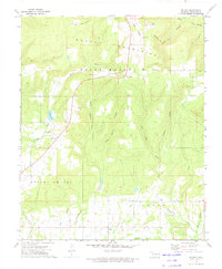
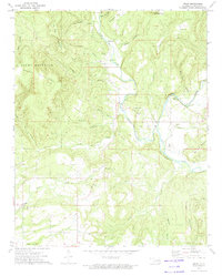
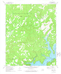
(23)- 1970 Map of Muldrow SW
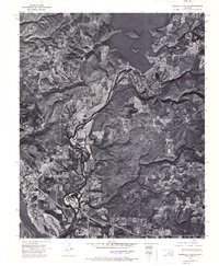
 1970 Muldrow SW1970 Print · USGSLe Flore County in the late seventies is captured in this orthophoto survey, showcasing the winding Arkansas River and its rural borderlands. Researchers can trace land divisions near Tucker or follow the paths of Onion Creek and Cache Creek as they weave through the valley.
 - 1972 Map of Blackgum, 1974 Print
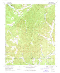
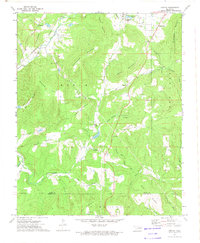
 1972 Blackgum1974 Print · USGSSequoyah County in the early seventies is mapped here in detail, showing a landscape of family-named peaks and small rural crossroads. Genealogists can locate several burial grounds including Cherokee-McCoy Cem and communities like Box and Pinhook Corners.4 unique versions available
 - 1972 Map of Webbers Falls SE, 1974 Print
 1972 Webbers Falls SE1974 Print · USGSSequoyah County during the early seventies is revealed in sharp photographic detail, showing the developed landscape around the confluence of major waterways. Researchers can trace the path of the Illinois River past Gore to the Arkansas River and study the structural footprint of the Tenkiller Ferry Dam.
 - 1972 Map of Marble City, 1974 Print
 1972 Marble City1974 Print · USGSMarble City and the surrounding Cherokee County hills are captured here in the early seventies during a period of industrial activity. Genealogists and historians can trace family-named sites like Hastings Mountain, Dwight Mission, and the McCoy Cem burial grounds.
 - 1972 Map of Webbers Falls SW, 1974 Print
 1972 Webbers Falls SW1974 Print · USGSThe Arkansas River valley of eastern Oklahoma is seen here in the early seventies, just as new infrastructure transformed the landscape. Trace the footprint of Webbers Falls and the engineering of the Webbers Falls Dam and its reservoir.
 - 1972 Map of Webbers Falls NE, 1974 Print
 1972 Webbers Falls NE1974 Print · USGSEastern Oklahoma's hills and timberlands are captured here in the early seventies as the lake era reshaped the landscape. Trace the rugged shorelines of Tenkiller Ferry Lake and the settlement at White Oak on this detailed aerial survey.
 - 1972 Map of Bunch, 1974 Print
 1972 Bunch1974 Print · USGSThe Cookson Hills of eastern Oklahoma are captured here in the early seventies, spanning the borders of Adair and Cherokee counties. Researchers can locate the mountain village of Bunch, follow the Kansas City Southern rail line, or trace family sites like Cave Springs Ch and Henderson Cem.
 - 1972 Map of Cookson, 1974 Print
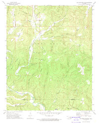
 1972 Cookson1974 Print · USGSCherokee County in the early 1970s shows a landscape transformed by the waters of Tenkiller Ferry Lake. Genealogists and local researchers can trace the roads around Cookson and Red Springs or locate family sites near the Cookson Cem.3 unique versions available
 - 1973 Map of Big Round Mountain, 1974 Print
 1973 Big Round Mountain1974 Print · USGSThe Adair County highlands are captured here in the early 1970s, showing a landscape of traditional upland settlements and deep hollows. Genealogists can trace family landmarks like John Watie Hollow or locate local centers like Salem Ch and Bell Sch.3 unique versions available
 - 1973 Map of Brushy, 1974 Print
 1973 Brushy1974 Print · USGSSequoyah County during the early 1970s showcases a landscape of ridge-top lookouts and deep hollows centered around the Home of Sequoyah. Researchers can trace family sites near Akins, locate the Brushy Cem, and explore the drainage of Big Skin Bayou.2 unique versions available
 - 1973 Map of Nicut, 1974 Print
 1973 Nicut1974 Print · USGSEastern Oklahoma’s hilly borderlands come into focus in the early 1970s, showing the rural communities of the Brushy Mountains. Genealogists and local historians can locate Belfont Sch, the John Seabolt Cem, and the river crossing at Reeder Ford.2 unique versions available
 - 1973 Map of Greasy, 1974 Print
 1973 Greasy1974 Print · USGSThe hill country of eastern Oklahoma in the early seventies shows a landscape of secluded hollows and family-named ridges. Genealogists and historians can trace local landmarks like Cherry Tree, the Kansas City Southern railroad, and rural cemeteries including Killer Cem and Chuliawa Cem.2 unique versions available
 - 1974 Map of Webbers Falls NW
 1974 Webbers Falls NW1974 Print · USGSMuskogee County in the early seventies is revealed through this detailed aerial survey, showing the transition of the local landscape. Genealogists and historians can trace the footprint of Camp Gruber (Abandoned) and the small town of Braggs alongside Greenleaf Lake.3 unique versions available
 - 1974 Map of Gore, 1978 Print
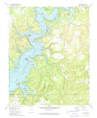
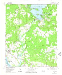 1974 Gore1978 Print · USGSGore and the surrounding Illinois River valley are shown in the mid-seventies just as the regional reservoir system was fully established. Researchers can trace family roots through numerous sites like Stevenson Cem, Notichtown Cem, and the Gum Spring Ch.2 unique versions available
 - 1974 Map of Qualls, 1978 Print
 1974 Qualls1978 Print · USGSCherokee County in the mid-1970s is a landscape of expansive conservation areas and the winding waters of Tenkiller Ferry Lake. Local historians can trace family ties at Sellers Cem or explore the early development of Burnt Cabin Ridge State Park.
 - 1974 Map of Webbers Falls, 1978 Print
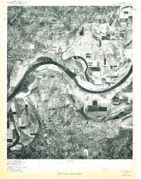
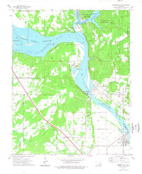 1974 Webbers Falls1978 Print · USGSThe river-and-rail landscape of Webbers Falls is shown here in the mid-1970s, as the Arkansas River reservoirs reached their modern levels. Researchers can trace family sites at Phillips Cem and Mountain Grove Ch or locate the Webbers Falls Lock and Dam.
 - 1976 Map of Fort Smith, 1978 Print
 1976 Fort Smith1978 Print · USGSFort Smith and the Oklahoma borderlands are captured in high-contrast detail in the mid-seventies, showing the region's transition from urban center to rural floodplain. Researchers can trace the layout of the city near Moffett or study the agricultural plots and timberlines surrounding Roland and Dora.
 - 1977 Map of Fort Coffee
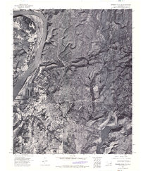
 1977 Fort Coffee1977 Print · USGSEastern Oklahoma's riverine landscape is captured in the late seventies, showing the sweeping bends of the Arkansas River. Genealogists and local historians can pinpoint the exact layouts of Fort Coffee, Murry Spur, and the fields of Paw Paw Bottom.
 - 1978 Map of Eufaula, 1979 Print
 1978 Eufaula1979 Print · USGSEastern Oklahoma in the late seventies is defined by the sprawling waters of Eufaula Lake and the dense timber of the Sans Bois Mountains. Genealogists and historians can trace the development of towns like Checotah and Stigler or locate legacy sites like the Old R R Grade and Robbers Cave State Park.
 - 1978 Map of Muskogee, 1979 Print
 1978 Muskogee1979 Print · USGSThe confluence of the Arkansas, Verdigris, and Neosho Rivers defines the Muskogee region in the late seventies. Genealogists and historians can trace the footprints of Camp Gruber (Abandoned), the campus of Bacone College, and early aviation at Hatbox Field.
 - 1978 Map of Fort Smith, 1979 Print
 1978 Fort Smith1979 Print · USGSThe Arkansas-Oklahoma borderlands in the late seventies show a landscape shaped by massive river reservoirs and sprawling military reservations. Trace the historic rail lines of the Missouri Pacific RR and locate regional landmarks like Fort Gibson, Tenkiller Ferry Lake, and Barling.2 unique versions available
 - 1978 Map of Fort Smith, 1979 Print
 1978 Fort Smith1979 Print · USGSThe Arkansas-Oklahoma borderlands in the late seventies show a region defined by river navigation, coal mining, and military expansion. You can trace industrial footprints like the Strip Mines and the vast Fort Chaffee Military Reservation.2 unique versions available
 - 1978 Map of Stilwell, 1979 Print
 1978 Stilwell1979 Print · USGSThe Oklahoma-Arkansas borderlands come alive in the late seventies, showing the transition from the Cherokee Nation hills to the Arkansas Ozarks. Researchers can trace the Kansas City Southern rail line through Stilwell, find Wrights Chapel, or locate the Northeastern State College campus in Tahlequah.
End of results
Showing maps 1-23 of 23
Top cities of Sequoyah County
- Sallisaw historical maps
- Muldrow historical maps
- Roland historical maps
- Vian historical maps
- Gore historical maps
- Marble City historical maps
See more
Frequently asked questions
- What are the different types of historical maps available for Sequoyah County?
- What is the oldest map of Sequoyah County?
- Where can I purchase historical maps of Sequoyah County for my home or office?
- Where can I download high-res historical maps of Sequoyah County?
- Are there historical topographic maps available for Sequoyah County?
- Is there historical aerial imagery available for Sequoyah County?
- Where are historical maps of Sequoyah County sourced from?