1960s Maps of Skiatook, Oklahoma
Explore 7 historic maps of Skiatook from the 1960s. These maps offer a rare glimpse into what life looked like during the 1960s — showing old roads, neighborhoods, homes, and landmarks that have changed or disappeared over time.
Whether you're researching your family's past, planning a metal detecting trip, or studying how Skiatook's landscape evolved across the 1960s, these high-resolution maps are a powerful tool for exploring the history of this region.
- Focus on a specific era: All maps on this page are from the 1960s, giving you a focused view of this time period.
- See what’s changed: Compare century-old streets, trails, and buildings to today's modern landscape using overlays and satellite layers.
- Research with precision: Use these maps for genealogy, historical research, land use analysis, or educational projects.
- View, download, or print: Maps are fully viewable online in high resolution, and can be downloaded or printed for your own records.
Start exploring Skiatook's history through authentic maps from the 1960s. This is your window into the past.
Skiatook, OK maps
(7)- 1963 Map of Tulsa
 1963 Tulsa1963 Print · USGSThe Oklahoma and Arkansas borderlands are shown here in the early sixties, a time of massive reservoir construction and heavy mining. Genealogists can trace family roots through settlements like Nowata, Pryor, and Jay, or locate historical zinc and lead mines and coal mines.
 - 1963 Map of Avant SE, 1964 Print
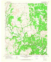
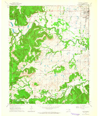 1963 Avant SE1964 Print · USGSOsage and Tulsa counties meet here in the early sixties, as the oil industry and railroads shaped the local landscape. Genealogists can trace family footprints at Captain Cem, Delaware Ch, and the outlying Osage Gardens development.4 unique versions available
 - 1966 Map of Avant NW, 1967 Print
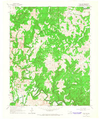 1966 Avant NW1967 Print · USGSOsage County in the mid-1960s was defined by its oil heritage and the winding creek valleys of the Oklahoma interior. Researchers can trace the dense network of Oil Wells across the West Avant Oil Field and the path of the Midland Valley rail line.2 unique versions available
 - 1966 Map of Avant SW, 1967 Print
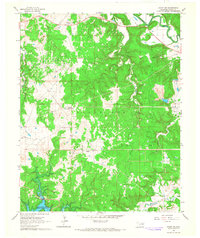 1966 Avant SW1967 Print · USGSOsage County's oil economy and changing shoreline are visible in this mid-sixties survey of the Oklahoma hill country. Researchers can trace the extent of the Wildhorse Oil Field or locate rural landmarks like Morgans Corner and Arrowhead Ranch.3 unique versions available
 - 1966 Map of Avant, 1967 Print
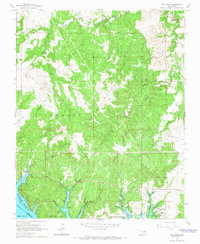
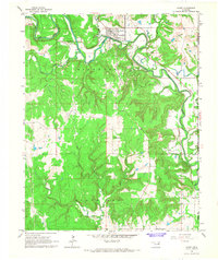 1966 Avant1967 Print · USGSOsage County is captured in the mid-1960s as a landscape of river-valley settlements and active industrial fields. Researchers can trace the Midland Valley rail route through Avant and locate family sites at Avant Cem or Lombard Cem.4 unique versions available
 - 1966 Map of Hominy NE, 1967 Print
 1966 Hominy NE1967 Print · USGSOsage County's petroleum landscape is captured here in the mid-1960s, showing a territory defined by oil production and winding waterways. Researchers can trace the Missouri - Kansas - Texas RR and locate sites like the Cem near the Sunset Oil Field.2 unique versions available
 - 1966 Map of New Prue, 1967 Print
 1966 New Prue1967 Print · USGSOsage County was undergoing a major geographic shift in the mid-sixties as the newly formed Keystone Reservoir altered the valley floor. Genealogists and historians can trace the early layout of New Prue and find industrial footprints in the Osage City Oil Field or near Wildhorse.3 unique versions available
End of results
Showing maps 1-7 of 7
Top cities near Skiatook
- Tulsa historical maps
- Bartlesville historical maps
- Owasso historical maps
- Sand Springs historical maps
- Collinsville historical maps
- Barnsdall historical maps
See more
Frequently asked questions
- What are the different types of historical maps available for Skiatook?
- What is the oldest map of Skiatook?
- Where can I purchase historical maps of Skiatook for my home or office?
- Where can I download high-res historical maps of Skiatook?
- Are there historical topographic maps available for Skiatook?
- Is there historical aerial imagery available for Skiatook?
- Where are historical maps of Skiatook sourced from?