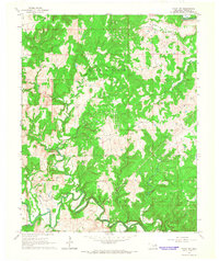
1966 Map of Avant NW
USGS Topo · Published 1967About this map
The petroleum industry of Osage County is central to this mid-1960s survey, dominated by the sprawling infrastructure of the West Avant Oil Field and the Barnsdall Oil Field. Numerous Oil Wells are scattered across the wooded landscape, connected by a network of unimproved roads and pipelines. This extraction economy is set against a complex drainage system where the Midland Valley railroad follows the course of Bird Creek in the northeastern corner. To the south, Hominy Creek carves a winding path through the hills, joined by tributaries such as Wildhorse Creek and Bull Creek. The map documents a rugged, industrial terrain within the Big Heart and Black Dog regions, showing how resource development adapted to the narrow valleys and steep ridges of the Oklahoma interior.
Find a feature on this map
14 named features on this map. Tap any name to fly to it.
Don’t see what you’re looking for? This feature index may not catch every label — zoom into the map to look around manually.
Map Details
Editions of this 1966 Avant NW Map
2 editions found
Other maps of this area

1909 · Pawhuska
USGS Topo · 1:125,000

1910 · Pawhuska
USGS Topo · 1:125,000

1912 · Hominy
USGS Topo · 1:125,000

1915 · Hominy
USGS Topo · 1:125,000

1915 · Hominy
USGS Topo · 1:62,500

1955 · Enid
USGS Topo · 1:250,000

1958 · Enid
USGS Topo · 1:250,000
1963 · Avant SE
USGS Topo · 1:24,000

1964 · Barnsdall
USGS Topo · 1:24,000
1964 · Wynona
USGS Topo · 1:24,000