
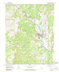
1964 Map of Barnsdall
USGS Topo · Published 1965About this map
The town of Barnsdall serves as the industrial hub for this section of Osage County, where the Midland railroad tracks follow the winding course of Bird Creek. The landscape is heavily defined by petroleum extraction, with the Pershing Oil Field and the West Barnsdall Oil Field marking the hillsides, supported by a significant tank farm and a pumping station near Tallant. This industrial presence is contrasted by numerous family and community landmarks, including Javine Cem, Red Eagle Cem, and Reece Cem.
Find a feature on this map
41 named features on this map. Tap any name to fly to it.
Don’t see what you’re looking for? This feature index may not catch every label — zoom into the map to look around manually.
Map Details
Editions of this 1964 Barnsdall Map
2 editions found
Other maps of this area

1906 · Nelagoney
USGS Topo · 1:24,000

1909 · Pawhuska
USGS Topo · 1:125,000

1910 · Pawhuska
USGS Topo · 1:125,000

1912 · Hominy
USGS Topo · 1:125,000

1915 · Hominy
USGS Topo · 1:125,000

1915 · Hominy
USGS Topo · 1:62,500

1955 · Enid
USGS Topo · 1:250,000

1958 · Enid
USGS Topo · 1:250,000

1960 · Nelagoney
USGS Topo · 1:24,000

1960 · Pawhuska
USGS Topo · 1:24,000