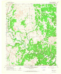
1966 Map of Hominy NE
USGS Topo · Published 1967About this map
Band Wheel Oil Field and the surrounding petroleum operations dominate this Osage County landscape in the mid-1960s. The map illustrates a region defined by its energy infrastructure, with numerous Oil Wells and named fields like Sunset Oil Field and Bigheart Oil Field scattered across the undulating terrain. This industrial development is interwoven with a dense network of watercourses, most notably the winding Hominy Creek, which features a section of Rapids and is fed by tributaries such as Mahala Creek and Sand Creek.
Find a feature on this map
22 named features on this map. Tap any name to fly to it.
Don’t see what you’re looking for? This feature index may not catch every label — zoom into the map to look around manually.
Map Details
Editions of this 1966 Hominy NE Map
2 editions found
Other maps of this area

1909 · Pawhuska
USGS Topo · 1:125,000

1910 · Pawhuska
USGS Topo · 1:125,000

1912 · Hominy
USGS Topo · 1:125,000

1915 · Hominy
USGS Topo · 1:125,000

1915 · Hominy
USGS Topo · 1:62,500

1955 · Enid
USGS Topo · 1:250,000

1958 · Enid
USGS Topo · 1:250,000

1964 · Barnsdall
USGS Topo · 1:24,000
1964 · Wynona
USGS Topo · 1:24,000

1966 · Cleveland
USGS Topo · 1:24,000