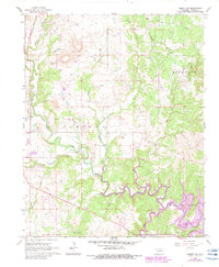
1966 Map of Hominy NE
USGS Topo · Published 1983About this map
Oil wells and extraction sites dominate this mid-century Osage County landscape, organized into established production areas like the Band Wheel Oil Field and Manion Oil Field. The sinuous path of Hominy Creek winds across the lower half of the quadrangle, punctuated by Rapids and eventually feeding into the northern reaches of Skiatook Lake, which is shown with purple photorevisions indicating rising water levels. In the north, the terrain is more sharply defined by Bigheart Canyon and numerous tributary drainages such as Mahala Creek and Sunset Creek. This map documents a period of industrial land use where the oil economy's infrastructure—marked by a network of pipelines and localized fields like the Flesher Oil Field—interfaces with the rural topography of the Black Dog area.
Find a feature on this map
25 named features on this map. Tap any name to fly to it.
Don’t see what you’re looking for? This feature index may not catch every label — zoom into the map to look around manually.
Map Details
Editions of this 1966 Hominy NE Map
2 editions found
Other maps of this area

1909 · Pawhuska
USGS Topo · 1:125,000

1910 · Pawhuska
USGS Topo · 1:125,000

1912 · Hominy
USGS Topo · 1:125,000

1915 · Hominy
USGS Topo · 1:125,000

1915 · Hominy
USGS Topo · 1:62,500

1955 · Enid
USGS Topo · 1:250,000

1958 · Enid
USGS Topo · 1:250,000

1964 · Barnsdall
USGS Topo · 1:24,000
1964 · Wynona
USGS Topo · 1:24,000

1966 · Cleveland
USGS Topo · 1:24,000