2020s Maps of Bray, Oklahoma
Explore 4 historic maps of Bray from the 2020s. These maps offer a rare glimpse into what life looked like during the 2020s — showing old roads, neighborhoods, homes, and landmarks that have changed or disappeared over time.
Whether you're researching your family's past, planning a metal detecting trip, or studying how Bray's landscape evolved across the 2020s, these high-resolution maps are a powerful tool for exploring the history of this region.
- Focus on a specific era: All maps on this page are from the 2020s, giving you a focused view of this time period.
- See what’s changed: Compare century-old streets, trails, and buildings to today's modern landscape using overlays and satellite layers.
- Research with precision: Use these maps for genealogy, historical research, land use analysis, or educational projects.
- View, download, or print: Maps are fully viewable online in high resolution, and can be downloaded or printed for your own records.
Start exploring Bray's history through authentic maps from the 2020s. This is your window into the past.
Bray, OK maps
(4)- 2022 Map of Bray, 2022 Print
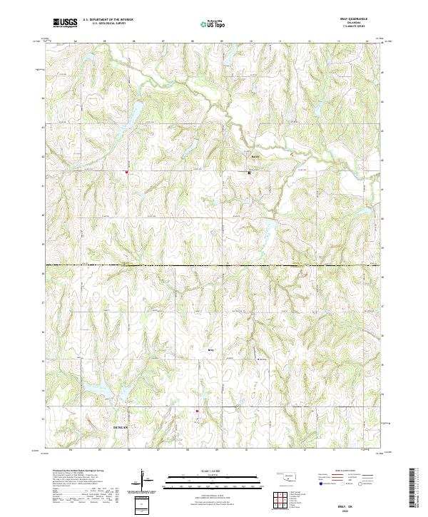 2022 Bray2022 Print · USGSThe rural border of Grady and Stephens counties is mapped here in the early twenty-first century, showing a landscape shaped by ranching and creek drainage. Researchers can trace family history at the Bailey Cemetery or locate the settlements of Bray and Bailey.
 - 2022 Map of Marlow, 2022 Print
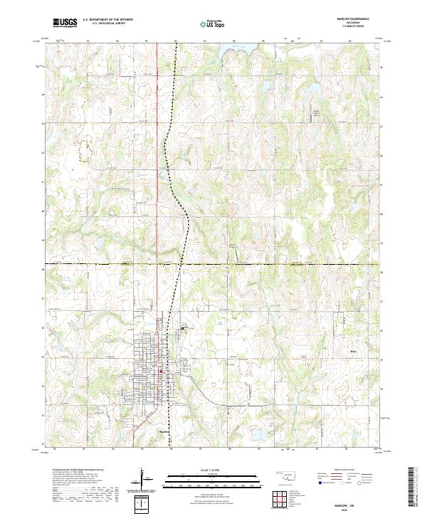 2022 Marlow2022 Print · USGSMarlow and the surrounding Stephens County plains are captured here in the early 2020s, showing the community's modern layout and tribal-named streets. Genealogists and local historians can locate the Marlow Cem, the Old Stover School Site, and landmarks like Taylor Lake.
 - 2022 Map of Hope, 2022 Print
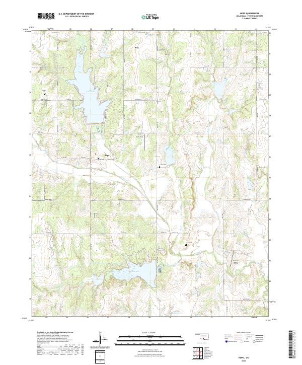 2022 Hope2022 Print · USGSStephens County is mapped here in the early 2020s, showing a rural landscape shaped by its reservoirs and creek systems. Genealogists can locate family burial sites like Colbert Cem and Cruce Cem or trace the rural settlements of Hope and Bray.
 - 2022 Map of Duncan North, 2022 Print
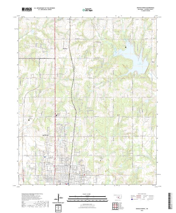 2022 Duncan North2022 Print · USGSMarlow and North Duncan are documented here during a period of steady growth along the Highway 81 corridor. Researchers can locate the Stephens County Courthouse, trace local family sites at Short Cem, or explore the development around Lake Humphreys.
End of results
Showing maps 1-4 of 4
Top cities near Bray
- Duncan historical maps
- Marlow historical maps
- Lindsay historical maps
- Comanche historical maps
- Rush Springs historical maps
- Central High historical maps
See more
Top neighborhoods of Bray
Frequently asked questions
- What are the different types of historical maps available for Bray?
- What is the oldest map of Bray?
- Where can I purchase historical maps of Bray for my home or office?
- Where can I download high-res historical maps of Bray?
- Are there historical topographic maps available for Bray?
- Is there historical aerial imagery available for Bray?
- Where are historical maps of Bray sourced from?