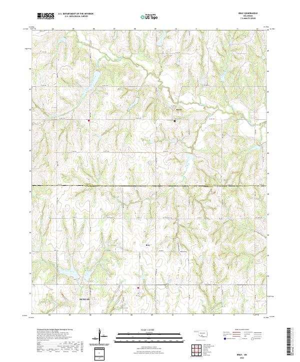
2022 Map of Bray
USGS Topo · Published 2022About this map
The town of Bray and the community of Bailey anchor this 2022 survey of the rural landscape along the Grady and Stephens County line. The terrain is defined by a dense network of winding waterways, including the upper reaches of Rush Creek and its tributaries like Murray Creek and Coon Creek. In the southern portion of the map, the northern outskirts of Duncan begin to emerge, while the rural character of the area is maintained by an extensive grid of local roads such as Goad Street and Ballpark Road. Genealogists and local historians can locate the Bailey Cemetery near the center of the sheet. The presence of the VR-Airstrip east of Bray indicates the modern utility of these open ranchlands, which remain largely divided into the traditional sections of the Public Land Survey System.
Find a feature on this map
34 named features on this map. Tap any name to fly to it.
Don’t see what you’re looking for? This feature index may not catch every label — zoom into the map to look around manually.
Map Details
Editions of this 2022 Bray Map
This is the sole edition of this map. No revisions or reprints were ever made.
Other maps of this area

1902 · Rush Springs
USGS Topo · 1:125,000

1949 · Rush Springs
USGS Topo · 1:62,500

1950 · Rush Springs
USGS Topo · 1:62,500

1950 · Marlow
USGS Topo · 1:62,500

1951 · Marlow
USGS Topo · 1:62,500

1957 · Ardmore
USGS Topo · 1:250,000

1963 · Ardmore
USGS Topo · 1:250,000

1966 · Lindsay SW
USGS Topo · 1:24,000
1974 · Cox City
USGS Topo · 1:24,000
1974 · Lake Fuqua
USGS Topo · 1:24,000