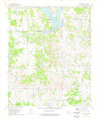
1974 Map of Lake Fuqua
USGS Topo · Published 1977About this map
Lake Fuqua and the surrounding mid-century petroleum operations dominate this 1970s landscape in Stephens County. The map details an environment where recreation and industry coexist, featuring the Picnic Area and Boat Ramp on the lake's eastern shore while numerous Oil Wells and a Pumping Station punctuate the northern and central terrain. The petroleum focus is geographically defined by the Hope Field and Parks Oil Field, showcasing the infrastructure of Oklahoma's energy sector during this period.
Find a feature on this map
28 named features on this map. Tap any name to fly to it.
Don’t see what you’re looking for? This feature index may not catch every label — zoom into the map to look around manually.
Map Details
Editions of this 1974 Lake Fuqua Map
This is the sole edition of this map. No revisions or reprints were ever made.
Other maps of this area

1901 · Addington
USGS Topo · 1:125,000

1902 · Rush Springs
USGS Topo · 1:125,000

1950 · Marlow
USGS Topo · 1:62,500

1951 · Marlow
USGS Topo · 1:62,500

1957 · Ardmore
USGS Topo · 1:250,000

1963 · Ardmore
USGS Topo · 1:250,000

1963 · Harrisburg
USGS Topo · 1:24,000
1974 · Pernell
USGS Topo · 1:24,000
1974 · Ratliff City
USGS Topo · 1:24,000
1974 · Purdy
USGS Topo · 1:24,000