Old Maps of Astoria, Oregon for Academic Research
Study the evolution of Astoria with 16 high-resolution historic maps. Whether you're teaching, researching, or modeling changes in land use, these maps provide essential visual documentation of urban, environmental, and geographic change.
- Analyze long-term change: Track patterns in development, transportation, and natural features.
- Ideal for environmental or urban studies: Support academic projects with primary historical map data.
- Use in the classroom or lab: Educators and researchers rely on these maps to bring historical context to life.
These maps are a powerful tool for teaching, research, and visualizing how Astoria has changed over the decades.
Astoria, OR maps
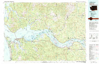
(16)- 1919 Map of Astoria, 1928 Print
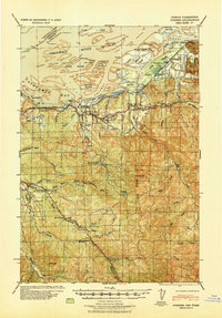
 1919 Astoria1928 Print · USGSCoastal Oregon at the end of the Great War reveals a busy network of military posts, rail lines, and river commerce. Genealogists and historians can trace the early footprints of Astoria and Warrenton or locate specific sites like Fort Stevens and Cullaby Lake.
 - 1939 Map of Astoria
 1939 Astoria1939 Print · USGSThe Columbia River mouth and Oregon coast appear here just before the Second World War, showing a landscape of maritime defense and timber industry. Genealogists can locate family-named landmarks and rural hubs like Netel Grange, Soldiers Cem, and Youngs River Falls Sch.
 - 1940 Map of Svensen
 1940 Svensen1940 Print · USGSCoastal Clatsop County at the start of the 1940s reveals a complex network of river channels and small rail-side settlements. Genealogists and historians can locate old landmarks like Ivy Station, the CCC Camp, and several rural schoolhouses including Olney Sch.
 - 1949 Map of Astoria
 1949 Astoria1949 Print · USGSThe mouth of the Columbia River comes to life in this mid-century survey, showing the busy maritime hub of Astoria and its surrounding riverbanks. Genealogists and historians can trace the development of Navy Heights, find the Astor Column, and locate early schools like School No 26.4 unique versions available
 - 1949 Map of Cathlamet Bay, 1955 Print
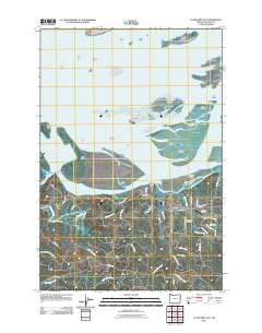
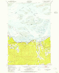 1949 Cathlamet Bay1955 Print · USGSClatsop County shorelines and the Columbia River islands appear here during the late 1940s. Researchers can trace the rail-and-road corridor through Svensen, locate family sites near Fern Hill Sch, and see early land reclamation at Mott Island.4 unique versions available
 - 1953 Map of Hoquiam
 1953 Hoquiam1953 Print · USGSSouthwest Washington in the early fifties shows a landscape shaped by timber, rail, and river commerce from the coast to the Cascades. Genealogists and historians can trace the development of timber towns like Ryderwood and the industrial hubs of Hoquiam and Kelso.2 unique versions available
 - 1955 Map of Svensen, 1957 Print
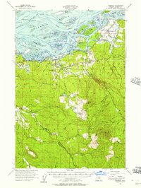 1955 Svensen1957 Print · USGSThe Columbia River estuary in the mid-fifties is a landscape of complex waterways and timber-driven settlements. Genealogists and historians can trace family locations near Svensen, Brownsmead, and Forest Hill Cemetery or locate old industrial sites like the Klaskanine Fish Hatchery.3 unique versions available
 - 1957 Map of Hoquiam
 1957 Hoquiam1957 Print · USGSCoastal timber ports and inland rail hubs define Southwest Washington during the late fifties. Genealogists can trace early twentieth-century settlements like Bordeaux, Tono, and Cosmopolis alongside the expanding tracks of the Northern Pacific.
 - 1958 Map of Hoquiam, 1969 Print
 1958 Hoquiam1969 Print · USGSSouthwest Washington and the Columbia River estuary appear here in the mid-century, before major landscape shifts. Researchers can trace the rail lines of the Northern Pacific, locate the Fort Henness Site, or explore the Naselle Air Force Station.2 unique versions available
 - 1962 Map of Hoquiam
 1962 Hoquiam1962 Print · USGSSouthwest Washington in the late fifties is defined by the bustling timber ports of Hoquiam and the rail-linked commerce of the interior valleys. Genealogists and historians can trace the early footprints of settlements like Raymond and Pe Ell, or locate family sites at Grand Mound Cem and Odd Fellows Cem.
 - 1981 Map of Astoria, 1982 Print
 1981 Astoria1982 Print · USGSThe Oregon and Washington borderlands meet at the Columbia River estuary in the early eighties, a time of active timber transport and maritime trade. Researchers can trace the river's many islands, the grounds of Fort Stevens, and riverside towns like Cathlamet and Westport.3 unique versions available
 - 2011 Map of Cathlamet Bay, 2011 Print
 2011 Cathlamet Bay2011 Print · USGSCovers Astoria, including Svensen, Fern Hill, and other nearby areas
 - 2014 Map of Astoria, 2014 Print
 2014 Astoria2014 Print · USGSCovers Astoria, including Warrenton, Jeffers Garden, and other nearby areas
 - 2014 Map of Cathlamet Bay, 2014 Print
 2014 Cathlamet Bay2014 Print · USGSCovers Astoria, including Svensen, Fern Hill, and other nearby areas
 - 2024 Map of Astoria, 2024 Print
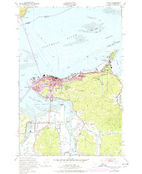
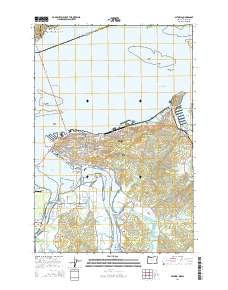
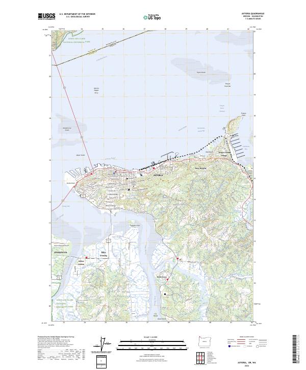 2024 Astoria2024 Print · USGSThe mouth of the Columbia River comes to life in this recent survey of the Astoria and Warrenton areas. Genealogists and researchers can pinpoint landmarks like the Clatsop County Courthouse, Pioneer Cem, and the specialized Clatsop Community College MERTS Campus.
 - 2024 Map of Cathlamet Bay, 2024 Print
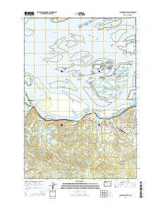
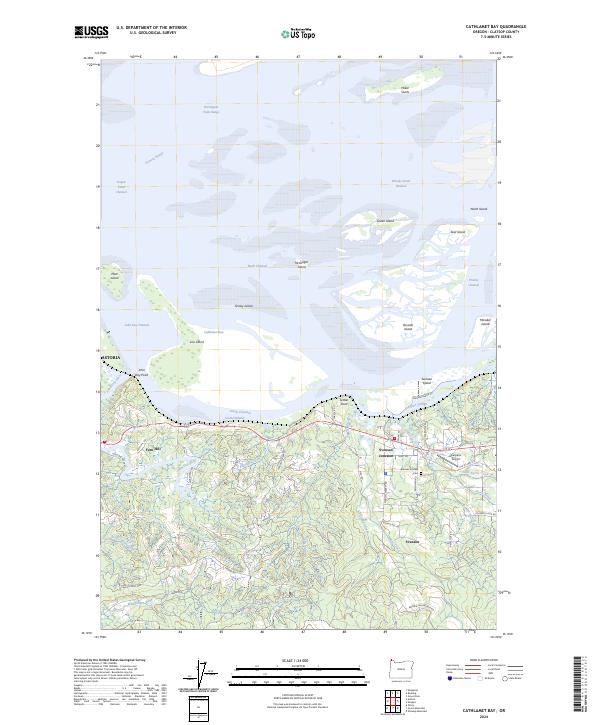 2024 Cathlamet Bay2024 Print · USGSThe Columbia River estuary meets the Clatsop County mainland in this modern survey of a complex tidal landscape. Local researchers can trace family landmarks and rural infrastructure near Svensen Junction, the Svensen Pioneer Cem, and Karpens Airport.
End of results
Showing maps 1-16 of 16
Top cities near Astoria
Top neighborhoods of Astoria
- Doughboy historical maps
- South Slope historical maps
- Tongue Point Village historical maps
- Uniontown historical maps
- Tide Point historical maps
- Uppertown historical maps
See more
Frequently asked questions
- What are the different types of historical maps available for Astoria?
- What is the oldest map of Astoria?
- Where can I purchase historical maps of Astoria for my home or office?
- Where can I download high-res historical maps of Astoria?
- Are there historical topographic maps available for Astoria?
- Is there historical aerial imagery available for Astoria?
- Where are historical maps of Astoria sourced from?