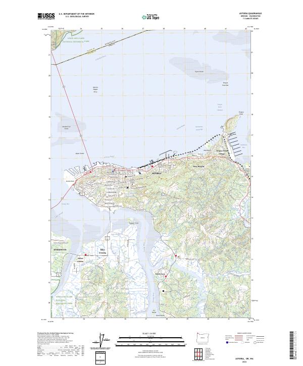
2024 Map of Astoria
USGS Topo · Published 2024About this map
Astoria anchors this coastal landscape where the Columbia River meets the Pacific tidewaters. The city's grid is dense with institutional history, from the Clatsop County Courthouse to the Clatsop Community College campus, while the waterfront reflects a legacy of maritime transit via the Astoria Megler Ferry. To the east, the peninsula at Tongue Point features the Tongue Point RR and Tongue Point Village, overlooking the waters of Cathlamet Bay.
Find a feature on this map
98 named features on this map. Tap any name to fly to it.
Don’t see what you’re looking for? This feature index may not catch every label — zoom into the map to look around manually.
Map Details
Editions of this 2024 Astoria Map
This is the sole edition of this map. No revisions or reprints were ever made.
Other maps of this area

1919 · Astoria
USGS Topo · 1:62,500

1938 · Fort Columbia
USGS Topo · 1:62,500

1939 · Astoria
USGS Topo · 1:62,500

1940 · Svensen
USGS Topo · 1:62,500

1940 · Brookfield
USGS Topo · 1:62,500

1943 · Fort Columbia
USGS Topo · 1:62,500

1949 · Astoria
USGS Topo · 1:24,000

1949 · Chinook
USGS Topo · 1:24,000

1949 · Knappton
USGS Topo · 1:24,000

1949 · Cathlamet Bay
USGS Topo · 1:24,000