Old Maps of Gunter, Oregon for Metal Detecting
Plan your next treasure hunt with 11 historic maps of Gunter. Find old homesites, ghost towns, trails, and gathering spots that may be lost to time — perfect for identifying promising metal detecting locations.
- Locate forgotten sites: Uncover places like long-lost settlements, abandoned rail lines, or gathering spots.
- Plan better hunts: Use map overlays combined with LiDAR or satellite views to narrow in on historically rich areas.
- Made for detectorists: Thousands of hobbyists use these maps to discover relics, coins, and hidden history.
Use these historic maps to boost your research and find new opportunities beneath the surface of Gunter.
Gunter, OR maps
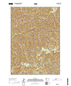
(11)- 1942 Map of Roman Nose Mtn, 1962 Print
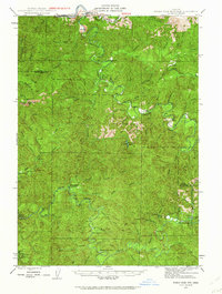 1942 Roman Nose Mtn1962 Print · USGSThe Oregon Coast Range during the early 1940s is revealed here as a landscape of isolated homesteads and river-carved valleys. Researchers can locate remote schools like Alma Sch, the Southern Pacific rail line, and family landmarks including Hess Ranch and Luce Place.2 unique versions available
 - 1945 Map of Roman Nose Mtn
 1945 Roman Nose Mtn1945 Print · USGSCoastal Oregon's winding river valleys and timberlands are captured here during the mid-1940s, showing a remote landscape of forest guard stations and isolated homesteads. Researchers can locate family-named landmarks like Luce Place and Hess Ranch, or trace the Southern Pacific line through Linslaw.2 unique versions available
 - 1958 Map of Roseburg, 1960 Print
 1958 Roseburg1960 Print · USGSThe timber valleys and high volcanic peaks of Southern Oregon are captured here in the late fifties. Researchers can trace the Southern Pacific rail line through historic settlements like Cottage Grove, Yoncalla, and Oakridge near the Cascade Range crest.4 unique versions available
 - 1959 Map of Roseburg
 1959 Roseburg1959 Print · USGSThe Umpqua and Willamette valleys meet the high Cascades in this late-fifties study of Southern Oregon's timber and rail corridors. Genealogists and researchers can trace the Southern Pacific RR through historic towns like Roseburg, Yoncalla, and Cottage Grove.
 - 1979 Map of Cottage Grove
 1979 Cottage Grove1979 Print · USGSThe Oregon timber and rail corridors of the late seventies are documented here, centered on the Coast Fork Willamette River and the growing hub of Cottage Grove. Researchers can trace the path of the Southern Pacific railroad as it connects small stations like Divide, Saginaw, and Yoncalla.2 unique versions available
 - 1984 Map of Gunter
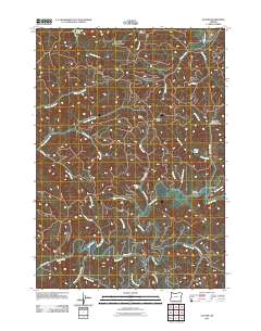
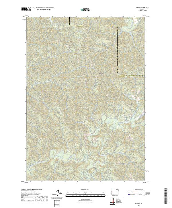
 1984 Gunter1984 Print · USGSThe Oregon Coast Range at the Douglas and Lane county line comes alive in the mid-eighties. Genealogists and historians can trace the remote settlement at Gunter, locating the local Cem, a Quarry, and the winding banks of the Smith River.
 - 2011 Map of Gunter, 2011 Print
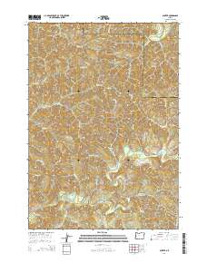
 2011 Gunter2011 Print · USGSCovers Gunter, including Lane County, Douglas County, and other nearby areas
 - 2014 Map of Gunter, 2014 Print
 2014 Gunter2014 Print · USGSCovers Gunter, including Lane County, Douglas County, and other nearby areas
 - 2017 Map of Gunter, 2017 Print
 2017 Gunter2017 Print · USGSCovers Gunter, including Lane County, Douglas County, and other nearby areas
 - 2020 Map of Gunter, 2020 Print
 2020 Gunter2020 Print · USGSCovers Gunter, including Lane County, Douglas County, and other nearby areas
 - 2023 Map of Gunter, 2023 Print
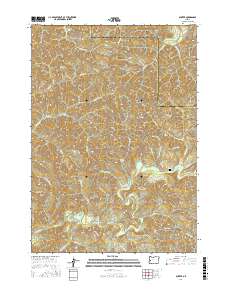
 2023 Gunter2023 Print · USGSThe community of Gunter and its surrounding timberlands are documented in this recent survey. Researchers can locate the Gunter Cem and trace drainage systems from the Siuslaw River to Yellow Lake and Pearl Lake.
End of results
Showing maps 1-11 of 11
Top cities near Gunter
Frequently asked questions
- What are the different types of historical maps available for Gunter?
- What is the oldest map of Gunter?
- Where can I purchase historical maps of Gunter for my home or office?
- Where can I download high-res historical maps of Gunter?
- Are there historical topographic maps available for Gunter?
- Is there historical aerial imagery available for Gunter?
- Where are historical maps of Gunter sourced from?