Old Maps of Izee, Oregon for Genealogy
Trace your family roots with 10 historic maps of Izee. These high-res maps reveal old neighborhoods, homesites, landmarks, and streets — helping you uncover where your ancestors lived and how the area evolved over time.
- Explore historic neighborhoods: Identify where your relatives may have lived in the 1800s or 1900s.
- Compare maps over time: Trace the changes in streets, buildings, and landmarks for multi-generational research.
- Perfect for genealogy & ancestry research: Used by family historians and researchers to map out lineage and migration.
These maps are an incredible resource for exploring your personal connection to Izee's past.
Izee, OR maps
(10)- 1955 Map of Canyon City, 1966 Print
 1955 Canyon City1966 Print · USGSCentral Oregon's high desert and timber country are captured here in the mid-fifties, showing the rugged ranching and logging landscape. Trace the path of the Sumpter Valley Ry or locate remote settlements like Izee, Whitney, and Ritter.4 unique versions available
 - 1959 Map of Canyon City
 1959 Canyon City1959 Print · USGSEastern Oregon in the late fifties was a landscape of high timber and remote river valleys shaped by the cattle and mining trades. Genealogists and historians can trace the paths of the Sumpter Valley RR and find early settlements like Antone, Richmond, and Dayville.2 unique versions available
 - 1961 Map of Izee, 1963 Print
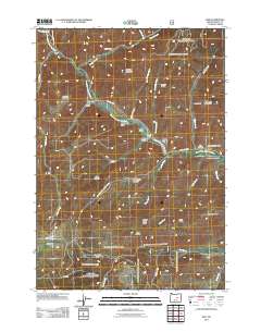
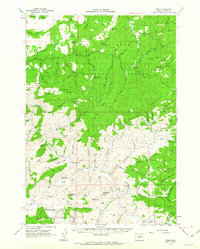 1961 Izee1963 Print · USGSThe high-desert ranching and logging country of Grant County is captured here in the early sixties. Researchers can trace the remote settlement of Izee, find the local Cem, and locate historical industrial sites like Buck Mill (Site) and the Robe Westfall Mine.2 unique versions available
 - 1981 Map of Dayville
 1981 Dayville1981 Print · USGSEastern Oregon’s high-desert rangeland and timber country are captured here in the early eighties, centered on the John Day River valley. Genealogists and historians can trace isolated settlements like Izee and Suplee alongside historical mining sites including Chambers Mine.2 unique versions available
 - 1990 Map of Izee
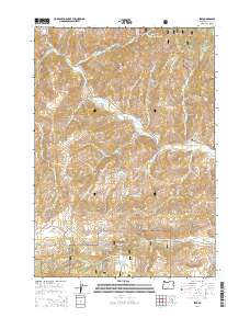
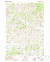 1990 Izee1990 Print · USGSGrant County ranching and timber lands are captured here in the late twentieth century, centered on the South Fork John Day River. Researchers can trace old family holdings like Kerrins Ranch and identify historical industrial locations such as the Bush Mill (Site).
 - 1998 Map of Izee, 2000 Print
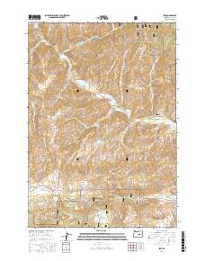
 1998 Izee2000 Print · USGSHigh-elevation ranching and timber country in the late nineties is documented here, centered on the South Fork John Day River. Researchers can locate the settlement of Izee, the Bush Mill (Site), and the local Cem among the peaks.
 - 2011 Map of Izee, 2011 Print
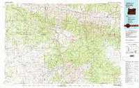
 2011 Izee2011 Print · USGSCovers Izee, including Grant County, United States, and other nearby areas
 - 2014 Map of Izee, 2014 Print
 2014 Izee2014 Print · USGSCovers Izee, including Grant County, United States, and other nearby areas
 - 2017 Map of Izee, 2017 Print
 2017 Izee2017 Print · USGSCovers Izee, including Grant County, United States, and other nearby areas
 - 2024 Map of Izee, 2024 Print
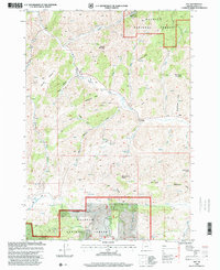
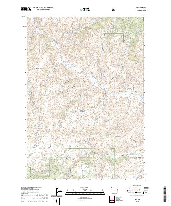 2024 Izee2024 Print · USGSGrant County’s high country is captured here in the contemporary era, centered on the remote ranching community of Izee. Researchers can locate the Izee Cem and trace seasonal drainages through family-named landmarks like Brisbois Gulch and Dons Butte.
End of results
Showing maps 1-10 of 10
Frequently asked questions
- What are the different types of historical maps available for Izee?
- What is the oldest map of Izee?
- Where can I purchase historical maps of Izee for my home or office?
- Where can I download high-res historical maps of Izee?
- Are there historical topographic maps available for Izee?
- Is there historical aerial imagery available for Izee?
- Where are historical maps of Izee sourced from?