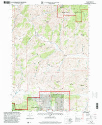
1998 Map of Izee
USGS Topo · Published 2000About this map
The South Fork John Day River winds through this high-elevation terrain in Grant County, anchoring a landscape defined by sharp ridges and significant vertical relief. At the eastern edge, the small settlement of Izee stands near Schoolhouse Gulch, providing a rare point of habitation in a region dominated by the Malheur National Forest. This late-1990s survey details the remnant footprints of local industry and infrastructure, including the Bush Mill (Site) and a Quarry located north of Dons Butte. Distinctive geologic and descriptive landmarks like Hole-in-the Ground and the narrow passage of Moonshine Alley reflect the character of the central Oregon backcountry. The map also records the location of a local Cem, an essential point of reference for family historians tracing early ranching or timber-related residents of the area.
Find a feature on this map
39 named features on this map. Tap any name to fly to it.
Don’t see what you’re looking for? This feature index may not catch every label — zoom into the map to look around manually.
Map Details
Editions of this 1998 Izee Map
This is the sole edition of this map. No revisions or reprints were ever made.
Other maps of this area

1932 · Dayville
USGS Topo · 1:125,000

1936 · Dayville
USGS Topo · 1:125,000

1955 · Burns
USGS Topo · 1:250,000

1955 · Canyon City
USGS Topo · 1:250,000

1958 · Burns
USGS Topo · 1:250,000

1959 · Burns
USGS Topo · 1:250,000

1959 · Canyon City
USGS Topo · 1:250,000

1959 · Sawtooth Creek
USGS Topo · 1:62,500

1961 · Delintment Lake
USGS Topo · 1:62,500

1961 · Izee
USGS Topo · 1:62,500