1990s Maps of Hood River County, Oregon
Explore 17 historic maps of Hood River County from the 1990s. These maps offer a rare glimpse into what life looked like during the 1990s — showing old roads, neighborhoods, homes, and landmarks that have changed or disappeared over time.
Whether you're researching your family's past, planning a metal detecting trip, or studying how Hood River County's landscape evolved across the 1990s, these high-resolution maps are a powerful tool for exploring the history of this region.
- Focus on a specific era: All maps on this page are from the 1990s, giving you a focused view of this time period.
- See what’s changed: Compare century-old streets, trails, and buildings to today's modern landscape using overlays and satellite layers.
- Research with precision: Use these maps for genealogy, historical research, land use analysis, or educational projects.
- View, download, or print: Maps are fully viewable online in high resolution, and can be downloaded or printed for your own records.
Start exploring Hood River County's history through authentic maps from the 1990s. This is your window into the past.
Hood River County, OR maps
(17)- 1994 Map of Hood River, 1996 Print
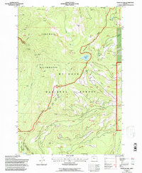
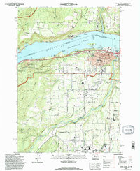 1994 Hood River1996 Print · USGSThe Columbia River Gorge area in the mid-1990s reflects a landscape shaped by orchards, timber, and the river economy. Genealogists and historians can trace family locations through Idelwild Cem, Frankton Sch, and the settlements of Underwood and Rockford.
 - 1994 Map of Mt. Defiance, 1996 Print
 1994 Mt. Defiance1996 Print · USGSThe Columbia River Gorge in the mid-nineties shows a landscape defined by federal forests and riverfront industry. Researchers can trace the path of the Old Wagon Road and locate the historic timber operations at Mill A and the Little White Salmon Nat Fish Hatchery.
 - 1994 Map of Carson, 1996 Print
 1994 Carson1996 Print · USGSThe Columbia River Gorge in the mid-nineties shows the vital intersection of Pacific Northwest timber lands and major transport corridors. Trace the paths of the Union Pacific Railroad and Pacific Crest National Scenic Trail past Carson and Wyeth.
 - 1994 Map of Tanner Butte, 1996 Print
 1994 Tanner Butte1996 Print · USGSThe Columbia River Gorge in the mid-1990s reveals a landscape of protected wilderness and dramatic waterfalls along the Washington border. Outdoor researchers and hikers can trace the paths to Elowah Falls, Tanner Butte, and the remote Dublin Lake.
 - 1994 Map of Bonneville Dam, 1996 Print
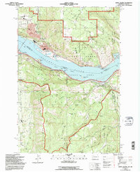
 1994 Bonneville Dam1996 Print · USGSThe Columbia River Gorge in the mid-nineties shows a landscape defined by massive hydropower and river traffic. Researchers can trace the engineering footprint of Bonneville Dam, find the Iman Cem, and follow the Bridge of the Gods into Cascade Locks.
 - 1994 Map of Dee, 1996 Print
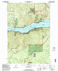
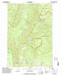
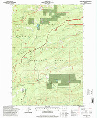
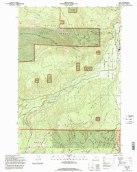 1994 Dee1996 Print · USGSHood River County’s timber and water network comes into focus in the mid-nineties as the forks of the river converge near Dee. Local researchers can trace old routes along Lolo Pass Road and locate landmarks like the Fish Hatchery and Punchbowl Falls.
 - 1994 Map of White Salmon, 1996 Print
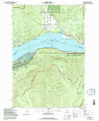
 1994 White Salmon1996 Print · USGSThe Columbia River Gorge comes to life in the mid-1990s as it winds between the growing communities of White Salmon, Washington, and Hood River, Oregon. Researchers can trace local landmarks like Skyline Hospital, Pine Grove School, and the historic Mosier Cem along the southern river bluffs.
 - 1994 Map of Parkdale, 1996 Print
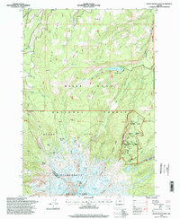
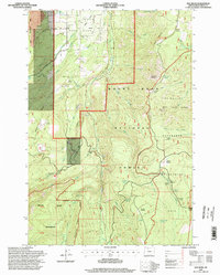
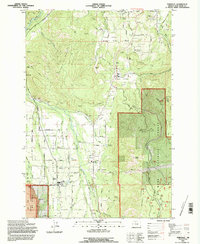 1994 Parkdale1996 Print · USGSThe Upper Hood River Valley was a thriving hub of orchards and forestry in the mid-1990s. Genealogists and local historians can locate Upper Valley Cem, trace the Farmers Ditch, and explore the settlement at Parkdale.2 unique versions available
 - 1994 Map of Ketchum Reservoir, 1997 Print
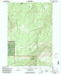 1994 Ketchum Reservoir1997 Print · USGSThe high ridges and deep canyons of Wasco County are documented here in the mid-1990s. Trace local landmarks like Ketchum Ranch, Old Schoolhouse Spring, and the critical water networks around Ketchum Reservoir and Mosier Creek.
 - 1994 Map of Wahtum Lake, 1997 Print
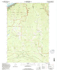
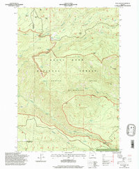
 1994 Wahtum Lake1997 Print · USGSThe Mt Hood National Forest back country is mapped here in the mid-1990s, detailing a high-elevation network of trails and campsites. Hikers and historians can trace the Pacific Crest National Scenic Trail past Wahtum Lake and Indian Springs.
 - 1996 Map of Flag Point, 1998 Print
 1996 Flag Point1998 Print · USGSThe eastern slopes of the Cascades in the mid-1990s reveal a landscape defined by timber, water, and wilderness. Researchers can trace the remote network of forest trails and access points like Bonney Crossing, the Flag Point lookout, and the Owl Quarry industrial site.
 - 1996 Map of Mount Hood North, 1998 Print
 1996 Mount Hood North1998 Print · USGSMount Hood’s north face in the late nineties reveals a high-alpine landscape of glacial basins and early forest management. Researchers can trace historic sites like the Cloud Cap Inn, explore the water systems of Laurance Lake, and locate remote points such as McNeil Point.2 unique versions available
 - 1996 Map of Badger Lake, 1998 Print
 1996 Badger Lake1998 Print · USGSMount Hood's eastern slopes and the high Cascades are preserved here in the late nineties, showing the vital watersheds of the Hood River and Wasco county lines. Researchers can trace remote alpine landmarks like Badger Lake, Elk Meadows, and the Valley View Cabin.
 - 1996 Map of Dog River, 1998 Print
 1996 Dog River1998 Print · USGSMount Hood National Forest in the mid-nineties reveals a landscape of high-altitude water engineering and timber management. Researchers can trace the water systems of The Dalles City Waterworks or locate recreation sites like Gibson Prairie Horse Camp and Cooper Spur Winter Sports Area.
 - 1996 Map of Fivemile Butte, 1998 Print
 1996 Fivemile Butte1998 Print · USGSThe Oregon Cascades during the mid-1990s are defined here by protected forest management and high-country water systems. Researchers can trace the path of the Wolf Run Ditch or locate the camp at Camp Baldwin and the landmark Fivemile Butte.
 - 1996 Map of Mount Hood South, 1998 Print
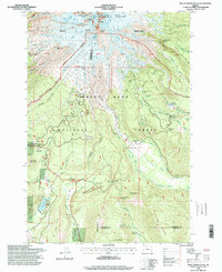 1996 Mount Hood South1998 Print · USGSThe south face of Oregon's iconic peak comes into focus in the mid-nineties, showing the intersection of pioneer history and modern recreation. Trace the historic Barlow Road, find the Pioneer Womans Grave, and locate the iconic Timberline Lodge along with numerous backcountry shelters.
 - 1997 Map of Bull Run Lake, 1999 Print
 1997 Bull Run Lake1999 Print · USGSThe northern slopes of Mount Hood are captured here in the late nineties, showcasing a landscape of high alpine lakes and protected watersheds. Hikers and historians can trace the Pacific Crest National Scenic Trail past Lolo Pass or locate the historic Lost Lake Resort.
End of results
Showing maps 1-17 of 17
Top cities of Hood River County
Frequently asked questions
- What are the different types of historical maps available for Hood River County?
- What is the oldest map of Hood River County?
- Where can I purchase historical maps of Hood River County for my home or office?
- Where can I download high-res historical maps of Hood River County?
- Are there historical topographic maps available for Hood River County?
- Is there historical aerial imagery available for Hood River County?
- Where are historical maps of Hood River County sourced from?