Old Maps of Lincoln County, Oregon for Hiking & Exploration
Hike through history with 200 historic maps of Lincoln County. Explore old trails, ghost towns, and forgotten backroads — perfect for outdoor adventurers and local explorers.
- Rediscover forgotten places: Map out old mining camps, roads, and footpaths that no longer exist on modern maps.
- Layer with modern tools: Combine with LiDAR or satellite views to plan hikes through historical terrain.
- Made for exploration: Popular among hikers, overlanders, and local history lovers.
Use these maps to find adventure and explore the hidden past of Lincoln County.
Lincoln County, OR maps
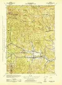
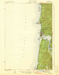
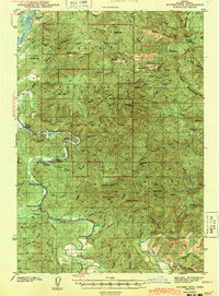
(200)- 1922 Map of Waldport
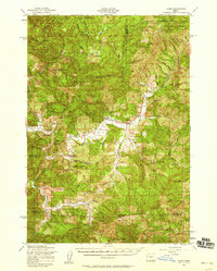
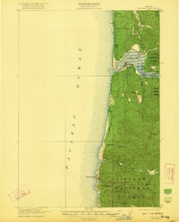 1922 Waldport1922 Print · USGSCoastal Oregon at the end of the Great War era reveals a landscape of isolated bays and forest outposts. Genealogists and local historians can trace early settlements like Waldport and Sanlots, or locate the site of the rural Alder Grove School.2 unique versions available
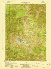
 - 1939 Map of Marys Peak, 1956 Print
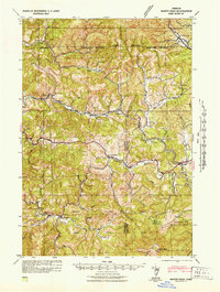
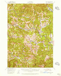 1939 Marys Peak1956 Print · USGSCoastal mountains and logging rail lines define this landscape in the late 1930s as it transitions from the Willamette Valley into the timberlands. Trace the Southern Pacific route through Nashville and locate local landmarks like Knights Of Pythias Camp and Wildwood Sch.
 - 1941 Map of Nestucca Bay
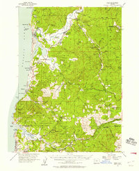
 1941 Nestucca Bay1941 Print · USGSThe Oregon coast at the start of the 1940s reveals a mix of timber industry and early seaside tourism. Trace the history of coastal work and recreation through labels like the Miles Lake CCC Camp, Hebo Alder Mill, and the many fire lookouts.
 - 1941 Map of Cape Foulweather
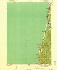 1941 Cape Foulweather1941 Print · USGSThe Oregon coast at the start of the 1940s reveals a chain of separate seaside villages along the Pacific. Genealogists and historians can trace early boundaries of Oceanlake, Delake, and Taft or locate the old ferry crossing at Kernville.
 - 1942 Map of Euchre Mtn
 1942 Euchre Mtn1942 Print · USGSCoastal Lincoln County during the early 1940s reveals a landscape of isolated timber outposts and river-oriented landings. Researchers can trace historic river access at Melco Landing and Mowrey Landing or locate family landmarks like Horner Ranch and the Ojalla Bridge.
 - 1942 Map of Marys Peak
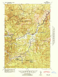
 1942 Marys Peak1942 Print · USGSCoastal Oregon timber country and the surrounding National Forest are mapped here just after the start of the war. Researchers can trace the Southern Pacific rail line through remote stops like Nashville, find old schoolhouses such as Noise Sch, or locate the Oregon State Fish Hatchery.
 - 1942 Map of Alsea
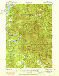
 1942 Alsea1942 Print · USGSBenton and Lincoln Counties are shown in great detail during the early 1940s, highlighting the intersection of the timber industry and rural settlement. Researchers can locate remote sites like Missouri Bend Sch, the Alsea Lumber Co, and early mountain lookouts including West Tree Lookout.
 - 1942 Map of Waldport
 1942 Waldport1942 Print · USGSThe Oregon coast at the onset of World War II reveals a landscape of isolated seaside settlements and managed forests. Trace the early layout of Waldport and Yachats alongside landmarks like the CCC Camp and Smithy Ranch.2 unique versions available
 - 1942 Map of Spirit Mtn
 1942 Spirit Mtn1942 Print · USGSThe northern Oregon Coast Range and Grand Ronde Valley come into focus during the early years of the war. Researchers can trace the timber economy and tribal history through landmarks like the Grand Ronde Agency, Midway Lumber Co, and Cloverleaf Sch.
 - 1942 Map of Nestucca Bay
 1942 Nestucca Bay1942 Print · USGSCoastal Oregon is captured here during the early war years as timber and forest management shaped the local economy. Researchers can locate vanished infrastructure like the Hebohalder Mill and Powder House, or trace the development of Pacific City and Neskowin.
 - 1942 Map of Yaquina
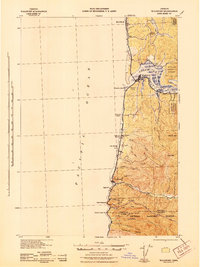
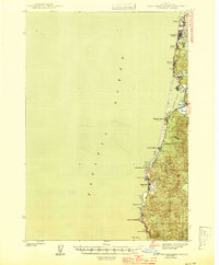
 1942 Yaquina1942 Print · USGSThe Oregon coast at the start of the 1940s reveals a maritime landscape centered on the working waterfront of Newport. Researchers can trace the development of the Oregon Coast Highway past landmarks like Yaquina Head, the U S Coast Guard Station, and Oysterville.2 unique versions available
 - 1942 Map of Valsetz
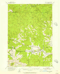
 1942 Valsetz1942 Print · USGSThe Oregon Coast Range was a hive of timber activity during the early 1940s, centered on the company town of Valsetz. Trace the operations of the Cobbs-Mitchell Lumber Co and locate high-altitude lookouts like Fanno Pk Lookout and Riley Pk Lookout.
 - 1942 Map of Tidewater, 1945 Print
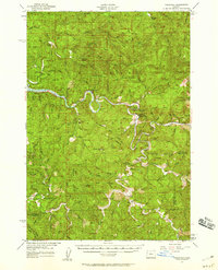
 1942 Tidewater1945 Print · USGSCoastal Oregon's winding river valleys are captured here during the mid-forties, showing the deep integration of the timber and fishing industries. You can locate early forest landmarks like Fivemile Shelter, the Upper Yachats Sch, and the State Fish Hatchery along the Alsea River.
 - 1942 Map of Toledo, 1946 Print
 1942 Toledo1946 Print · USGSCoastal Oregon's timber and rail networks are frozen in time just after the war, showing the industrial heart of the Yaquina watershed. Genealogists can trace family roots through locations like Riverside Cem or rural schools such as Moody Sch and Bear Creek Sch.
 - 1943 Map of Euchre Mtn
 1943 Euchre Mtn1943 Print · USGSThe Oregon Coast Range at the start of the 1940s reveals a river-driven landscape shaped by the Siletz River and deep forest. Genealogists and historians can trace riverside settlements and river access points like Mack Landing, the Horner Ranch, and the Ojalla Bridge near The Maples.
 - 1944 Map of Cape Foulweather
 1944 Cape Foulweather1944 Print · USGSThe Oregon coastline north of Newport appears here in the late 1930s as a series of emerging seaside communities connected by the Coast Highway. Researchers can trace the early footprints of Depoe Bay and Taft, or locate landmarks like Devils Lake and Otter Rock.
 - 1948 Map of Vancouver, 1957 Print
 1948 Vancouver1957 Print · USGSPost-war growth transforms the river valleys of the Pacific Northwest as the timber and rail economy thrives. Trace family roots in Tillamook or Oregon City, and locate vanished landmarks like the spit at Bayocean or the Skamania Mine.
 - 1950 Map of Vancouver
 1950 Vancouver1950 Print · USGSCoastal Oregon and the lower Columbia River valley are captured in detail just after the war. Researchers can trace historic rail routes like the Southern Pacific or locate early settlements such as Vernonia, Gaston, and the Grand Ronde Indian Reservation.
 - 1950 Map of Vancouver, 1951 Print
 1950 Vancouver1951 Print · USGSThe Pacific Northwest urban corridor meets the rugged coast in the years following the war, showing the expansion of Portland and Vancouver. Genealogists and historians can trace the reach of the Southern Pacific RR and locate coastal communities like Tillamook, Seaside, and Tolovana Park.
 - 1953 Map of Salem
 1953 Salem1953 Print · USGSMid-century Oregon comes to life through this detailed survey of the Willamette Valley and the adjacent Pacific coastline. Researchers can trace the rail lines of the Southern Pacific RR, visit rural hubs like Fairview School, or locate coastal landmarks like the Yaquina Head Lighthouse.
 - 1954 Map of Salem
 1954 Salem1954 Print · USGSMid-century Western Oregon is centered on the productive Willamette River valley as its cities and infrastructure expand toward the mountains. Genealogists and historians can trace the rail lines of the Southern Pacific RR and Oregon Electric Ry through towns like Dallas, Independence, and Brownsville.
 - 1955 Map of Hebo, 1957 Print
 1955 Hebo1957 Print · USGSCoastal Tillamook County is captured here in the mid-fifties, showing the development of beach communities and forest management. Genealogists can trace family sites like Herbst Place or locate the Town Lake Cemetery and Cloverdale School.3 unique versions available
 - 1955 Map of Grand Ronde, 1957 Print
 1955 Grand Ronde1957 Print · USGSThe Oregon Coast Range at mid-century reveals a landscape of tribal history and timber economy centered around the Grand Ronde Agency. Researchers can trace the legacy of rural education and faith at the Coneridge Sch and the Church in the Wildwood.2 unique versions available
 - 1956 Map of Alsea, 1958 Print
 1956 Alsea1958 Print · USGSCoastal Oregon mountain life centered on the Alsea River valley in the mid-1950s, a time of transitions between old rural school districts and modern forest management. Genealogists and historians can trace family-named sites like Sharp Ranch or the Missouri Bend School and Cem alongside the State Fish Hatchery.2 unique versions available
 - 1956 Map of Tidewater, 1958 Print
 1956 Tidewater1958 Print · USGSThe Alsea River valley and the Siuslaw National Forest are captured here in the mid-fifties, during a decade of active timber management and rural growth. Researchers can find family-named landmarks like Bohannon Ranch, old school sites like Yachats Sch, and historic crossings including a Covered Bridge.3 unique versions available
Showing maps 1-25 of 200
Top cities of Lincoln County
- Newport historical maps
- Lincoln City historical maps
- Toledo historical maps
- Waldport historical maps
- Depoe Bay historical maps
- Siletz historical maps
See more
Frequently asked questions
- What are the different types of historical maps available for Lincoln County?
- What is the oldest map of Lincoln County?
- Where can I purchase historical maps of Lincoln County for my home or office?
- Where can I download high-res historical maps of Lincoln County?
- Are there historical topographic maps available for Lincoln County?
- Is there historical aerial imagery available for Lincoln County?
- Where are historical maps of Lincoln County sourced from?