1980s Maps of Lincoln County, Oregon
Explore 32 historic maps of Lincoln County from the 1980s. These maps offer a rare glimpse into what life looked like during the 1980s — showing old roads, neighborhoods, homes, and landmarks that have changed or disappeared over time.
Whether you're researching your family's past, planning a metal detecting trip, or studying how Lincoln County's landscape evolved across the 1980s, these high-resolution maps are a powerful tool for exploring the history of this region.
- Focus on a specific era: All maps on this page are from the 1980s, giving you a focused view of this time period.
- See what’s changed: Compare century-old streets, trails, and buildings to today's modern landscape using overlays and satellite layers.
- Research with precision: Use these maps for genealogy, historical research, land use analysis, or educational projects.
- View, download, or print: Maps are fully viewable online in high resolution, and can be downloaded or printed for your own records.
Start exploring Lincoln County's history through authentic maps from the 1980s. This is your window into the past.
Lincoln County, OR maps
(32)- 1980 Map of Eugene
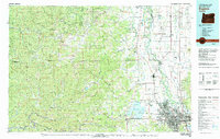 1980 Eugene1980 Print · USGSThe southern Willamette Valley and Coast Range are captured in the early eighties as the urban centers of Eugene and Springfield expanded. Researchers can trace the legacy of family estates and regional infrastructure through landmarks like Mahlon Sweet Airport, Fern Ridge Lake, and Junction City.
 - 1980 Map of Yamhill River
 1980 Yamhill River1980 Print · USGSThe Oregon Coast Range and the western Willamette Valley meet in this 1980 survey, showing the landscape from the Pacific shore to the valley floor. Genealogists and historians can trace old routes like the Salmon River Highway to find the Grand Ronde Agency, Cloverdale, and Perrydale.3 unique versions available
 - 1980 Map of Waldport
 1980 Waldport1980 Print · USGSCoastal Oregon at the start of the 1980s reveals a landscape of rugged headlands and timbered ridges between Waldport and the Siuslaw River. Researchers can trace old beach communities and landmarks like the US Coast Guard Res Lighthouse at Heceta Head and Cape Perpetua.2 unique versions available
 - 1980 Map of Corvallis, 1981 Print
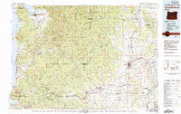
 1980 Corvallis1981 Print · USGSThe Oregon Coast Range meets the fertile Willamette Valley in the early eighties, documenting a landscape of timber, agriculture, and growing college towns. Genealogists and historians can trace old rail lines like the Southern Pacific or locate landmarks like Marys Peak and the College of Education.
 - 1981 Map of Newport
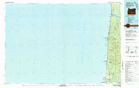
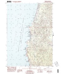
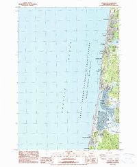
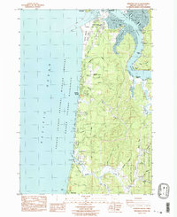
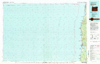 1981 Newport1981 Print · USGSThe Oregon coast in the early eighties shows a landscape of busy estuaries and established seaside communities from Lincoln City down to Southbench. Genealogists and local historians can trace the development of towns like Depoe Bay, locate family-named landmarks like McLean Point, or explore the many inlets of Yaquina Bay.
 - 1984 Map of Tidewater
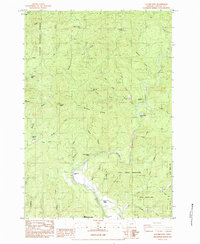
 1984 Tidewater1984 Print · USGSThe Alsea River valley in the mid-1980s reveals a network of small riverside settlements and timberland terrain. Researchers can trace the layout of Westwood Village, find the cemetery near Tidewater, and locate landmarks like Butler Peak.
 - 1984 Map of Mowrey Landing
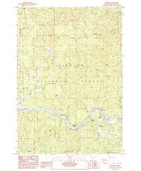
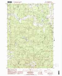
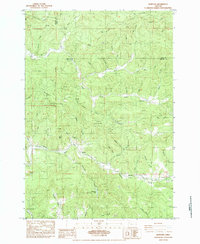
 1984 Mowrey Landing1984 Print · USGSThe Siletz River corridor in Lincoln County appears in the mid-1980s as a landscape of timber and small riverside outposts. Researchers can trace local landmarks like Reed Creek Grange, the Camas Prairie, and several named river access points including Mowrey Landing.
 - 1984 Map of Toledo North
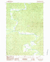
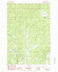
 1984 Toledo North1984 Print · USGSThe Siletz River valley and the industrial corridor of Toledo are captured here in the mid-1980s. Local researchers can trace family landmarks and timber history through sites like Paul Washington Cem, the Siletz Indian Reservation, and the Southern Pacific rail line.
 - 1984 Map of Depoe Bay
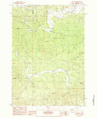
 1984 Depoe Bay1984 Print · USGSThe Oregon coast at Depoe Bay in the mid-eighties shows a rugged maritime landscape where small-town infrastructure meets protected wilderness. Researchers can trace the development of the shoreline near Cape Foulweather and locate early sites like the Train Depot and Lincoln Beach.2 unique versions available
 - 1984 Map of Toledo South
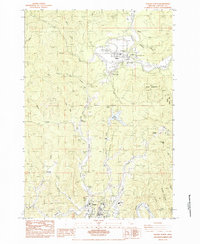
 1984 Toledo South1984 Print · USGSThe Yaquina River valley in the mid-eighties shows a landscape of timber and rail operations centered around Toledo. Researchers can trace old family sites and rural infrastructure like the Sunnyridge Grange, Butler Bridge, and the Historical Monument at Craigie Point.
 - 1984 Map of Eddyville
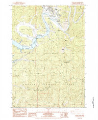
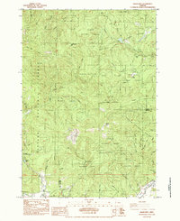
 1984 Eddyville1984 Print · USGSThe Siletz and Yaquina River valleys in the early 1980s show a landscape of timber and rail. Trace the historic Southern Pacific line near Eddyville or locate the landmark Chitwood Covered Bridge and Twin Bridges Memorial Park.
 - 1984 Map of Waldport
 1984 Waldport1984 Print · USGSThe Oregon coast at Waldport comes alive in this mid-eighties survey, showing the delicate balance between the Siuslaw National Forest and the Pacific. Researchers can trace the layout of Wakonda Beach or locate early sites like the Memorial Home Cem and Eckman Quarry.2 unique versions available
 - 1984 Map of Marys Peak
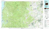
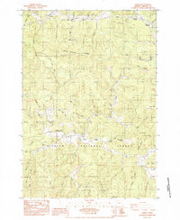
 1984 Marys Peak1984 Print · USGSBenton and Lincoln counties are captured here in the mid-1970s and early 1980s as the regional timber and rail economy flourished. Genealogists can trace family footprints at Mulkey Cem and Davidson Cem or locate the old Blodgett Sch near the Southern Pacific tracks.2 unique versions available
 - 1984 Map of Devils Lake
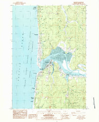
 1984 Devils Lake1984 Print · USGSCoastal development meets the deep timber of the Oregon Coast Range in the mid-eighties as Lincoln City expands around the shores of Devils Lake. Researchers can trace the layout of Oceanlake, find Sunset Landing on the Siletz River, or locate the Schooner Creek Campground within the Siuslaw National Forest.
 - 1984 Map of Grass Mtn
 1984 Grass Mtn1984 Print · USGSThe Oregon Coast Range in the mid-eighties shows a rugged landscape of timber management and river culture along the Lincoln and Benton County line. Researchers can locate the Covered Bridge on the Alsea River and the Fall Creek State Fish Hatchery.
 - 1984 Map of Stott Mountain
 1984 Stott Mountain1984 Print · USGSCoastal Oregon in the mid-1980s reveals a landscape of high timbered ridges and remote mountain outposts. Researchers can trace old homestead sites like Horner Ranch and Minski Place or locate isolated landmarks like Four Cabin Corner.
 - 1984 Map of Euchre Mtn
 1984 Euchre Mtn1984 Print · USGSCoastal Oregon timberlands and tribal history meet in the 1980s as the Siletz River cuts through the Siletz Indian Reservation. Researchers can locate former work sites like Werner Camp and family landmarks such as Moonshine Park.
 - 1984 Map of Nortons
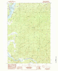
 1984 Nortons1984 Print · USGSThe Siletz Indian Reservation and the winding Yaquina River define this Oregon landscape in the mid-1980s. Local researchers can trace family landmarks and rural life at Nortons, Wigle Cem, and the old Southern Pacific rail line.
 - 1984 Map of Summit
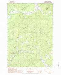
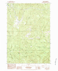
 1984 Summit1984 Print · USGSThe Coast Range summit of Benton County comes into focus in the mid-1980s, where the headwaters of the Luckiamute and Marys rivers meet. Genealogists and local historians can trace family plots at Claremont Cem and May Stouts Cem or follow the Southern Pacific rail line through Summit.
 - 1984 Map of Digger Mtn
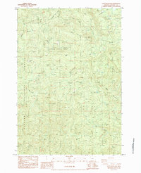
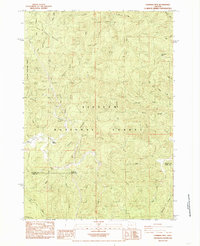
 1984 Digger Mtn1984 Print · USGSThe Alsea River valley in the early 1980s reveals a landscape of remote timberlands and river-based recreation at the Benton-Lincoln county line. Trace local landmarks like the Missouri Bend School, the Lone Fir Cem, and the winding Lobster Creek.
 - 1984 Map of Lincoln City
 1984 Lincoln City1984 Print · USGSThe Oregon Coast in the mid-1980s reveals a series of growing seaside communities from Wecoma Beach down to Gleneden Beach. Trace the historical layout of Lincoln City neighborhoods and waterfront landmarks like Salishan Spit, Devils Lake, and Kernville.
 - 1984 Map of Harlan
 1984 Harlan1984 Print · USGSThe community of Harlan sits deep in the Oregon Coast Range during the mid-1980s, centered on the Big Elk Creek valley. Researchers can trace local landmarks like the Chapel of the Valley, the Cem., and the Big Elk Forest Service Sta.
 - 1984 Map of Elk City
 1984 Elk City1984 Print · USGSThe Oregon Coast Range in the mid-1980s was a landscape of timber and secluded valley settlements like Elk City. Researchers can trace old family sites and logging tracks near Glenwood Cem, Salado, and the winding waters of Big Elk Creek.
 - 1984 Map of Cannibal Mtn, 1985 Print
 1984 Cannibal Mtn1985 Print · USGSThe Oregon coast range in the mid-eighties reveals a landscape of deep national forest drainages and high timbered peaks. Researchers can locate the River Covered Bridge, the Yachats Grange, and the small settlement of Upper Yachats along the river's path.
 - 1984 Map of Newport South, 1985 Print
 1984 Newport South1985 Print · USGSThe Oregon coast south of Newport in the mid-eighties reveals a landscape of maritime research, tidal sloughs, and emerging beach communities. Trace the development of South Beach, the Marine Science Center, and riverside hamlets like Winant and Oysterville.2 unique versions available
Showing maps 1-25 of 32
Top cities of Lincoln County
- Newport historical maps
- Lincoln City historical maps
- Toledo historical maps
- Waldport historical maps
- Depoe Bay historical maps
- Siletz historical maps
See more
Frequently asked questions
- What are the different types of historical maps available for Lincoln County?
- What is the oldest map of Lincoln County?
- Where can I purchase historical maps of Lincoln County for my home or office?
- Where can I download high-res historical maps of Lincoln County?
- Are there historical topographic maps available for Lincoln County?
- Is there historical aerial imagery available for Lincoln County?
- Where are historical maps of Lincoln County sourced from?