Old Maps of Ontario Heights, Oregon for Metal Detecting
Plan your next treasure hunt with 10 historic maps of Ontario Heights. Find old homesites, ghost towns, trails, and gathering spots that may be lost to time — perfect for identifying promising metal detecting locations.
- Locate forgotten sites: Uncover places like long-lost settlements, abandoned rail lines, or gathering spots.
- Plan better hunts: Use map overlays combined with LiDAR or satellite views to narrow in on historically rich areas.
- Made for detectorists: Thousands of hobbyists use these maps to discover relics, coins, and hidden history.
Use these historic maps to boost your research and find new opportunities beneath the surface of Ontario Heights.
Ontario Heights, OR maps
(10)- 1951 Map of Malheur Butte, 1952 Print
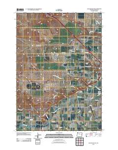
 1951 Malheur Butte1952 Print · USGSEastern Oregon agriculture and infrastructure are captured here in the early fifties as irrigation transformed the high desert. Researchers can trace the development of rural social life and utility networks near Malheur Butte and the Ontario Heights Grange.4 unique versions available
 - 1951 Map of Moores Hollow, 1953 Print
 1951 Moores Hollow1953 Print · USGSThe Oregon-Idaho borderlands thrive on river-fed irrigation and rail transport in the early fifties. Genealogists can trace family footprints near Annex and Ontario Heights or locate the historic path of the Oregon Trail as it nears the Snake River.3 unique versions available
 - 1955 Map of Baker, 1964 Print
 1955 Baker1964 Print · USGSThe Oregon-Idaho borderlands are captured here in the mid-fifties as the Snake River underwent massive changes from dam construction. Trace the Oregon Trail Memorial Monument near Baker, find early mines like Virtue Mine, and follow the Union Pacific Railroad through Huntington.4 unique versions available
 - 1959 Map of Baker
 1959 Baker1959 Print · USGSThe Oregon and Idaho borderlands come alive in the late fifties, showing the rugged corridor along the Snake River and the high peaks of the Wallowa Mountains. Researchers can trace the legacy of the Union Pacific railroad or locate historic mining sites like the Flagstaff Mine and Virtue Mine.2 unique versions available
 - 1980 Map of Brogan, 1997 Print
 1980 Brogan1997 Print · USGSThe Oregon-Idaho borderlands come alive in this late-century survey of the high desert and river valleys. Researchers can trace the legacy of ranching and transport through sites like Malheur City, the Union Pacific rail lines, and the Snake River crossings.
 - 2011 Map of Malheur Butte, 2011 Print
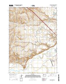
 2011 Malheur Butte2011 Print · USGSCovers Ontario Heights, including Ontario, Malheur County, and other nearby areas
 - 2014 Map of Malheur Butte, 2014 Print
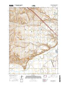
 2014 Malheur Butte2014 Print · USGSCovers Ontario Heights, including Ontario, Malheur County, and other nearby areas
 - 2017 Map of Malheur Butte, 2017 Print
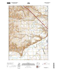
 2017 Malheur Butte2017 Print · USGSCovers Ontario Heights, including Ontario, Malheur County, and other nearby areas
 - 2020 Map of Malheur Butte, 2020 Print
 2020 Malheur Butte2020 Print · USGSCovers Ontario Heights, including Ontario, Malheur County, and other nearby areas
 - 2023 Map of Malheur Butte, 2023 Print
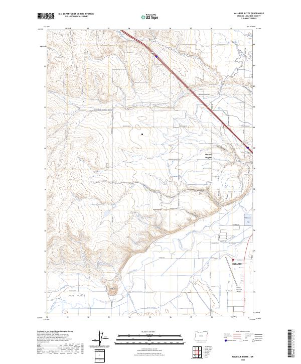 2023 Malheur Butte2023 Print · USGSThe western edge of Ontario and the rising profile of Malheur Butte characterize this contemporary look at Malheur County's high-desert landscape. Local historians can trace water engineering through the Owyhee Canal and Malheur Siphon alongside the Malheur River.
End of results
Showing maps 1-10 of 10
Top cities near Ontario Heights
- Ontario historical maps
- Payette historical maps
- Fruitland historical maps
- Weiser historical maps
- Nyssa historical maps
- Vale historical maps
See more
Frequently asked questions
- What are the different types of historical maps available for Ontario Heights?
- What is the oldest map of Ontario Heights?
- Where can I purchase historical maps of Ontario Heights for my home or office?
- Where can I download high-res historical maps of Ontario Heights?
- Are there historical topographic maps available for Ontario Heights?
- Is there historical aerial imagery available for Ontario Heights?
- Where are historical maps of Ontario Heights sourced from?