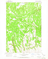
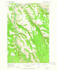
1960s Maps of Wallowa County, Oregon
Explore 36 historic maps of Wallowa County from the 1960s. These maps offer a rare glimpse into what life looked like during the 1960s — showing old roads, neighborhoods, homes, and landmarks that have changed or disappeared over time.
Whether you're researching your family's past, planning a metal detecting trip, or studying how Wallowa County's landscape evolved across the 1960s, these high-resolution maps are a powerful tool for exploring the history of this region.
- Focus on a specific era: All maps on this page are from the 1960s, giving you a focused view of this time period.
- See what’s changed: Compare century-old streets, trails, and buildings to today's modern landscape using overlays and satellite layers.
- Research with precision: Use these maps for genealogy, historical research, land use analysis, or educational projects.
- View, download, or print: Maps are fully viewable online in high resolution, and can be downloaded or printed for your own records.
Start exploring Wallowa County's history through authentic maps from the 1960s. This is your window into the past.
Wallowa County, OR maps
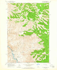
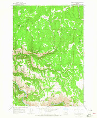
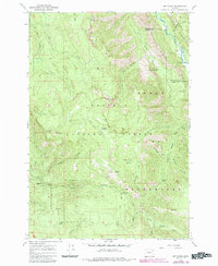
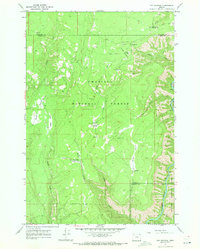
(36)- 1963 Map of Cactus Mtn, 1964 Print
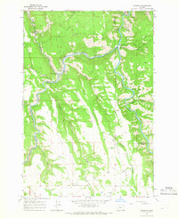
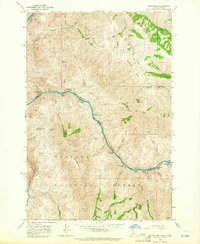 1963 Cactus Mtn1964 Print · USGSThe Snake and Salmon rivers meet along the Idaho-Oregon border in the early sixties, a landscape of high summits and deep river canyons. Researchers can trace remote outposts like Spencer Ranch, the historic river crossing at Dug Bar, and the long Wallowa Summit Ridge.2 unique versions available
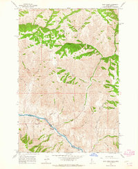
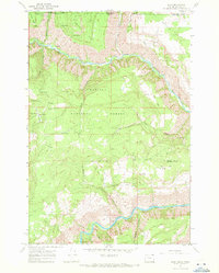
 - 1963 Map of Deadhorse Ridge, 1965 Print
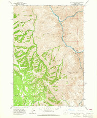 1963 Deadhorse Ridge1965 Print · USGSThe confluence of the Salmon and Snake Rivers is captured here in the early sixties, a time when mining and ranching still defined this remote borderland. Researchers can locate specific industrial sites like the Mountain Chief Mine and Mine Ruins at Eureka Bar, or trace early homesteads at Cherry Creek Ranch and Dobbin Cabin.3 unique versions available
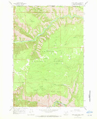
 - 1963 Map of Jim Creek Butte, 1965 Print
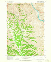 1963 Jim Creek Butte1965 Print · USGSThe Snake River canyon and the Wallowa high country meet in this mid-century survey of the Oregon-Idaho border. Researchers can trace the rugged network of trails and jeep tracks leading to remote landmarks like Jim Creek Butte, an isolated mine, and Cochran Islands.2 unique versions available
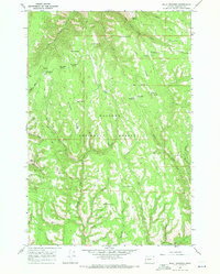
 - 1963 Map of Kirkwood Creek, 1965 Print
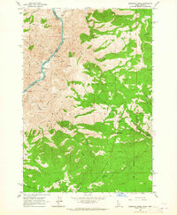 1963 Kirkwood Creek1965 Print · USGSHigh-altitude ranching and river navigation dominate this mid-century survey of the Snake River canyon as it cuts through the national forests. Researchers can locate remote seasonal sites like Dixon Cow Camp, the historic Blue Jacket Mine, and ancient Pictographs along the river banks.2 unique versions available
 - 1963 Map of Grave Point, 1965 Print
 1963 Grave Point1965 Print · USGSThe Snake River canyon country along the Idaho-Oregon border is captured here in the early 1960s. Genealogists and local historians can trace river-side activity at Upper Pittsburg Landing, locate the remote Walters Ranch, or identify the high-altitude Camp Howard Cow Camp.2 unique versions available
 - 1963 Map of Wapshilla Creek, 1965 Print
 1963 Wapshilla Creek1965 Print · USGSThe high canyons of the Craig Mountains meet the Snake and Salmon Rivers in the early sixties. Genealogists and historians can trace riverbank sites like Geneva Bar, the Wallowa National Forest boundary, and remote water sources like Coyote Spr.2 unique versions available
 - 1963 Map of Poison Point, 1965 Print
 1963 Poison Point1965 Print · USGSHigh in the Wallowa Mountains during the early 1960s, this area reveals a landscape shaped by forest management and water resource development. Researchers can trace remote pack routes and vital water sources like the Howard Trail, Mitchell Spring, and Rice Corral Reservoir.2 unique versions available
 - 1963 Map of Wolf Creek, 1965 Print
 1963 Wolf Creek1965 Print · USGSThe Snake River canyon at the Idaho-Oregon border is captured here in the early sixties, showing a frontier of steep ridges and river rapids. Researchers can trace remote ranching outposts like Davidson and Mexican Place or locate river landmarks like Ragtown Bar.2 unique versions available
 - 1964 Map of Howard Butte, 1965 Print
 1964 Howard Butte1965 Print · USGSWallowa and Union counties meet among the high meadows and forest ridges of the Oregon backcountry during the mid-1960s. Researchers can trace remote landmarks like the Lookout Tower on Howard Butte, find a lonely Grave, or locate Camp Five.3 unique versions available
 - 1964 Map of Akers Butte, 1965 Print
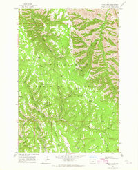
 1964 Akers Butte1965 Print · USGSWallowa County in the mid-1960s was a landscape of remote forest outposts and high-elevation terrain. Researchers can trace the drainage of Tamarack Canyon, locate the high Landing Strip near Smith Mountain, and explore the area surrounding Maxville.2 unique versions available
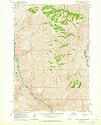
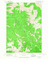
 - 1964 Map of Wallowa, 1966 Print
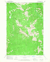
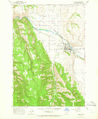 1964 Wallowa1966 Print · USGSWallowa and the surrounding high-country valleys are documented here during the mid-1960s, showing a landscape defined by the timber industry and river-fed agriculture. You can trace early irrigation via the Chamberlin Ditch or locate the Bramlet Memorial Cem and Sasser Landing Strip.2 unique versions available
 - 1964 Map of Minam, 1966 Print
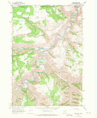
 1964 Minam1966 Print · USGSThe rail-and-river settlement of Minam sits at a strategic canyon junction in the 1960s, where the Union Pacific tracks meet the water. Researchers can trace historic access routes across Elliott Flat or find named landmarks like Chestnut Spring and the Wallowa National Forest boundary.2 unique versions available
 - 1964 Map of Rondowa, 1966 Print
 1964 Rondowa1966 Print · USGSNear the Union and Wallowa county line in the mid-sixties, the Union Pacific railroad followed the serpentine Grande Ronde River. Trace the old rail stop at Rondowa, the mountain settlement of Palmer Junction, or family sites near Mt Pleasant Cem.3 unique versions available
 - 1965 Map of China Cap, 1967 Print
 1965 China Cap1967 Print · USGSThe high Divide between Union and Wallowa counties is documented here in the mid-1960s before modern road expansion. Researchers can trace remote backcountry outposts and early exploration sites like Catherine Creek Cabin, Mule Peak Lookout, and several unnamed prospects.2 unique versions available
 - 1965 Map of Fox Point, 1967 Print
 1965 Fox Point1967 Print · USGSWallowa County high country is documented here in the mid-1960s as a landscape of remote ranger outposts and pack trails. Researchers can trace historic forest management routes and landmarks like Bear Creek Guard Station, Bald Knob, and the Boundary Campground.2 unique versions available
 - 1965 Map of Mount Moriah, 1967 Print
 1965 Mount Moriah1967 Print · USGSThe wilderness surrounding the Union and Wallowa county line is captured here in the mid-sixties before modern road expansion. Researchers can trace remote routes across Mount Moriah or follow the paths to Collusion Point, Horse Meadow, and the Minam River.2 unique versions available
 - 1965 Map of Mt. Fanny, 1985 Print
 1965 Mt. Fanny1985 Print · USGSThe Oregon backcountry of the Wallowas is captured here in the mid-sixties, detailing the high ridges and river valleys of Union and Wallowa Counties. Researchers can trace remote mountain outposts like Minam Lodge and Rede Horse Ranch or locate the old Guard Station near Moss Spring.
 - 1966 Map of Jim White Ridge, 1967 Print
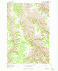
 1966 Jim White Ridge1967 Print · USGSIn the mid-1960s, this area of the Eagle Cap Wilderness remained a backcountry of pack trails and high-altitude basins. Local historians can trace early wilderness routes to the Landing Strip, Jim White Ridge, and the Minam River corridor.2 unique versions available
 - 1967 Map of Wood Butte, 1971 Print
 1967 Wood Butte1971 Print · USGSWallowa County high country is shown here in the late sixties, a landscape of deep canyons and prominent ridges. Researchers can trace the Courtney Trail and locate the settlement at Olson amidst the Wallowa National Forest.2 unique versions available
 - 1967 Map of Troy, 1971 Print
 1967 Troy1971 Print · USGSThe Oregon-Washington border region comes to life in the late sixties as the Grande Ronde River carves through the high plateaus. Genealogists and hikers can trace the remote settlement of Troy, the upland community of Bartlett, and the Bartlett Cem tucked away on the flat.2 unique versions available
 - 1967 Map of Table Mountain, 1971 Print
 1967 Table Mountain1971 Print · USGSWallowa County high country is documented here in the late sixties, showing a wilderness of springs, creeks, and forest service infrastructure. Map collectors and hikers can trace the Sleepy Bill Trail, locate the Kirkland Lookout Tower, and find old water sources like Wilder Spring.2 unique versions available
 - 1967 Map of Fry Meadow, 1971 Print
 1967 Fry Meadow1971 Print · USGSThe high timberlands along the Union and Wallowa county line are documented here in the late sixties, showing a landscape defined by forest management and rugged river canyons. Researchers can locate remote outposts like the Fry Meadow Guard Sta and Jaussaud Corral or trace the steep banks of the Grande Ronde River.3 unique versions available
 - 1967 Map of Eden, 1971 Print
 1967 Eden1971 Print · USGSThe Oregon and Washington borderlands in the late 1960s reveal a landscape of deep river canyons and high timbered ridges. Genealogists and historians can locate remote landmarks like Eden Cem, Eden Community Hall, and the Hoodoo Lookout Tower.2 unique versions available
 - 1967 Map of Elbow Creek, 1971 Print
 1967 Elbow Creek1971 Print · USGSThe Oregon-Washington borderlands appear here in the late 1960s, showing a landscape defined by the Wenaha River and national forest boundaries. Researchers can trace historic access routes via the Pack Trails and locate named water sources like Mosier Spring and Squaw Falls.3 unique versions available
 - 1967 Map of Billy Meadows, 1971 Print
 1967 Billy Meadows1971 Print · USGSWallowa County in the late 1960s was a landscape of high timber ridges and forest service outposts. Researchers can trace historic access routes like the Aspen Spring Trail and locate remote operational sites such as the Billy Meadows Guard Station and Hollow Log Cow Camp.2 unique versions available
Showing maps 1-25 of 36
Top cities of Wallowa County
Frequently asked questions
- What are the different types of historical maps available for Wallowa County?
- What is the oldest map of Wallowa County?
- Where can I purchase historical maps of Wallowa County for my home or office?
- Where can I download high-res historical maps of Wallowa County?
- Are there historical topographic maps available for Wallowa County?
- Is there historical aerial imagery available for Wallowa County?
- Where are historical maps of Wallowa County sourced from?