1900s (20th Century) Maps of Wallowa County, Oregon
Explore 131 historic maps of Wallowa County from the 1900s (20th Century). These maps offer a rare glimpse into what life looked like during the 1900s — showing old roads, neighborhoods, homes, and landmarks that have changed or disappeared over time.
Whether you're researching your family's past, planning a metal detecting trip, or studying how Wallowa County's landscape evolved across the 1900s, these high-resolution maps are a powerful tool for exploring the history of this region.
- Focus on a specific era: All maps on this page are from the 1900s, giving you a focused view of this time period.
- See what’s changed: Compare century-old streets, trails, and buildings to today's modern landscape using overlays and satellite layers.
- Research with precision: Use these maps for genealogy, historical research, land use analysis, or educational projects.
- View, download, or print: Maps are fully viewable online in high resolution, and can be downloaded or printed for your own records.
Start exploring Wallowa County's history through authentic maps from the 1900s. This is your window into the past.
Wallowa County, OR maps
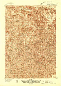
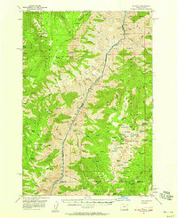
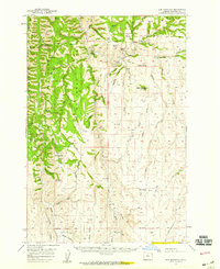
(131)- 1906 Map of Telocaset
 1906 Telocaset1906 Print · USGSEastern Oregon at the peak of its railroad and ranching era features a landscape of thriving valley towns and high forest reserves. Genealogists and local historians can trace early settlements like Union and Cove, or locate long-standing landmarks such as Hot Lake and Medical Springs.3 unique versions available
 - 1920 Map of Seven Devils Mining District
 1920 Seven Devils Mining District1920 Print · USGSThe Seven Devils Mining District was a bustling area of extraction and high-country ranching in the 1920s. Genealogists and historians can trace old homesteads and mining hubs like Cuprum, Landore, and Towsley Cabin, or locate the Landore School and Iron Springs Ranger Sta.
 - 1922 Map of He Devil
 1922 He Devil1922 Print · USGSThe Seven Devils Mountains of the early 1920s reveal a landscape of remote mining claims and high-elevation ranching camps. Researchers can locate historical sites like the Winchester Mine, Mc Gaffees Ranch, and Jacks Cabin.
 - 1937 Map of Pomeroy
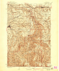
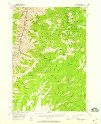
 1937 Pomeroy1937 Print · USGSGarfield and Columbia Counties appear in the late thirties as a patchwork of upland farms and forest outposts. Genealogists and historians can locate rural landmarks like Pataha Cem, the Tucannon Guard Sta, and various country schools including Pine Grove Sch.3 unique versions available
 - 1942 Map of Pomeroy
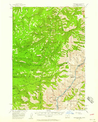
 1942 Pomeroy1942 Print · USGSThe foothills of the Blue Mountains are captured here in the late 1930s, showing the settled valleys of Garfield and Columbia Counties. Genealogists and local historians can locate early rural landmarks like Pataha City, Jackson Sch, and the UNION PACIFIC rail line serving Dayton.2 unique versions available
 - 1954 Map of Cornucopia, 1958 Print
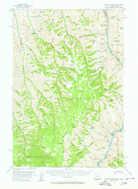
 1954 Cornucopia1958 Print · USGSThe Wallowa Mountains are shown in the mid-1950s during a peak era for high-country mining and forest administration. Researchers can locate the Cornucopia Mines, trace the trails to Nebo Lookout, and find remote outposts like Fish Lake Guard Sta.4 unique versions available
 - 1954 Map of Imnaha, 1958 Print
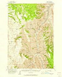 1954 Imnaha1958 Print · USGSNortheast Oregon ranching and canyon country are captured here during the mid-1950s, showing the intersection of private homesteads and national forest land. Researchers can find old landmarks like Zumwalt, the Imnaha School, and the Chesnimnus Cow Camp among the deep draws.2 unique versions available
 - 1954 Map of Kernan Point, 1958 Print
 1954 Kernan Point1958 Print · USGSThe Snake River canyon and the Oregon-Idaho border are captured here in the mid-1950s, showing a landscape defined by isolated ranching life. Genealogists and historians can trace the remote Litch Ranch, Somers Ranch, and the Kneeland Place during this era.3 unique versions available
 - 1954 Map of Eagle Cap, 1958 Print
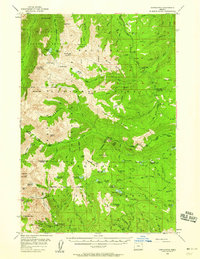
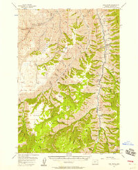
 1954 Eagle Cap1958 Print · USGSThe Wallowa Mountains are captured here in the mid-fifties, showing a landscape of alpine lakes and high-country outposts. You can trace early trails and mining sites like the Basin Mine, or locate backcountry landmarks such as Boulder Park Resort and the Two Color Guard Sta.4 unique versions available
 - 1954 Map of Harl Butte, 1958 Print
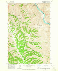
 1954 Harl Butte1958 Print · USGSWallowa County's high country is captured here during the mid-fifties, showing the remote ridges and schoolhouses of the Imnaha River region. Genealogists and local historians can locate Freezout Sch, the Imnaha Grange, and family-named landmarks like Needham Butte.3 unique versions available
 - 1955 Map of Pullman, 1963 Print
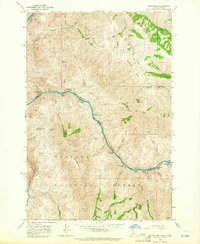
 1955 Pullman1963 Print · USGSThe Palouse and Clearwater regions are captured here in the mid-1950s, showing the height of the rail-and-river economy. Genealogists and historians can trace rail lines like the Camas Prairie RR, find local landmarks like Whitman County Memorial Cem, and locate early academic centers at Washington State University and the University of Idaho.3 unique versions available
 - 1955 Map of Grangeville, 1964 Print
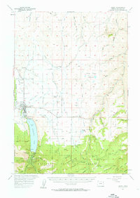
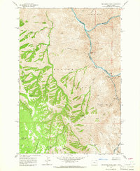
 1955 Grangeville1964 Print · USGSThe high country of the Idaho-Oregon border comes alive in the mid-1950s, showing the deep river canyons and mountain peaks. Trace the Union Pacific RR through the valleys or locate settlements like Grangeville, Joseph, and the shoreline of Wallowa Lake.4 unique versions available
 - 1957 Map of Enterprise
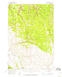
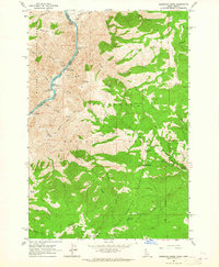
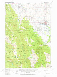 1957 Enterprise1957 Print · USGSWallowa County at the mid-century shows the transition from valley ranching to the high peaks of the WALLOWA MOUNTAINS. Genealogists and historians can trace local landmarks like the Chief Joseph Monument, the Joseph Cem, and the remote Lapover Ranch.2 unique versions available
 - 1957 Map of Joseph
 1957 Joseph1957 Print · USGSThe high valley and rugged mountain peaks of Wallowa County are captured here in the late fifties as agriculture and irrigation reshaped the landscape. Researchers can trace family sites at Pratt Sch and Liberty Grange or locate the historic Chief Joseph Cem near the shores of Wallowa Lake.3 unique versions available
 - 1957 Map of He Devil, 1958 Print
 1957 He Devil1958 Print · USGSThe high country of the Idaho-Oregon border is mapped here in the late fifties, centered on the dramatic Snake River Canyon. Trace the footprint of local history through outposts like Horse Creek Cabin and the site of the Rankin Mill (Aband).4 unique versions available
 - 1957 Map of Cuprum, 1958 Print
 1957 Cuprum1958 Print · USGSThe Seven Devils Mountains of Idaho are captured here during the 1950s, showing the intersection of forest management and declining copper mining. Genealogists and historians can locate old mining sites like Bluejacket Mine and the remnants of former settlements at Landore and Helena.3 unique versions available
 - 1957 Map of Homestead, 1958 Print
 1957 Homestead1958 Print · USGSThe Snake River canyon and the high Wallowa wilderness are captured in the late 1950s as a landscape of isolated outposts and steep timberlands. Local historians can trace the remote Homestead settlement, the winding Kleinschmidt Grade, and the Coverdale Guard Station.3 unique versions available
 - 1957 Map of Sled Springs, 1959 Print
 1957 Sled Springs1959 Print · USGSWallowa County during the late 1950s was a land of high mountain ridges and remote forest camps. Researchers can trace the path of the Union Pacific Railroad near Evans, locate the Wallowa Cem, or find the Feagin Ranch and Sled Springs Guard Sta.2 unique versions available
 - 1957 Map of Elk Mountain, 1959 Print
 1957 Elk Mountain1959 Print · USGSThe high timber and ranchlands of Wallowa County come to life in the late 1950s, showing a landscape of forest camps and isolated buttes. Genealogists and historians can trace local landmarks like Lewis Sch, the Hinton Ranch, and the remote Chico outpost.3 unique versions available
 - 1958 Map of Pullman
 1958 Pullman1958 Print · USGSThe Palouse and Clearwater regions are captured here in the late fifties, showing the vital river-and-rail connection between eastern Washington and northern Idaho. Local historians can trace the paths of the Camas Prairie RR and Union Pacific RR as they serve towns like Colfax, Kamiah, and Nezperce.2 unique versions available
 - 1959 Map of Grangeville
 1959 Grangeville1959 Print · USGSThe high alpine peaks and deep river canyons of the Idaho-Oregon borderlands are captured in the late fifties. Researchers can trace the Union Pacific RR through the valleys to settlements like Enterprise, Union, and Grangeville.2 unique versions available
 - 1963 Map of Cactus Mtn, 1964 Print
 1963 Cactus Mtn1964 Print · USGSThe Snake and Salmon rivers meet along the Idaho-Oregon border in the early sixties, a landscape of high summits and deep river canyons. Researchers can trace remote outposts like Spencer Ranch, the historic river crossing at Dug Bar, and the long Wallowa Summit Ridge.2 unique versions available
 - 1963 Map of Deadhorse Ridge, 1965 Print
 1963 Deadhorse Ridge1965 Print · USGSThe confluence of the Salmon and Snake Rivers is captured here in the early sixties, a time when mining and ranching still defined this remote borderland. Researchers can locate specific industrial sites like the Mountain Chief Mine and Mine Ruins at Eureka Bar, or trace early homesteads at Cherry Creek Ranch and Dobbin Cabin.3 unique versions available
 - 1963 Map of Jim Creek Butte, 1965 Print
 1963 Jim Creek Butte1965 Print · USGSThe Snake River canyon and the Wallowa high country meet in this mid-century survey of the Oregon-Idaho border. Researchers can trace the rugged network of trails and jeep tracks leading to remote landmarks like Jim Creek Butte, an isolated mine, and Cochran Islands.2 unique versions available
 - 1963 Map of Kirkwood Creek, 1965 Print
 1963 Kirkwood Creek1965 Print · USGSHigh-altitude ranching and river navigation dominate this mid-century survey of the Snake River canyon as it cuts through the national forests. Researchers can locate remote seasonal sites like Dixon Cow Camp, the historic Blue Jacket Mine, and ancient Pictographs along the river banks.2 unique versions available
Showing maps 1-25 of 131
Top cities of Wallowa County
Frequently asked questions
- What are the different types of historical maps available for Wallowa County?
- What is the oldest map of Wallowa County?
- Where can I purchase historical maps of Wallowa County for my home or office?
- Where can I download high-res historical maps of Wallowa County?
- Are there historical topographic maps available for Wallowa County?
- Is there historical aerial imagery available for Wallowa County?
- Where are historical maps of Wallowa County sourced from?