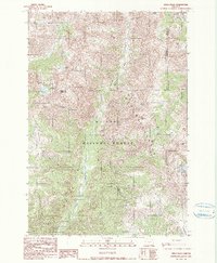
1990s Maps of Wallowa County, Oregon
Explore 68 historic maps of Wallowa County from the 1990s. These maps offer a rare glimpse into what life looked like during the 1990s — showing old roads, neighborhoods, homes, and landmarks that have changed or disappeared over time.
Whether you're researching your family's past, planning a metal detecting trip, or studying how Wallowa County's landscape evolved across the 1990s, these high-resolution maps are a powerful tool for exploring the history of this region.
- Focus on a specific era: All maps on this page are from the 1990s, giving you a focused view of this time period.
- See what’s changed: Compare century-old streets, trails, and buildings to today's modern landscape using overlays and satellite layers.
- Research with precision: Use these maps for genealogy, historical research, land use analysis, or educational projects.
- View, download, or print: Maps are fully viewable online in high resolution, and can be downloaded or printed for your own records.
Start exploring Wallowa County's history through authentic maps from the 1990s. This is your window into the past.
Wallowa County, OR maps
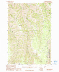
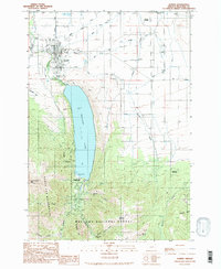
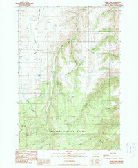
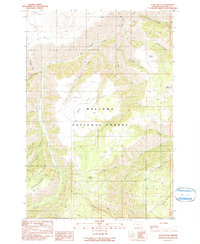
(68)- 1990 Map of Lostine
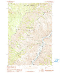
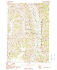
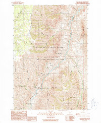
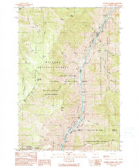
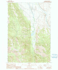 1990 Lostine1990 Print · USGSLostine and the Wallowa Valley in the late twentieth century show a landscape defined by the balance of mountain wilderness and valley irrigation. Genealogists and local historians can trace the paths of the Poley Allen Ditch, the riverside Gaging Station, and the Pole Bridge Picnic Area.
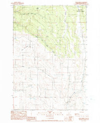
 - 1990 Map of Puderbaugh Ridge
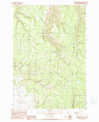
 1990 Puderbaugh Ridge1990 Print · USGSWallowa County's high forest and canyon country are captured here in the late twentieth century, showing a landscape shaped by the Imnaha River. Researchers can locate old backcountry landmarks like the Mc Graw Lookout, P O Saddle, and the Borrow Pit.
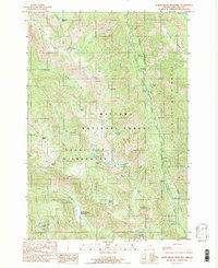
 - 1990 Map of Krag Peak
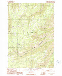
 1990 Krag Peak1990 Print · USGSIn the high Wallowa Mountains during the late twentieth century, this survey tracks a wilderness landscape at the intersection of three counties. Hikers and historians can trace the Cliff Creek Trail and locate remote landmarks like the Bradley Creek Mine and Lookingglass Lake.2 unique versions available
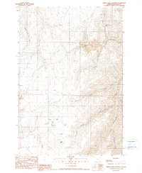
 - 1990 Map of Deadman Point
 1990 Deadman Point1990 Print · USGSThe high backcountry of Baker and Wallowa Counties is captured here in the early 1990s, where national forest boundaries and wilderness areas intersect. Researchers can trace alpine water routes like Buchanan Ditch and locate landmarks such as Imnaha Falls and Twin Lakes.
 - 1990 Map of Chief Joseph Mtn
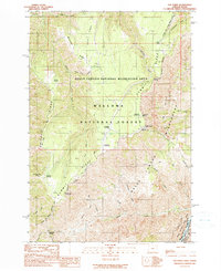
 1990 Chief Joseph Mtn1990 Print · USGSThe high Wallowa backcountry and its rugged mining history are preserved in this 1990 survey. Trace the trails to high-altitude sites like Legore Mine and Miners Basin, or locate the Hurricane Grange and Hurricane Creek Campground near the valley edge.3 unique versions available
 - 1990 Map of Imnaha
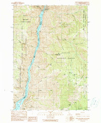
 1990 Imnaha1990 Print · USGSImnaha and the surrounding canyonlands appear in the late 1980s as a remote outpost of river-valley settlement and public forest land. Researchers can trace local landmarks like the Cem, the Gaging Station, and the winding route of Hat Point Road.
 - 1990 Map of Sleepy Ridge
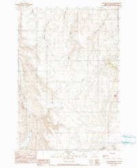
 1990 Sleepy Ridge1990 Print · USGSWallowa County's high ridges and deep canyons are captured here as they appeared in the early 1990s. Researchers can locate the historic Haas Horse Troughs (Site) or trace the remote drainages of Windy Hell Canyon and Medicine Creek.
 - 1990 Map of Gumboot Butte
 1990 Gumboot Butte1990 Print · USGSWallowa County during the 1980s and 1990s showcases the intersection of federal forest management and the high-elevation wilderness of the Imnaha drainage. Researchers can trace land use through a Prospect and Gravel Pit near Gumboot Butte and Nesbit Butte.
 - 1990 Map of Hat Point
 1990 Hat Point1990 Print · USGSThe Oregon-Idaho borderlands in the 1990s were a landscape of massive canyon descents and forest outposts. Researchers can trace the high-country infrastructure of Memaloose Guard Sta and follow the Western Rim National Recreation Trail past Hat Point.
 - 1990 Map of Eagle Cap
 1990 Eagle Cap1990 Print · USGSHigh in the Wallowas during the late twentieth century, this survey documents a dense cluster of alpine lakes and granite peaks. Trace the trails between Eagle Cap and Mirror Lake, or locate the high-altitude headwaters of the Lostine River.3 unique versions available
 - 1990 Map of Joseph
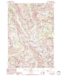
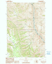
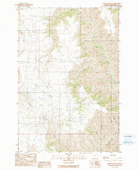
 1990 Joseph1990 Print · USGSThe town of Joseph and its deep glacial lake are shown here in the 1990s as the area balanced mountain ranching with growing recreation. Researchers can find old mining sites like Transvaal Mines, the local Liberty Grange, and the Chief Joseph Cem.2 unique versions available
 - 1990 Map of Hicks Spring
 1990 Hicks Spring1990 Print · USGSThe high meadows and drainage basins of Wallowa County are documented in the early nineties, showing a landscape defined by timber and water. Researchers can trace the forks of Middle Fork Whisky Creek or locate landmarks like Hicks Spring and Braham Meadows.
 - 1990 Map of North Minam Meadows
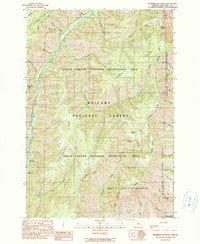
 1990 North Minam Meadows1990 Print · USGSWallowa County's high wilderness is documented here in the late twentieth century, showing a landscape defined by mountain peaks and remote pack trails. Researchers can locate isolated sites like Lapover Ranch, the Lostine Guard Sta, and various prospects and mines.
 - 1990 Map of Three Lakes Country
 1990 Three Lakes Country1990 Print · USGSWallowa County high country is captured here during the 1980s, detailing a landscape of isolated ranching and high-elevation lakes. Researchers can trace the water systems around Three Lakes and find landmarks like Lightning Creek Ranch and Hayden Butte.
 - 1990 Map of Temperance Creek
 1990 Temperance Creek1990 Print · USGSThe Wallowa high country and the Snake River corridor meet in the late 1980s along the Idaho border. Genealogists and historians can trace isolated homestead sites like Wisner Place and Brockman Ranch or locate Mine Tunnels along the canyon floor.
 - 1990 Map of Sheep Creek Divide
 1990 Sheep Creek Divide1990 Print · USGSThe high ridges of Wallowa County are mapped here in the late twentieth century, capturing the area's complex network of mountain divides and river canyons. Researchers can locate the College Creek Ranger Station, the Imnaha Grange, and numerous family-named landmarks like Beeler Ridge.
 - 1990 Map of Haas Hollow
 1990 Haas Hollow1990 Print · USGSThe remote Imnaha river valley in Oregon's northeastern corner was still largely managed as wilderness in the late twentieth century. Researchers can trace the rugged network of forest roads and trails connecting the Thorn Creek Guard Station to landmarks like Grizzly Ridge and Packsaddle Creek.
 - 1990 Map of Squirrel Prairie
 1990 Squirrel Prairie1990 Print · USGSHells Canyon at the turn of the 1990s reveals a landscape of high-elevation prairies and dangerous whitewater along the Idaho border. Researchers can trace historic sites like Hibbs Ranch (Site) and navigate the river's path through Wild Sheep Rapids and Rocky Point Rapids.
 - 1990 Map of Kinney Lake
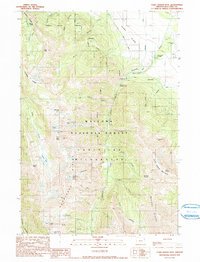
 1990 Kinney Lake1990 Print · USGSWallowa County during the early 1990s showcases a rugged high-country landscape where the national forest meets valley irrigation. Researchers can trace the path of the Wallowa Valley Improvement Canal and locate remote sites like Pappose Lake and Sheep Creek Hill.
 - 1990 Map of Sherod Meadows
 1990 Sherod Meadows1990 Print · USGSThe high forest of Wallowa County is captured here in the early 1990s, centered on the prominent Powwatka Ridge. Researchers can find backcountry landmarks like Tope Creek Lookout Tower and remote water sources including Five Dollar and Yellow Jacket Spring.
 - 1990 Map of Elk Mountain SE
 1990 Elk Mountain SE1990 Print · USGSWallowa County high country is mapped here in the late twentieth century, showing a landscape defined by its complex drainage networks and survey boundaries. Trace the seasonal flows of Dry Salmon Creek, the prominent Findley Buttes, and the rugged headwaters of Crow Creek.
 - 1990 Map of Lord Flat
 1990 Lord Flat1990 Print · USGSHells Canyon remained a primitive borderland in the early nineties, where the high ridges of Oregon overlook the Idaho line. Researchers can find isolated ranching outposts like Tryon Creek Ranch and Somers Ranch, alongside navigation points like Highrange Rapids on the Snake River.
 - 1990 Map of Harl Butte
 1990 Harl Butte1990 Print · USGSWallowa County, Oregon, is mapped here in the late twentieth century within the expansive Wallowa National Forest. Researchers can trace the high-country 4WD trails and remote water sources that define this landscape, from Spoon Spring to the heights of Harl Butte and White Horse Ridge.
 - 1990 Map of White Monument
 1990 White Monument1990 Print · USGSHells Canyon and the Snake River corridor are captured here at the start of the 1990s as the landscape transitions from industrial mining to wilderness recreation. Genealogists and historians can locate old mining operations like the South Peacock Mine and the former settlement at Helena (Site).
 - 1990 Map of Findley Buttes
 1990 Findley Buttes1990 Print · USGSWallowa County's high ridges and drainage basins are captured here in the decade before the millennium. Genealogists and researchers can trace the rugged topography of Findley Buttes and numerous watercourses like Little Sheep Creek and Cottonwood Creek.
Showing maps 1-25 of 68
Top cities of Wallowa County
Frequently asked questions
- What are the different types of historical maps available for Wallowa County?
- What is the oldest map of Wallowa County?
- Where can I purchase historical maps of Wallowa County for my home or office?
- Where can I download high-res historical maps of Wallowa County?
- Are there historical topographic maps available for Wallowa County?
- Is there historical aerial imagery available for Wallowa County?
- Where are historical maps of Wallowa County sourced from?