
1990 Map of Lostine
USGS Topo · Published 1990About this map
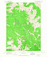
The town of Lostine sits at the northern edge of this high-country landscape, where the Lostine River and Wallowa River converge amidst a complex system of agricultural irrigation. Vital local waterways are managed via the Poley Allen Ditch and Westside Ditch, which redirect snowmelt from the surrounding peaks to support the valley floor. Moving south, the terrain rises sharply into the Wallowa National Forest and the protected Eagle Cap Wilderness, a transition marked by dramatic features like Huckleberry Mountain and McCoy Flats. This 1990 survey captures the intersection of rural ranching infrastructure and pristine mountain recreation, documented through landmarks such as the Pole Bridge Picnic Area and a riverside Gaging Station. Small-scale industry is visible at a local Quarry, while the upper reaches of the map are defined by timber and pack trails along Sheep Ridge and Little Bear Creek.
Find a feature on this map
23 named features on this map. Tap any name to fly to it.
Don’t see what you’re looking for? This feature index may not catch every label — zoom into the map to look around manually.
Map Details
Editions of this 1990 Lostine Map
This is the sole edition of this map. No revisions or reprints were ever made.
Other maps of this area

1906 · Telocaset
USGS Topo · 1:125,000

1955 · Grangeville
USGS Topo · 1:250,000

1957 · Enterprise
USGS Topo · 1:62,500

1957 · Sled Springs
USGS Topo · 1:62,500

1959 · Grangeville
USGS Topo · 1:250,000

1964 · Wallowa
USGS Topo · 1:24,000

1965 · Fox Point
USGS Topo · 1:24,000
1966 · Jim White Ridge
USGS Topo · 1:24,000

1982 · Wallowa
USGS Topo · 1:100,000

1986 · Enterprise
USGS Topo · 1:100,000