1980s Maps of Wasco County, Oregon
Explore 28 historic maps of Wasco County from the 1980s. These maps offer a rare glimpse into what life looked like during the 1980s — showing old roads, neighborhoods, homes, and landmarks that have changed or disappeared over time.
Whether you're researching your family's past, planning a metal detecting trip, or studying how Wasco County's landscape evolved across the 1980s, these high-resolution maps are a powerful tool for exploring the history of this region.
- Focus on a specific era: All maps on this page are from the 1980s, giving you a focused view of this time period.
- See what’s changed: Compare century-old streets, trails, and buildings to today's modern landscape using overlays and satellite layers.
- Research with precision: Use these maps for genealogy, historical research, land use analysis, or educational projects.
- View, download, or print: Maps are fully viewable online in high resolution, and can be downloaded or printed for your own records.
Start exploring Wasco County's history through authentic maps from the 1980s. This is your window into the past.
Wasco County, OR maps
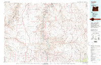
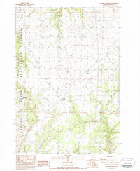
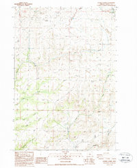
(28)- 1980 Map of Goldendale, 1981 Print
 1980 Goldendale1981 Print · USGSThe Columbia River corridor in the 1980s was a critical junction of rail, water, and highway commerce between Washington and Oregon. Genealogists and historians can trace riverside settlements like Wishram, high-country towns like Bickleton, and the grounds of the Maryhill Museum.
 - 1981 Map of Stephenson Mountain, 1997 Print
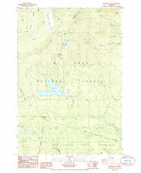
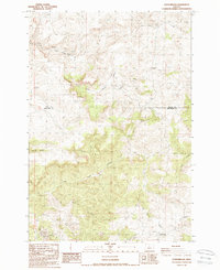
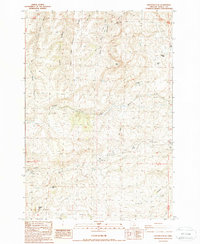
 1981 Stephenson Mountain1997 Print · USGSThe high-desert ranching and mining heart of North Central Oregon is captured here in the early eighties. Genealogists and historians can trace old settlements and mineral prospects from Shaniko to the Oregon King Mine and the John Day River canyon.
 - 1981 Map of Condon, 1997 Print
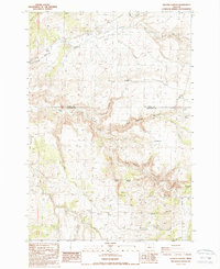
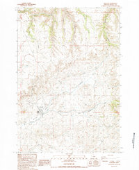
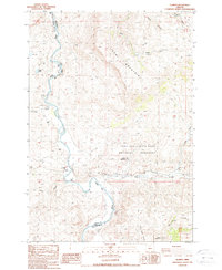
 1981 Condon1997 Print · USGSNorth-central Oregon in the early eighties reveals a vast plateau landscape defined by the deep canyons of the John Day and Deschutes rivers. Researchers can trace the rural legacy of the region through small hubs like Condon, Fossil, and the Old Railroad Grade.2 unique versions available
 - 1982 Map of Hood River, 1983 Print
 1982 Hood River1983 Print · USGSThe Columbia River Gorge in the early eighties shows a landscape shaped by massive hydroelectric projects and deep-rooted timber communities. Researchers can trace the rail-and-river network through Cascade Locks and The Dalles Dam, or explore the terrain of Gifford Pinchot National Forest.
 - 1983 Map of Mount Hood
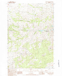
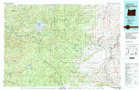 1983 Mount Hood1983 Print · USGSMount Hood and its surrounding national forest are captured here in the early eighties, spanning from alpine glaciers to the high desert plains. Genealogists and historians can trace old routes like the Barlow Road and locate remote landmarks like Bear Springs Ranger Sta or the settlement of Tygh Valley.
 - 1983 Map of Madras
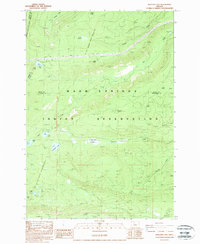
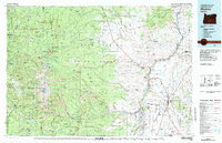 1983 Madras1983 Print · USGSJefferson County and the Warm Springs Indian Reservation are shown in detail during the early 1980s, from the Cascade peaks to the high desert. Researchers can trace the legacy of tribal lands at Simnasho, find the Abbot Cemetery, or follow the rail lines through Madras Sta.
 - 1985 Map of Beaver Butte
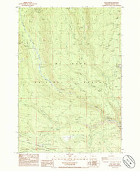
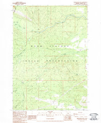
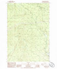 1985 Beaver Butte1985 Print · USGSThe high forest and reservation lands of Wasco County are captured here in the mid-1980s, a period defined by complex land management. Trace historical survey markers like the Mc Quinn Line 1887 and locate the Bear Springs Ranger Station.
 - 1985 Map of Wapinitia Pass
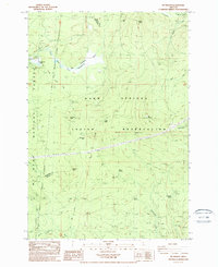
 1985 Wapinitia Pass1985 Print · USGSHigh mountain passes and the boundary of the Warm Springs Indian Reservation define this mid-1980s Oregon landscape. Trace the Pacific Crest National Scenic Trail past Clear Lake Butte and locate the historic Mc Quinn Line of 1887.
 - 1985 Map of Timothy Lake
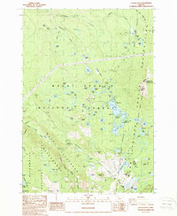
 1985 Timothy Lake1985 Print · USGSTimothy Lake and the surrounding Cascades are captured in the mid-1980s as a developed recreational landscape within the Mt Hood National Forest. Hikers and historians can trace the Pacific Crest National Scenic Trail past Summit Lake and explore old resource sites like the Quarries near Buck Creek.
 - 1985 Map of Post Point
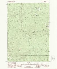
 1985 Post Point1985 Print · USGSThe Mt Hood National Forest and the Warm Springs Indian Reservation border meet in this 1980s landscape of timber and transit. Researchers can trace the historic Barlow Road and find old outposts like Post Point Lookout Tower, Keeps Mill Campground, and Post Camp.
 - 1985 Map of Mt. Wilson, 1988 Print
 1985 Mt. Wilson1988 Print · USGSThe high Cascade country of Wasco County is shown here in the mid-eighties, where tribal lands and national forest boundaries intersect. Researchers can trace historic survey markers like the McQuinn Line or locate remote water sources like Deadman Spring and Willow Springs.
 - 1986 Map of Pinhead Buttes
 1986 Pinhead Buttes1986 Print · USGSThe Oregon Cascades meet the western boundary of the Warm Springs Reservation in the mid-eighties. Researchers can trace the high-altitude Pacific Crest National Scenic Trail and locate the historic Sisi Lookout Tower near Lemiti Butte.4 unique versions available
 - 1987 Map of Donnybrook, 1988 Print
 1987 Donnybrook1988 Print · USGSJefferson and Wasco counties meet in this high-desert survey of the late eighties, documenting a remote stretch of central Oregon. Local history researchers can trace the drainage of Eagle Creek Valley and identify small settlements like Post and Donnybrook.
 - 1987 Map of Degner Canyon, 1988 Print
 1987 Degner Canyon1988 Print · USGSThe border of Wasco and Jefferson counties comes alive in the late 1980s, showing a landscape shaped by water and early land claims. Trace family history at Maupin Cem or explore the rugged topography of The Flatirons, Paulina Butte, and Timber Culture Gulch.
 - 1987 Map of Shaniko Junction, 1988 Print
 1987 Shaniko Junction1988 Print · USGSWasco County high desert life in the late eighties centers on the critical transit corridors of the Shaniko Junction plateau. Researchers can trace the descent into Boardtree Canyon, locate Cottonwood Springs, and find family-named landmarks like Criterion Summit.
 - 1987 Map of Willowdale, 1988 Print
 1987 Willowdale1988 Print · USGSThe high desert landscape around the Wasco and Jefferson County line is captured here in the late eighties. Researchers can trace the path of Route 97 past Willowdale or locate landforms like Friends Peak and the Deschutes River Recreation Lands.
 - 1987 Map of Hastings Peak, 1988 Print
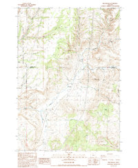
 1987 Hastings Peak1988 Print · USGSWasco County ranching country is shown here in the late twentieth century before modern developments. Researchers can locate remote outposts like Sorefoot Ranch and Middle Camp or trace landmarks such as Hastings Peak and Chinaman Hat.
 - 1987 Map of Antelope, 1988 Print
 1987 Antelope1988 Print · USGSAntelope is shown during the late 1980s, situated at the meeting point of high-desert canyons and vital watercourses. Genealogists and local historians can trace the town layout, the nearby settlement of Cold Camp, and local infrastructure like the Antelope Levee.
 - 1987 Map of Shaniko Summit, 1988 Print
 1987 Shaniko Summit1988 Print · USGSWasco County high-desert ranching and canyon lands are captured here in the late twentieth century. Researchers can trace land holdings and natural landmarks like Rooper Ranch, Courthouse Rock, and the historic town site of Shaniko.
 - 1987 Map of Muddy Ranch, 1988 Print
 1987 Muddy Ranch1988 Print · USGSThe high desert of Jefferson and Wasco counties comes into focus during the late eighties, centered on the rugged canyons of the John Day River. Researchers can trace old property boundaries and landmarks like Muddy Ranch, Wagner Mountain, and the Rock Fort (Site).
 - 1987 Map of Arrastra Butte, 1988 Print
 1987 Arrastra Butte1988 Print · USGSCentral Oregon high country near the Jefferson and Wasco county line is shown here in the late eighties. Trace mining history at Queen Oregon Mines and explore the complex terrain of Arrastra Butte and Gallagher Canyon.
 - 1988 Map of Sidwalter Buttes
 1988 Sidwalter Buttes1988 Print · USGSThe Warm Springs Indian Reservation in Wasco County is shown during the late 1980s as a landscape of remote ridges and high-country creeks. Genealogists and historians can trace the Old Indian Reservation Boundary (Forbes Line 1887) and find landmarks like Schoolie Pasture or the Lookout Tower.2 unique versions available
 - 1988 Map of Boulder Lake
 1988 Boulder Lake1988 Print · USGSThe Oregon Cascades during the late 1980s reveal a landscape shaped by historical tribal boundaries and high-altitude water systems. Researchers can trace the Old Indian Reservation Boundary (Rumsey Line 1882) and locate remote landmarks like Francis Lake and Lookout Butte.2 unique versions available
 - 1988 Map of Clarno
 1988 Clarno1988 Print · USGSWheeler County was a landscape of remote canyons and fossil beds in the late eighties. Genealogists and researchers can trace the banks of the John Day River to find landmarks like the Tillotson Cemetery, Clarno, and Camp Hancock.
 - 1988 Map of Olallie Butte
 1988 Olallie Butte1988 Print · USGSThe Oregon Cascades meet the tribal lands of the Warm Springs Reservation in this late-century survey. Trace historical surveying history through the McQuinn Line-1887 and Campbell Line-1909 or locate backcountry sites near Fish Lake.2 unique versions available
Showing maps 1-25 of 28
Top cities of Wasco County
- The Dalles historical maps
- Chenowith historical maps
- Dufur historical maps
- Maupin historical maps
- Mosier historical maps
- Antelope historical maps
See more
Frequently asked questions
- What are the different types of historical maps available for Wasco County?
- What is the oldest map of Wasco County?
- Where can I purchase historical maps of Wasco County for my home or office?
- Where can I download high-res historical maps of Wasco County?
- Are there historical topographic maps available for Wasco County?
- Is there historical aerial imagery available for Wasco County?
- Where are historical maps of Wasco County sourced from?