1990s Maps of Wasco County, Oregon
Explore 30 historic maps of Wasco County from the 1990s. These maps offer a rare glimpse into what life looked like during the 1990s — showing old roads, neighborhoods, homes, and landmarks that have changed or disappeared over time.
Whether you're researching your family's past, planning a metal detecting trip, or studying how Wasco County's landscape evolved across the 1990s, these high-resolution maps are a powerful tool for exploring the history of this region.
- Focus on a specific era: All maps on this page are from the 1990s, giving you a focused view of this time period.
- See what’s changed: Compare century-old streets, trails, and buildings to today's modern landscape using overlays and satellite layers.
- Research with precision: Use these maps for genealogy, historical research, land use analysis, or educational projects.
- View, download, or print: Maps are fully viewable online in high resolution, and can be downloaded or printed for your own records.
Start exploring Wasco County's history through authentic maps from the 1990s. This is your window into the past.
Wasco County, OR maps
(30)- 1994 Map of Wishram, 1995 Print
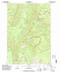
 1994 Wishram1995 Print · USGSThe Columbia River corridor in the mid-nineties shows a landscape of sharp vertical relief and critical rail junctions. Researchers can trace the riverfront developments of Wishram and Celilo Village or find family landmarks like the Centerville Cem and Warwick.
 - 1994 Map of The Dalles North, 1995 Print
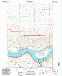
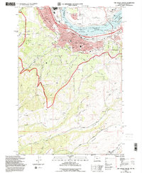
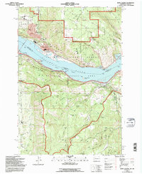
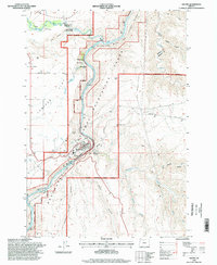
 1994 The Dalles North1995 Print · USGSThe Columbia River Gorge was a hub of transit and industry in the mid-nineties, where Washington and Oregon meet. Researchers can trace the river's industrial past through the Aluminum Plant and The Dalles Municipal Airport, or find family sites like Wish-Ham Cem and Lone Pine Cemetery.
 - 1994 Map of Petersburg, 1995 Print
 1994 Petersburg1995 Print · USGSMid-nineties Wasco County is shown here at the intersection of massive Columbia River energy projects and traditional wheat farming. Genealogists and local historians can trace family roots at Eightmile Cem or locate old rail-side landmarks like the Rice Grain Elevator.
 - 1994 Map of Stacker Butte, 1995 Print
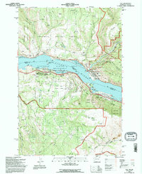
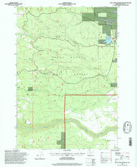
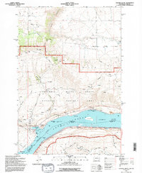 1994 Stacker Butte1995 Print · USGSThe Columbia River Gorge transitioned toward a protected scenic landscape in the 1990s as modern recreation took root along the river. Trace historical river navigation and local landmarks from Memaloose Island to the heights of Stacker Butte and the shores of Lake Celilo.
 - 1994 Map of The Dalles South, 1995 Print
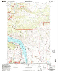
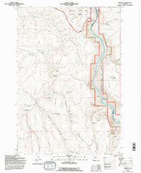
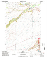
 1994 The Dalles South1995 Print · USGSThe Dalles and Dallesport are shown in the mid-1990s as the river economy transitioned into the modern era. Genealogists can locate historic burial sites like GAR Cem and Masonic Cem while tracing the Union Pacific rail corridor.
 - 1994 Map of Emerson, 1995 Print
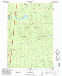
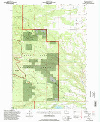
 1994 Emerson1995 Print · USGSThe high plateau of the Columbia Basin in the mid-nineties shows a landscape of deep canyons and ridge-top farming. Genealogists and local historians can trace the foundations of this rural community through the Douglas Hollow School, the Free Bridge Historical Site, and the small settlement of Emerson.
 - 1994 Map of Lyle, 1996 Print
 1994 Lyle1996 Print · USGSThe Columbia River Gorge in the mid-1990s shows the bustling confluence at Lyle and the transition into the Columbia Hills. Researchers can trace the riverfront rail lines, locate the Lyle Cemetery, and explore the shoreline from Rowland Lake to Chamberlain Lake.
 - 1994 Map of Brown Creek, 1996 Print
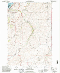
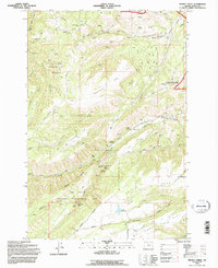 1994 Brown Creek1996 Print · USGSThe high country south of the Columbia River comes into focus in the mid-1990s, showcasing the intersection of wilderness management and rural life. Researchers can locate the Grange Hall, trace the steep Suicide Grade, and find Mill Creek Falls.
 - 1994 Map of White Salmon, 1996 Print
 1994 White Salmon1996 Print · USGSThe Columbia River Gorge comes to life in the mid-1990s as it winds between the growing communities of White Salmon, Washington, and Hood River, Oregon. Researchers can trace local landmarks like Skyline Hospital, Pine Grove School, and the historic Mosier Cem along the southern river bluffs.
 - 1994 Map of Ketchum Reservoir, 1997 Print
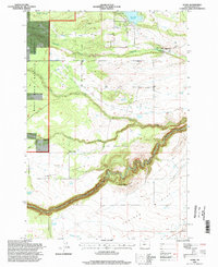
 1994 Ketchum Reservoir1997 Print · USGSThe high ridges and deep canyons of Wasco County are documented here in the mid-1990s. Trace local landmarks like Ketchum Ranch, Old Schoolhouse Spring, and the critical water networks around Ketchum Reservoir and Mosier Creek.
 - 1996 Map of Flag Point, 1998 Print
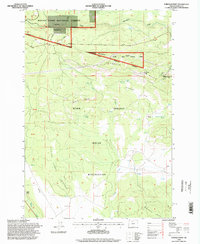
 1996 Flag Point1998 Print · USGSThe eastern slopes of the Cascades in the mid-1990s reveal a landscape defined by timber, water, and wilderness. Researchers can trace the remote network of forest trails and access points like Bonney Crossing, the Flag Point lookout, and the Owl Quarry industrial site.
 - 1996 Map of Wolf Run, 1998 Print
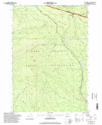
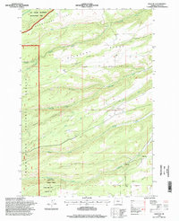 1996 Wolf Run1998 Print · USGSWasco County during the late twentieth century reveals a landscape shaped by water management and forest preservation. Researchers can trace the drainage of Fifteenmile Creek or locate the Wolf Run Community Hall and the reservoir system near Taylorville.
 - 1996 Map of Fort Butte, 1998 Print
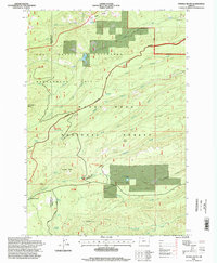
 1996 Fort Butte1998 Print · USGSHigh in the Cascade Range during the late nineties, this landscape spans the border of the Warm Springs Indian Reservation. Hikers and historians can trace the Pacific Crest National Scenic Trail past Fort Butte and the springs of Camas Prairie.
 - 1996 Map of Badger Lake, 1998 Print
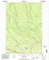
 1996 Badger Lake1998 Print · USGSMount Hood's eastern slopes and the high Cascades are preserved here in the late nineties, showing the vital watersheds of the Hood River and Wasco county lines. Researchers can trace remote alpine landmarks like Badger Lake, Elk Meadows, and the Valley View Cabin.
 - 1996 Map of Foreman Point, 1998 Print
 1996 Foreman Point1998 Print · USGSThe Oregon high country at the edge of the Cascade Range comes into focus in this late-nineties survey, showing the intersection of tribal and federal lands. Researchers can trace the boundaries of the Warm Springs Indian Reservation and locate remote features like the Dahl Pine settlement, Rainbow Quarry, and the Airstrip.
 - 1996 Map of Tygh Valley, 1998 Print
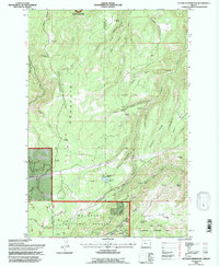
 1996 Tygh Valley1998 Print · USGSTygh Valley and the high tablelands of Wasco County are captured here in the late twentieth century. Researchers can trace the deep gorge of the White River, locate the local Cemetery, and see the extent of the Deschutes National Recreation Lands.
 - 1996 Map of Maupin, 1998 Print
 1996 Maupin1998 Print · USGSNear the close of the twentieth century, the riverside communities of Maupin and Cambrai remained vital hubs along the Deschutes River. Genealogists and historians can trace the paths of the Bakeoven Trail and find landmarks like the Powerhouse and Oak Springs fish hatchery.
 - 1996 Map of Rock Creek Reservoir, 1998 Print
 1996 Rock Creek Reservoir1998 Print · USGSWasco County highlands are shown in the late twentieth century as timber and water management shaped the landscape. Researchers can trace irrigation history through Threemile Ditch and locate landmarks like Codys Camp or Immigrant Spring.
 - 1996 Map of Mount Wilson, 1998 Print
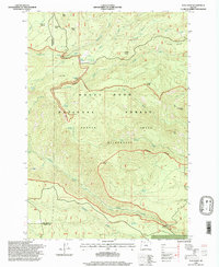
 1996 Mount Wilson1998 Print · USGSThe Oregon Cascades in the late 1990s are defined here by the intersection of the Mount Hood National Forest and the Warm Springs Indian Reservation. Hikers and historians can trace the Pacific Crest National Scenic Trail and locate landmarks like the Joe Graham Horse Camp and Red Wolf Pass.
 - 1996 Map of Fivemile Butte, 1998 Print
 1996 Fivemile Butte1998 Print · USGSThe Oregon Cascades during the mid-1990s are defined here by protected forest management and high-country water systems. Researchers can trace the path of the Wolf Run Ditch or locate the camp at Camp Baldwin and the landmark Fivemile Butte.
 - 1996 Map of Post Point, 1998 Print
 1996 Post Point1998 Print · USGSMount Hood National Forest and the Warm Springs Reservation meet in this late-twentieth-century study of the Oregon high country. Trace the historical route of the Barlow Road and find landmarks like White River Station and Barlow Crossing.
 - 1996 Map of Friend, 1998 Print
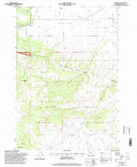
 1996 Friend1998 Print · USGSThe eastern slopes of the Cascades in Wasco County come to life in this mid-nineties survey of the Friend area. Genealogists and historians can trace local water and land use through features like the Highland Ditch, Pine Hollow Reservoir, and Camp Morrow.
 - 1996 Map of Beaver Butte, 1998 Print
 1996 Beaver Butte1998 Print · USGSThe intersection of federal and tribal lands in the 1990s is captured here, centered on the historic McQuinn Line. Researchers can trace the layout of the Warm Springs Indian Reservation and locate local landmarks like the Bear Springs Ranger Station and Beaver Butte.
 - 1996 Map of Wamic, 1998 Print
 1996 Wamic1998 Print · USGSThe Wamic area of Wasco County is shown in the mid-1990s as a high-plateau landscape defined by deep river canyons and forest boundaries. Researchers can trace local landmarks like Smock School, the Cem at Graveyard Butte, and the White River.
 - 1996 Map of Wapinitia, 1998 Print
 1996 Wapinitia1998 Print · USGSHigh plateau agriculture meets the reservation boundary in Wasco County during the late nineties. Genealogists and local historians can locate the Oak Grove Sch, the settlement of Wapinitia, and the historic McQuinn Line 1884 survey marker.
Showing maps 1-25 of 30
Top cities of Wasco County
- The Dalles historical maps
- Chenowith historical maps
- Dufur historical maps
- Maupin historical maps
- Mosier historical maps
- Antelope historical maps
See more
Frequently asked questions
- What are the different types of historical maps available for Wasco County?
- What is the oldest map of Wasco County?
- Where can I purchase historical maps of Wasco County for my home or office?
- Where can I download high-res historical maps of Wasco County?
- Are there historical topographic maps available for Wasco County?
- Is there historical aerial imagery available for Wasco County?
- Where are historical maps of Wasco County sourced from?