1960s Maps of Wasco County, Oregon
Explore 34 historic maps of Wasco County from the 1960s. These maps offer a rare glimpse into what life looked like during the 1960s — showing old roads, neighborhoods, homes, and landmarks that have changed or disappeared over time.
Whether you're researching your family's past, planning a metal detecting trip, or studying how Wasco County's landscape evolved across the 1960s, these high-resolution maps are a powerful tool for exploring the history of this region.
- Focus on a specific era: All maps on this page are from the 1960s, giving you a focused view of this time period.
- See what’s changed: Compare century-old streets, trails, and buildings to today's modern landscape using overlays and satellite layers.
- Research with precision: Use these maps for genealogy, historical research, land use analysis, or educational projects.
- View, download, or print: Maps are fully viewable online in high resolution, and can be downloaded or printed for your own records.
Start exploring Wasco County's history through authentic maps from the 1960s. This is your window into the past.
Wasco County, OR maps
(34)- 1961 Map of Fort Butte, 1963 Print
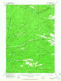 1961 Fort Butte1963 Print · USGSThe high Cascades of Wasco and Jefferson counties are captured here in the early sixties, showing a landscape shaped by timber and range. Researchers can trace the drainage of Shitike Creek or locate local landmarks like Old Mill Camp and the Schoolie Pasture.2 unique versions available
 - 1961 Map of Breitenbush Hot Springs, 1964 Print
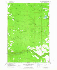
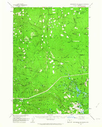 1961 Breitenbush Hot Springs1964 Print · USGSThe Oregon Cascades in the early 1960s are documented here during a period of active Forest Service management and recreational growth. Trace the development of Breitenbush Hot Springs or locate remote landmarks like the Rho Ridge Shelter and the Clackamas Ranger Sta.3 unique versions available
 - 1962 Map of Sherars Bridge
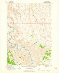
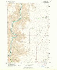
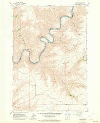
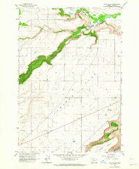
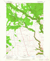
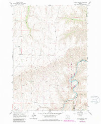 1962 Sherars Bridge1962 Print · USGSThe Deschutes River canyon serves as a vital transit and recreation corridor during the early sixties. Follow the historic rail lines of the Northern Pacific and trace local landmarks like Sherars Bridge, Warner Cemetery, and Sherar.3 unique versions available
 - 1962 Map of Wolf Run, 1963 Print
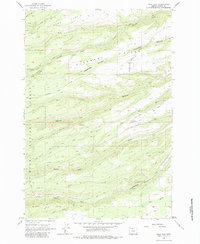 1962 Wolf Run1963 Print · USGSWasco County's forested ridges and narrow canyons appear in the early sixties as a landscape of timber roads and rural outposts. Researchers can trace the path of the Dufur Mill Road or find local landmarks like Wolf Run Community Hall and Dufur City Reservoir.2 unique versions available
 - 1962 Map of Rock Creek Reservoir, 1964 Print
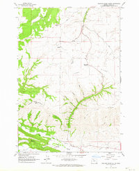
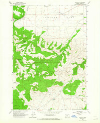
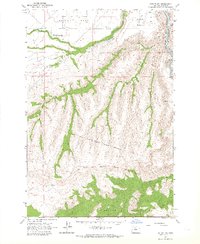
 1962 Rock Creek Reservoir1964 Print · USGSUpper Wasco County in the early sixties was a rugged intersection of historic migration trails and modern timber management. Researchers can trace the legendary Barlow Road and locate mid-century sites like Codys Camp, Bus Point, and the Rock Creek Reservoir.2 unique versions available
 - 1962 Map of Postage Stamp Butte, 1964 Print
 1962 Postage Stamp Butte1964 Print · USGSThe high plateau and deep canyons of Wasco County come into focus in the early sixties. Researchers can trace rural life through the Kingsley Cem, the Kingsley settlement, and the Tygh Valley Fairgrounds near Tygh Creek.3 unique versions available
 - 1962 Map of Dant, 1964 Print
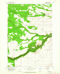
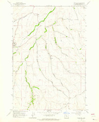
 1962 Dant1964 Print · USGSThe Deschutes River canyon in the early sixties remains a vital rail corridor through Wasco County. Researchers can trace the Oregon Trunk railroad past Dant and locate the Mc Quinn Line 1884.2 unique versions available
 - 1962 Map of Foreman Point, 1964 Print
 1962 Foreman Point1964 Print · USGSHigh desert timber and volcanic buttes define this portion of Wasco County in the early 1960s. Genealogists and researchers can trace the roads near the Dahl Pine settlement or locate landmarks like the fire lookout at Foreman Point and the Rainbow Quarry.3 unique versions available
 - 1962 Map of Erskine, 1964 Print
 1962 Erskine1964 Print · USGSThe Deschutes River canyon in Sherman County remained a vital transportation artery in the early sixties as competing rail lines navigated its steep walls. Researchers can trace the junction of the Oregon Trunk Railroad and Spokane Portland and Seattle, or locate rural sites like Erskine and the IOOF Cem.2 unique versions available
 - 1962 Map of Wamic, 1964 Print
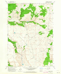
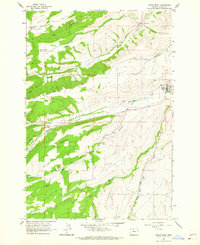
 1962 Wamic1964 Print · USGSWamic and its surrounding wheat and juniper lands appear here during the early sixties, as the community stood at the threshold of the Mt Hood National Forest. Genealogists and local historians can locate the Smock Sch, Batty Sch, and Graveyard Butte Cem along the historic Barlow Road.4 unique versions available
 - 1962 Map of Badger Lake, 1964 Print
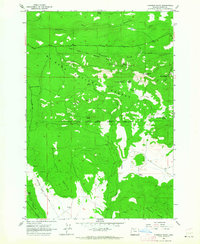
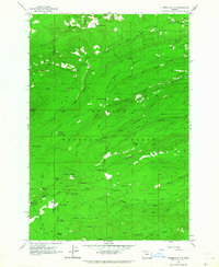
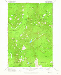 1962 Badger Lake1964 Print · USGSThe high country of the Oregon Cascades comes into focus in the early sixties, showing the vital drainage basins and forest outposts of the day. Trace the network of trails and roads leading to Badger Lake, Robinhood Guard Sta, and Elk Meadows.3 unique versions available
 - 1962 Map of Summit Ridge, 1964 Print
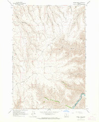 1962 Summit Ridge1964 Print · USGSThe high plateau of Wasco and Sherman counties comes into focus in the early sixties, centered on the dramatic rise of Summit Ridge. Researchers can trace the riverfront rail operations of the Oregon Trunk and Spokane Portland and Seattle Ry and locate remote landmarks like Ferry Canyon and Center Ridge Road.
 - 1962 Map of Wapinitia, 1964 Print
 1962 Wapinitia1964 Print · USGSIn the early sixties, this portion of Wasco County shows the interplay between high plateaus and reservation lands. Researchers can trace historic boundary markers like the Mc Quinn Line-1884 or locate local landmarks including Oak Grove Sch and the Rainbow Quarry.2 unique versions available
 - 1962 Map of Dufur East, 1964 Print
 1962 Dufur East1964 Print · USGSDufur and the surrounding Wasco County canyons are captured in the early sixties as they balanced high-desert agriculture with established township life. Genealogists and local historians can trace family locations near the IOOF Cem, the Nansene Community Hall, and the small settlement of Boyd.2 unique versions available
 - 1962 Map of Simnasho, 1964 Print
 1962 Simnasho1964 Print · USGSThe Warm Springs Indian Reservation in the early sixties is shown here as a landscape of plateau flats and vital water sources. Researchers can trace the layout of Simnasho, locate the Simnasho Cemetery, and find family-named sites like La Clair Spring.2 unique versions available
 - 1962 Map of Sinamox, 1964 Print
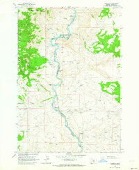
 1962 Sinamox1964 Print · USGSThe Deschutes River canyon serves as a vital rail corridor in the early 1960s, carrying heavy transit through the high desert. Genealogists and rail historians can trace the remote outposts of Sinamox and Oakbrook alongside the Oregon Trunk railroad.2 unique versions available
 - 1962 Map of Tygh Valley, 1964 Print
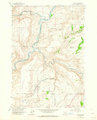
 1962 Tygh Valley1964 Print · USGSThe high desert plateau of central Oregon meets the deep canyons of the White River in the early sixties. Researchers can trace rural life through the Tygh Valley townsite, a local Cem, and landmarks like the Grange Hall and Airstrip.3 unique versions available
 - 1962 Map of Kaskela, 1964 Print
 1962 Kaskela1964 Print · USGSThe Deschutes River canyon in the early 1960s serves as a busy rail corridor where the Spokane Portland and Seattle and Oregon Trunk meet. Researchers can trace small settlements and landmarks like Kaskela, North Junction (Davidson), and Jersey Sch.2 unique versions available
 - 1962 Map of Timberline Lodge, 1964 Print
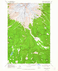 1962 Timberline Lodge1964 Print · USGSMount Hood and its surrounding national forest in the early sixties reveal a landscape of glaciated peaks and rising alpine tourism. Trace historic transit routes like the Barlow Road and explore landmarks such as Timberline Lodge and Trillium Lake.3 unique versions available
 - 1962 Map of Fivemile Butte, 1964 Print
 1962 Fivemile Butte1964 Print · USGSWasco and Hood River counties are shown here in the early 1960s, documenting a landscape shaped by high-elevation forestry and old mountain routes. You can trace early logistics and recreation at Camp Baldwin, the Hollow Rail Road, and the Lookout Tower on Fivemile Butte.
 - 1962 Map of Hehe Butte, 1964 Print
 1962 Hehe Butte1964 Print · USGSWasco County, Oregon, is mapped in the early sixties as it appears within the Warm Springs Indian Reservation. Researchers can trace the path of the Mill Creek Canal and locate isolated landmarks like the Island Windmill and Sidwalter Buttes.2 unique versions available
 - 1962 Map of Maupin SW, 1964 Print
 1962 Maupin SW1964 Print · USGSWasco County’s high desert landscape meets the canyon of the Deschutes River in the early sixties. Researchers can trace the Warm Springs Indian Reservation Boundary and the paths of the Oregon Trunk and Spokane Portland and Seattle railroads.2 unique versions available
 - 1962 Map of Eagle Butte, 1964 Print
 1962 Eagle Butte1964 Print · USGSThe Warm Springs Indian Reservation and Agency Plains meet in the early 1960s at the confluence of the Deschutes and Warm Springs rivers. Trace local development and genealogy through the Dry Creek Cem, the Lumber Mill, and the riverside site of Mecca.
 - 1962 Map of Dufur West, 1964 Print
 1962 Dufur West1964 Print · USGSDufur and the Wasco County uplands are captured in the early sixties as a thriving network of mills and high-country farms. Genealogists and local historians can trace family-named landmarks such as the Henderson Pioneer Cem, Ramsey Hall, and Endersby.3 unique versions available
 - 1962 Map of Gateway, 1964 Print
 1962 Gateway1964 Print · USGSJefferson County ranchlands and river canyons are captured here in the early sixties, showing the vital rail and water networks of the high desert. Researchers can trace the paths of the Oregon Trunk railroad through Old Maids Canyon and locate the small settlement of Gateway.4 unique versions available
Showing maps 1-25 of 34
Top cities of Wasco County
- The Dalles historical maps
- Chenowith historical maps
- Dufur historical maps
- Maupin historical maps
- Mosier historical maps
- Antelope historical maps
See more
Frequently asked questions
- What are the different types of historical maps available for Wasco County?
- What is the oldest map of Wasco County?
- Where can I purchase historical maps of Wasco County for my home or office?
- Where can I download high-res historical maps of Wasco County?
- Are there historical topographic maps available for Wasco County?
- Is there historical aerial imagery available for Wasco County?
- Where are historical maps of Wasco County sourced from?