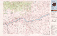
1980 Map of Goldendale
USGS Topo · Published 1981About this map
The Columbia River serves as the dominant boundary on this 1980 survey, where the Washington Oregon state line follows the water's path through the Columbia Hills. To the north, Goldendale sits as a regional hub near the Little Klickitat River, while the southern reaches across Sherman Co and Gilliam Co reveal a high desert landscape of expansive flats and deep canyons. The river corridor itself shows a sophisticated mid-century transportation and energy network, featuring the John Day Dam and the transition from Lake Cellilo to Lake Umatilla. Small railroad settlements and cultural landmarks like the Maryhill Museum and Wishram anchor the shoreline, while the upland interior is marked by agricultural outposts such as Bickleton and Cleveland at the edge of the Simcoe Mountains. This map documents the region's character as a major transit corridor for the Burlington Northern and Union Pacific railroads.
Find a feature on this map
87 named features on this map. Tap any name to fly to it.
Don’t see what you’re looking for? This feature index may not catch every label — zoom into the map to look around manually.
Map Details
Editions of this 1980 Goldendale Map
This is the sole edition of this map. No revisions or reprints were ever made.
Other maps of this area

1904 · Mount Adams
USGS Topo · 1:125,000

1906 · Blalock Island
USGS Topo · 1:125,000

1907 · Mount Adams
USGS Topo · 1:125,000

1908 · Blalock Island
USGS Topo · 1:125,000

1910 · Zillah
USGS Topo · 1:125,000

1915 · Prosser
USGS Topo · 1:125,000

1916 · Arlington
USGS Topo · 1:125,000

1916 · Condon
USGS Topo · 1:125,000

1917 · Prosser
USGS Topo · 1:125,000

1930 · Dufur
USGS Topo · 1:125,000