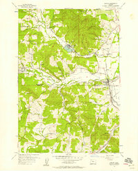
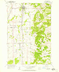
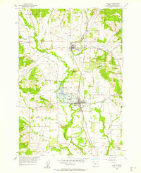
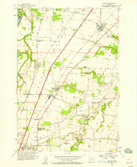
1950s Maps of Yamhill County, Oregon
Explore 22 historic maps of Yamhill County from the 1950s. These maps offer a rare glimpse into what life looked like during the 1950s — showing old roads, neighborhoods, homes, and landmarks that have changed or disappeared over time.
Whether you're researching your family's past, planning a metal detecting trip, or studying how Yamhill County's landscape evolved across the 1950s, these high-resolution maps are a powerful tool for exploring the history of this region.
- Focus on a specific era: All maps on this page are from the 1950s, giving you a focused view of this time period.
- See what’s changed: Compare century-old streets, trails, and buildings to today's modern landscape using overlays and satellite layers.
- Research with precision: Use these maps for genealogy, historical research, land use analysis, or educational projects.
- View, download, or print: Maps are fully viewable online in high resolution, and can be downloaded or printed for your own records.
Start exploring Yamhill County's history through authentic maps from the 1950s. This is your window into the past.
Yamhill County, OR maps
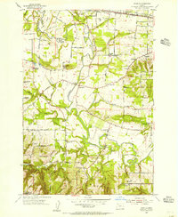
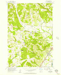
(22)- 1950 Map of Vancouver
 1950 Vancouver1950 Print · USGSCoastal Oregon and the lower Columbia River valley are captured in detail just after the war. Researchers can trace historic rail routes like the Southern Pacific or locate early settlements such as Vernonia, Gaston, and the Grand Ronde Indian Reservation.
 - 1950 Map of Vancouver, 1951 Print
 1950 Vancouver1951 Print · USGSThe Pacific Northwest urban corridor meets the rugged coast in the years following the war, showing the expansion of Portland and Vancouver. Genealogists and historians can trace the reach of the Southern Pacific RR and locate coastal communities like Tillamook, Seaside, and Tolovana Park.
 - 1954 Map of Scholls, 1956 Print
 1954 Scholls1956 Print · USGSWashington County agricultural life is centered on the winding Tualatin River during the mid-fifties. Genealogists can trace family roots through sites like Pleasant Hill Cemetery, the Grange Hall, and several locations of abandoned schools.
 - 1954 Map of Sherwood, 1957 Print
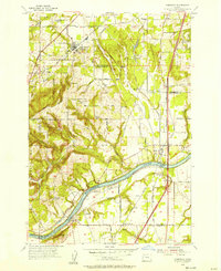 1954 Sherwood1957 Print · USGSThe northern Willamette Valley comes to life in the mid-1950s as the rail-and-river economy transitions toward highway development. Genealogists and local historians can trace family roots through the Pleasant Hill Cemetery, St Paul School, and the early riverfront layout of Butteville.
 - 1954 Map of Newberg, 1957 Print
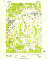
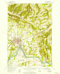 1954 Newberg1957 Print · USGSNewberg and the northern Willamette Valley are captured in the mid-1950s as a landscape of river-bend orchards and mountain-foothill farms. You can locate family-named sites like Gibbs Cemetery, trace the Southern Pacific tracks through Rex, and explore the grounds of Champoeg State Park.
 - 1955 Map of Hebo, 1957 Print
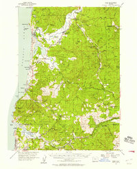 1955 Hebo1957 Print · USGSCoastal Tillamook County is captured here in the mid-fifties, showing the development of beach communities and forest management. Genealogists can trace family sites like Herbst Place or locate the Town Lake Cemetery and Cloverdale School.3 unique versions available
 - 1955 Map of Fairdale, 1957 Print
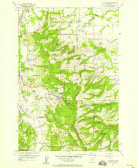
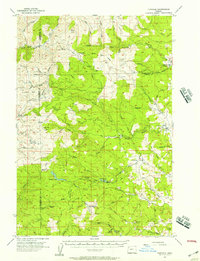 1955 Fairdale1957 Print · USGSThe Coast Range wilderness and logging frontier of the mid-fifties come into focus here at the intersection of Yamhill, Tillamook, and Washington Counties. Researchers can trace timber history and early outposts at Neverstill, Sixteenmile Cabin, and the High Heaven Lookout.3 unique versions available
 - 1955 Map of Grand Ronde, 1957 Print
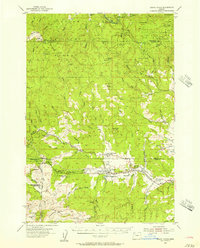 1955 Grand Ronde1957 Print · USGSThe Oregon Coast Range at mid-century reveals a landscape of tribal history and timber economy centered around the Grand Ronde Agency. Researchers can trace the legacy of rural education and faith at the Coneridge Sch and the Church in the Wildwood.2 unique versions available
 - 1956 Map of Sheridan
 1956 Sheridan1956 Print · USGSThe South Yamhill River valley in the mid-fifties is a landscape of active timber mills and expanding highways. You can trace the development of Sheridan and Willamina through their millponds, railroads, and rural landmarks like the St Francis Xavier Novitiate.4 unique versions available
 - 1956 Map of Ballston, 1957 Print
 1956 Ballston1957 Print · USGSThe rural borderlands of Yamhill and Polk counties come alive in this mid-century survey of the Willamette Valley. Genealogists and historians can trace the foundations of local life through the Southern Pacific line, the McKinley Sch, and the Ball Cemetery.4 unique versions available
 - 1956 Map of Dundee, 1957 Print
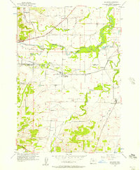
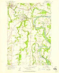
 1956 Dundee1957 Print · USGSDundee and the surrounding agricultural valleys are captured here in the mid-fifties as the local railroad and school networks shaped the community. Genealogists and researchers can trace local landmarks like the Noble Cemetery, the Ribbon Ridge School, and the Trappist Abbey of Our Lady of Guadalupe.3 unique versions available
 - 1956 Map of Laurelwood, 1958 Print
 1956 Laurelwood1958 Print · USGSThe Tualatin Valley in the mid-fifties shows a landscape of rural schoolhouses and high-ridge parks. You can trace the Southern Pacific rails through Dilley or locate historic sites like Laurelwood Academy and the Wapato Lake Bed.4 unique versions available
 - 1956 Map of St. Paul, 1958 Print
 1956 St. Paul1958 Print · USGSThe Willamette Valley in the mid-fifties shows a rural landscape transitioning toward a modern highway era. Genealogists can trace the location of community anchors like Champoeg Cem, the St Louis School, and the now-abandoned Arbor Grove School.4 unique versions available
 - 1956 Map of Sheridan, 1958 Print
 1956 Sheridan1958 Print · USGSMid-century Oregon valley life is preserved here, centered on the South Yamhill River as it flows through Sheridan and Willamina. Genealogists can trace family names at Ball Cem and locate rural landmarks like the St Francis Xavier Novitiate.2 unique versions available
 - 1956 Map of Gaston, 1958 Print
 1956 Gaston1958 Print · USGSThe northern Willamette Valley foothills are captured here in the mid-fifties, showing a landscape defined by timber and valley agriculture. Researchers can trace the Logging Railroad to Stimson Mill or locate several local schoolhouses like Forest Dale School and Seth School.3 unique versions available
 - 1957 Map of Amity, 1958 Print
 1957 Amity1958 Print · USGSThe Willamette Valley agricultural landscape and the rising slopes of the Amity Hills are captured here in the late fifties. Genealogists and local historians can trace the rail-side community of McCoy or locate family sites at Bethel Cem and Zena Cem.3 unique versions available
 - 1957 Map of Carlton, 1958 Print
 1957 Carlton1958 Print · USGSYamhill County's agricultural heartland is documented here in the late fifties, showing the rail-dependent growth of the Tualatin Valley. Researchers can trace old property lines and local landmarks like the Hillside Sch, McBride Cemetery, and the Carlton Lake State Game Refuge.3 unique versions available
 - 1957 Map of Gervais, 1958 Print
 1957 Gervais1958 Print · USGSMid-century Marion County farming life centers on the rich soils of French Prairie and the transition of Lake Labish into agricultural land. Researchers can trace the layout of the U S Indian School Chemawa or locate family roots near St Louis and Labish Village.3 unique versions available
 - 1957 Map of Mission Bottom, 1958 Print
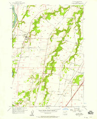
 1957 Mission Bottom1958 Print · USGSThe Willamette Valley in the late fifties is captured here through its river landings and rich prairie lands. Genealogists can trace family landmarks like Claggett Cem or follow the path of the Wheatland Ferry and the Oregon Electric railroad.4 unique versions available
 - 1957 Map of Mc Minnville, 1958 Print
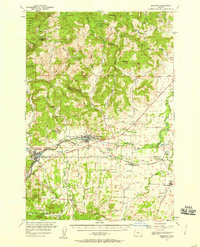
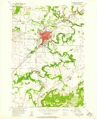 1957 Mc Minnville1958 Print · USGSThe Yamhill Valley in the late fifties is captured here during a period of steady growth and agricultural productivity. Researchers can trace the mid-century footprint of Mc Minnville and find rural landmarks like St Joseph, the Mcminnville Grange Hall, and Taylor Cemetery.3 unique versions available
 - 1957 Map of Dayton, 1959 Print
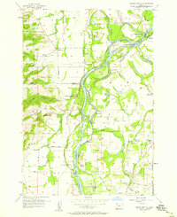
 1957 Dayton1959 Print · USGSThe confluence of the Yamhill and Willamette rivers defines this fertile valley landscape during the late fifties. Genealogists and historians can trace old landings and rural landmarks like Durettes Landing, the Webfoot Grange Hall, and Grand Island Sch.4 unique versions available
 - 1958 Map of Vancouver, 1968 Print
 1958 Vancouver1968 Print · USGSThe Lower Columbia and Willamette valleys thrive in the late sixties as major rail and river hubs. Genealogists and historians can trace the development of Portland, identify the grounds of Camp Withycombe, and locate coastal landmarks from Tillamook Head to Garibaldi.3 unique versions available
End of results
Showing maps 1-22 of 22
Top cities of Yamhill County
- McMinnville historical maps
- Newberg historical maps
- Sheridan historical maps
- Lafayette historical maps
- Dundee historical maps
- Dayton historical maps
See more
Frequently asked questions
- What are the different types of historical maps available for Yamhill County?
- What is the oldest map of Yamhill County?
- Where can I purchase historical maps of Yamhill County for my home or office?
- Where can I download high-res historical maps of Yamhill County?
- Are there historical topographic maps available for Yamhill County?
- Is there historical aerial imagery available for Yamhill County?
- Where are historical maps of Yamhill County sourced from?