1970s Maps of Yamhill County, Oregon
Explore 10 historic maps of Yamhill County from the 1970s. These maps offer a rare glimpse into what life looked like during the 1970s — showing old roads, neighborhoods, homes, and landmarks that have changed or disappeared over time.
Whether you're researching your family's past, planning a metal detecting trip, or studying how Yamhill County's landscape evolved across the 1970s, these high-resolution maps are a powerful tool for exploring the history of this region.
- Focus on a specific era: All maps on this page are from the 1970s, giving you a focused view of this time period.
- See what’s changed: Compare century-old streets, trails, and buildings to today's modern landscape using overlays and satellite layers.
- Research with precision: Use these maps for genealogy, historical research, land use analysis, or educational projects.
- View, download, or print: Maps are fully viewable online in high resolution, and can be downloaded or printed for your own records.
Start exploring Yamhill County's history through authentic maps from the 1970s. This is your window into the past.
Yamhill County, OR maps
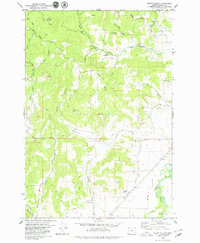
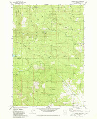
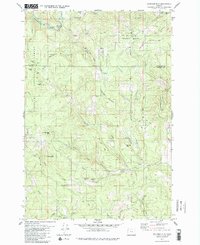
(10)- 1979 Map of Stony Mountain
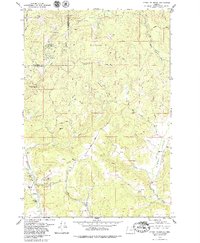 1979 Stony Mountain1979 Print · USGSYamhill County timberlands and river valleys are captured here in the late seventies. Genealogists and local historians can trace the Highland Cemetery and Deer Creek Park or follow the waters of Willamina Creek and Gopher Valley Creek.2 unique versions available
 - 1979 Map of Midway
 1979 Midway1979 Print · USGSCoastal mountains and timberlands meet in the late seventies where Yamhill, Tillamook, Lincoln, and Polk counties converge. Researchers can locate the Church in the Wildwood, trace the Nestucca River, and find small settlements like Midway and Boyer.
 - 1979 Map of Grand Ronde
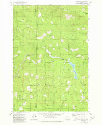
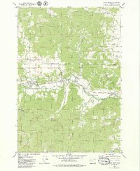 1979 Grand Ronde1979 Print · USGSGrand Ronde and the surrounding valley floor appear in the late 1970s as a hub of river-fronting industry and timber activity. Genealogists and researchers can trace the Longview Portland and Northern rail line, identify the Holmes Cem, and locate the Grand Ronde Agency at a turning point in the region's development.2 unique versions available
 - 1979 Map of Niagara Creek
 1979 Niagara Creek1979 Print · USGSYamhill and Tillamook counties meet in this high-altitude forest landscape during the late seventies. Researchers can trace the timber and military history of the Coast Range through features like the U S Military Reservation and Asinine Bridge.
 - 1979 Map of Muddy Valley
 1979 Muddy Valley1979 Print · USGSYamhill County's rural valley and highlands are captured in the late seventies as a landscape of timbered peaks and winding creeks. Genealogists and researchers can trace family landmarks like the South Yamhill Cemetery, Huber County Park, and Erratic Rock Wayside.2 unique versions available
 - 1979 Map of Trask Mtn, 1980 Print
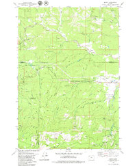
 1979 Trask Mtn1980 Print · USGSThe rugged timberlands of the Coast Range are documented here in the late seventies as industrial forestry and water management shaped the landscape. Researchers can trace forest access via Headquarters Grade, locate remote spots like Ball Bearing Hill, and explore the area around McGuire Reservoir.2 unique versions available
 - 1979 Map of Gobblers Knob, 1980 Print
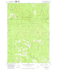
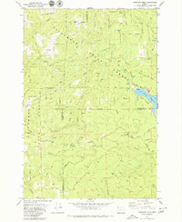 1979 Gobblers Knob1980 Print · USGSThe northern Coast Range peaks and headwaters appear in detail during the late seventies at the junction of three Oregon counties. Trace the timber and water infrastructure of the era through Barney Reservoir, the Toll Road, and Headquarters Grade.
 - 1979 Map of Fairdale, 1980 Print
 1979 Fairdale1980 Print · USGSThe Yamhill highlands come into focus in the late 1970s, showing a terrain shaped by timber, water management, and remote outposts. Researchers can find mountain landmarks like Kutch Mountain and High Heaven Lookout Tower alongside historic sites like Pike Cem and the Flying M Ranch.2 unique versions available
 - 1979 Map of Turner Creek, 1980 Print
 1979 Turner Creek1980 Print · USGSThe Washington and Yamhill county line in the late seventies is defined by timber-rich highlands and critical water reservoirs. Researchers can trace the heritage of Neverstill (Site), the settlement of Pike, and landmarks like Menefee Footbridge Park.2 unique versions available
 - 1979 Map of Springer Mtn, 1980 Print
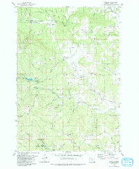
 1979 Springer Mtn1980 Print · USGSThe high timber country of the Oregon Coast Range is captured here in the late 1970s, spanning the border of Yamhill and Tillamook counties. Researchers can trace the logging infrastructure and backcountry outposts of the era, from Camp Cooper to the Nestucca River and the remote Rocky Bend Campground.2 unique versions available
End of results
Showing maps 1-10 of 10
Top cities of Yamhill County
- McMinnville historical maps
- Newberg historical maps
- Sheridan historical maps
- Lafayette historical maps
- Dundee historical maps
- Dayton historical maps
See more
Frequently asked questions
- What are the different types of historical maps available for Yamhill County?
- What is the oldest map of Yamhill County?
- Where can I purchase historical maps of Yamhill County for my home or office?
- Where can I download high-res historical maps of Yamhill County?
- Are there historical topographic maps available for Yamhill County?
- Is there historical aerial imagery available for Yamhill County?
- Where are historical maps of Yamhill County sourced from?