Old Maps of Altoona, Pennsylvania for Hiking & Exploration
Hike through history with 26 historic maps of Altoona. Explore old trails, ghost towns, and forgotten backroads — perfect for outdoor adventurers and local explorers.
- Rediscover forgotten places: Map out old mining camps, roads, and footpaths that no longer exist on modern maps.
- Layer with modern tools: Combine with LiDAR or satellite views to plan hikes through historical terrain.
- Made for exploration: Popular among hikers, overlanders, and local history lovers.
Use these maps to find adventure and explore the hidden past of Altoona.
Altoona, PA maps
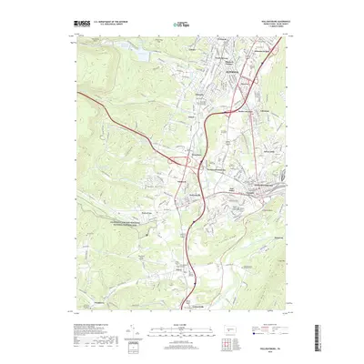
(26)- 1902 Map of Hollidaysburg, 1957 Print
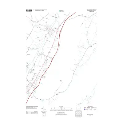
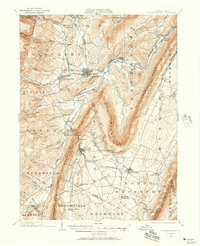 1902 Hollidaysburg1957 Print · USGSCentral Pennsylvania at the opening of the twentieth century shows a landscape defined by the iron and rail industries. Genealogists and historians can trace the early footprints of Hollidaysburg, locate the Ore Hill mine, and follow the Pennsylvania R. R. through the steep gaps of the Allegheny Mountain.2 unique versions available
 - 1903 Map of Hollidaysburg
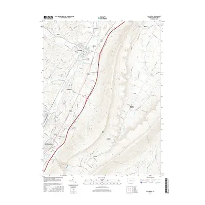
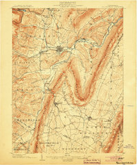 1903 Hollidaysburg1903 Print · USGSBlair County was a hub of Appalachian industry and transit at the opening of the twentieth century. Genealogists and historians can trace the early rail networks of the Pennsylvania RR and locate vanished mining activity near Orehill and Henrietta.7 unique versions available
 - 1920 Map of Altoona, 1954 Print
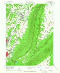
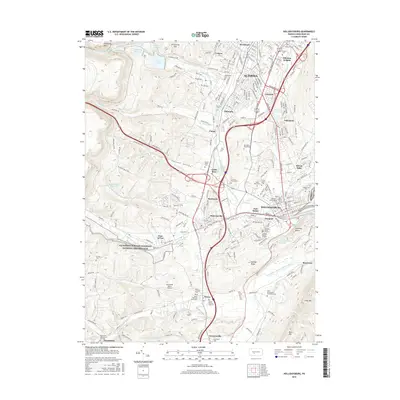
 1920 Altoona1954 Print · USGSThe industrial and rail-heavy corridor of the 1920s is on full display as the Pennsylvania RR cuts through the mountains. Genealogists and local historians can trace family roots through numerous country schools like Beech Grove School and lost settlements such as Wopsononock or Fostoria.6 unique versions available
 - 1922 Map of Altoona
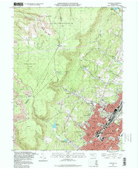
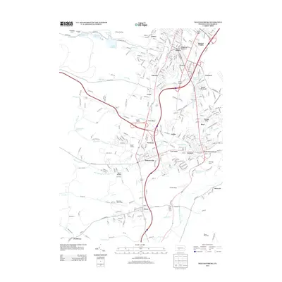
 1922 Altoona1922 Print · USGSThe industrial hub of Altoona and the steep slopes of the Allegheny Front are captured here in the early 1920s. Researchers can trace the extensive rail operations of the Pennsylvania railroad and locate numerous vanished rural landmarks like the Richland School and Grandview Cemetery.8 unique versions available
 - 1953 Map of Pittsburgh
 1953 Pittsburgh1953 Print · USGSWestern Pennsylvania's industrial landscape at the start of the fifties shows the steel and rail corridors between Pittsburgh and Altoona. Trace family roots in river towns like Tarentum or follow the Pennsylvania Turnpike across Laurel Hill.
 - 1954 Map of Pittsburgh
 1954 Pittsburgh1954 Print · USGSWestern Pennsylvania in the early fifties remains a powerhouse of heavy industry and vital transit corridors. Genealogists and historians can trace the rail-and-river network connecting Pittsburgh, Johnstown, and Altoona via the Pennsylvania RR and the Lincoln Highway.2 unique versions available
 - 1958 Map of Pittsburgh
 1958 Pittsburgh1958 Print · USGSWestern Pennsylvania in the late fifties shows an industrial heartland defined by the confluence of the Allegheny River and Monongahela River. Researchers can trace the sprawling rail networks of the Pennsylvania RR and find established towns like Butler, Latrobe, and Windber.5 unique versions available
 - 1959 Map of Pittsburgh
 1959 Pittsburgh1959 Print · USGSWestern Pennsylvania in the late fifties is captured here at the height of its industrial era. Genealogists and historians can trace the riverfront growth of Pittsburgh, the rail works at Altoona, and the mountain gaps of Laurel Hill.
 - 1963 Map of Hollidaysburg, 1965 Print
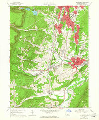 1963 Hollidaysburg1965 Print · USGSBlair County’s mid-century industrial and suburban growth is on full display during this era of rail and road expansion. Researchers can trace institutional landmarks like Hollidaysburg State Hospital and iconic engineering feats such as the Horseshoe Curve.5 unique versions available
 - 1963 Map of Altoona, 1965 Print
 1963 Altoona1965 Print · USGSAltoona and its mountain suburbs are captured here in the early sixties, showing the city's transition from a rail industrial center to a regional academic and civic hub. Researchers can trace family roots through numerous parish schools and cemeteries or locate defunct mountain settlements like Wopsononock and Highland Fling.6 unique versions available
 - 1963 Map of Bellwood, 1965 Print
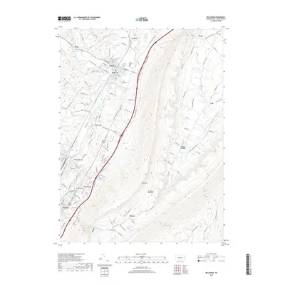
 1963 Bellwood1965 Print · USGSBlair County’s industrial and rail heart beats along the Little Juniata River during the early sixties. Genealogists and local historians can trace the foundations of Bellwood and East Altoona, alongside landmarks like Blair Mem Park (Cem) and the Pennsylvania Railroad.4 unique versions available
 - 1964 Map of Pittsburgh
 1964 Pittsburgh1964 Print · USGSWestern Pennsylvania in the late fifties and early sixties shows a landscape of powerful river industries and expanding highways. Genealogists and historians can trace the rail corridors of the Pennsylvania RR through industrial hubs like Johnstown, Altoona, and Nanty Glo.
 - 1981 Map of Johnstown, 1983 Print
 1981 Johnstown1983 Print · USGSSouth Central Pennsylvania is captured here in the early eighties, from the industrial heart of the Conemaugh Valley to the ridges of the Allegheny Front. Local historians can trace the rail corridors of Conrail and the growth of mountain communities like Ebensburg, Nanty Glo, and Windber.
 - 1984 Map of Tyrone, 1985 Print
 1984 Tyrone1985 Print · USGSCentral Pennsylvania in the mid-eighties shows a rugged landscape defined by the industry of Altoona and the ridges of the Appalachians. Genealogists and historians can trace the rail corridors of CONRAIL and locate vanished family homes near Glendale Lake or within Sinking Valley.
 - 1993 Map of Altoona, 1998 Print
 1993 Altoona1998 Print · USGSAltoona and the steep Allegheny Front are captured here in the 1990s as the city expanded its residential footprint into the surrounding hills. Genealogists and local historians can trace legacy neighborhoods and institutions like Agudath Achim Cem, Logan Sch, and Grandview Cemetery.
 - 2010 Map of Hollidaysburg, 2010 Print
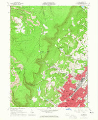
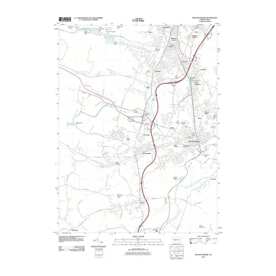 2010 Hollidaysburg2010 Print · USGSCovers Altoona, including Frankstown Township, Hollidaysburg, and other nearby areas
 - 2010 Map of Bellwood, 2010 Print
 2010 Bellwood2010 Print · USGSCovers Altoona, including Frankstown Township, Bellwood, and other nearby areas
 - 2013 Map of Bellwood, 2013 Print
 2013 Bellwood2013 Print · USGSCovers Altoona, including Frankstown Township, Bellwood, and other nearby areas
 - 2013 Map of Hollidaysburg, 2013 Print
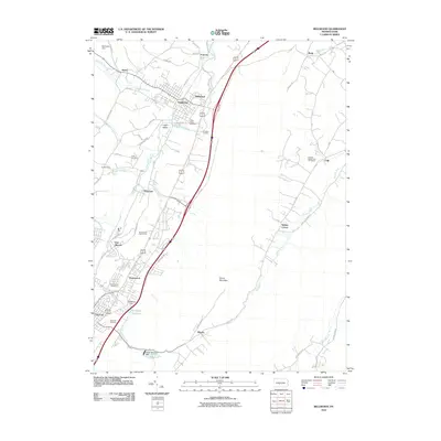
 2013 Hollidaysburg2013 Print · USGSCovers Altoona, including Frankstown Township, Hollidaysburg, and other nearby areas
 - 2016 Map of Bellwood, 2016 Print
 2016 Bellwood2016 Print · USGSCovers Altoona, including Frankstown Township, Bellwood, and other nearby areas
 - 2016 Map of Hollidaysburg, 2016 Print
 2016 Hollidaysburg2016 Print · USGSCovers Altoona, including Frankstown Township, Hollidaysburg, and other nearby areas
 - 2019 Map of Hollidaysburg, 2019 Print
 2019 Hollidaysburg2019 Print · USGSCovers Altoona, including Frankstown Township, Hollidaysburg, and other nearby areas
 - 2019 Map of Bellwood, 2019 Print
 2019 Bellwood2019 Print · USGSCovers Altoona, including Frankstown Township, Bellwood, and other nearby areas
 - 2023 Map of Bellwood, 2023 Print
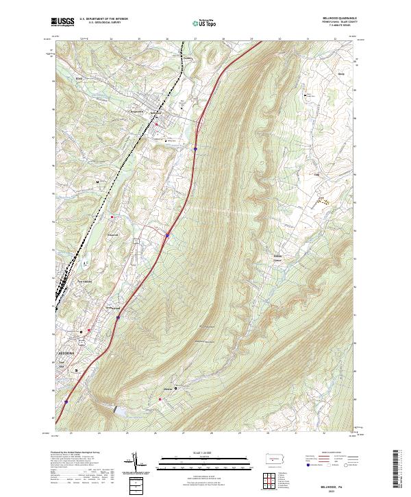 2023 Bellwood2023 Print · USGSThe Logan Valley and the steep slopes of the Allegheny Mountains are shown here in the 2020s. Researchers can locate numerous local burial sites like Valley Cem or trace the route of the Bells Gap Rail Trl through Roots and Bellwood.
 - 2023 Map of Altoona, 2023 Print
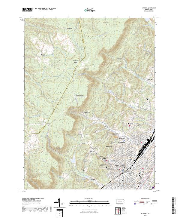 2023 Altoona2023 Print · USGSThe Altoona area is captured here in the early twenty-first century, showing the city's complex urban layout against the steep Allegheny ridges. Genealogists and historians can locate numerous burial sites like Grandview Cem or trace the geography of the Penn State Altoona campus and local reservoirs.
Showing maps 1-25 of 26
Top cities near Altoona
- Frankstown Township historical maps
- Hollidaysburg historical maps
- Tyrone historical maps
- Roaring Spring historical maps
- Martinsburg historical maps
- Bellwood historical maps
See more
Top neighborhoods of Altoona
- Llyswen historical maps
- South Altoona historical maps
- Pleasant Valley historical maps
- Hileman Heights historical maps
- Westmont historical maps
- Allegheny Furnace historical maps
See more
Frequently asked questions
- What are the different types of historical maps available for Altoona?
- What is the oldest map of Altoona?
- Where can I purchase historical maps of Altoona for my home or office?
- Where can I download high-res historical maps of Altoona?
- Are there historical topographic maps available for Altoona?
- Is there historical aerial imagery available for Altoona?
- Where are historical maps of Altoona sourced from?