2000s (21st Century) Maps of Miles Township, Pennsylvania
Explore 6 historic maps of Miles Township from the 2000s (21st Century). These maps offer a rare glimpse into what life looked like during the 2000s — showing old roads, neighborhoods, homes, and landmarks that have changed or disappeared over time.
Whether you're researching your family's past, planning a metal detecting trip, or studying how Miles Township's landscape evolved across the 2000s, these high-resolution maps are a powerful tool for exploring the history of this region.
- Focus on a specific era: All maps on this page are from the 2000s, giving you a focused view of this time period.
- See what’s changed: Compare century-old streets, trails, and buildings to today's modern landscape using overlays and satellite layers.
- Research with precision: Use these maps for genealogy, historical research, land use analysis, or educational projects.
- View, download, or print: Maps are fully viewable online in high resolution, and can be downloaded or printed for your own records.
Start exploring Miles Township's history through authentic maps from the 2000s. This is your window into the past.
Miles Township, PA maps
(6)- 2023 Map of Loganton, 2023 Print
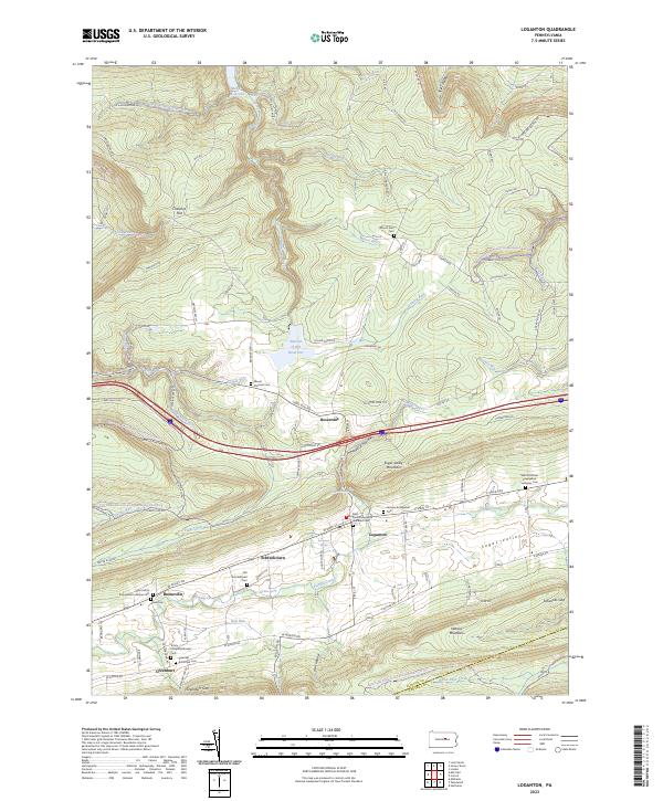 2023 Loganton2023 Print · USGSSugar Valley and its traditional farming settlements are mapped here in the early twenty-first century. Genealogists can trace family names through landmarks like Old Schracktown Cem, Booneville, and Saint Johns Evangelical Lutheran Cem.
 - 2023 Map of Millheim, 2023 Print
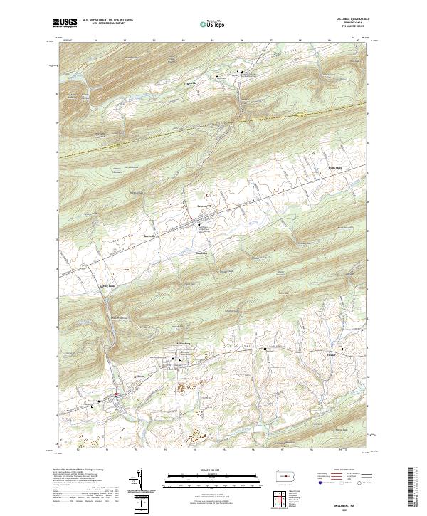 2023 Millheim2023 Print · USGSCentral Pennsylvania's ridge-and-valley landscape is preserved here as it appeared recently, showing the enduring layouts of Milheim and Aaronsburg. Researchers can locate numerous family burial sites, including Stover Cem, Fairview Cem, and the Union Cem near Tylersville.
 - 2023 Map of Madisonburg, 2023 Print
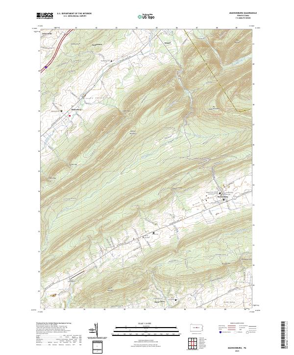 2023 Madisonburg2023 Print · USGSCentre County's valley settlements are captured in this recent survey of the ridges and agricultural corridors east of Jacksonville. Genealogists can trace family sites at the Yearick Cem, Hublersburg Cem, and the unique Penns Cave Spring area.
 - 2023 Map of Woodward, 2023 Print
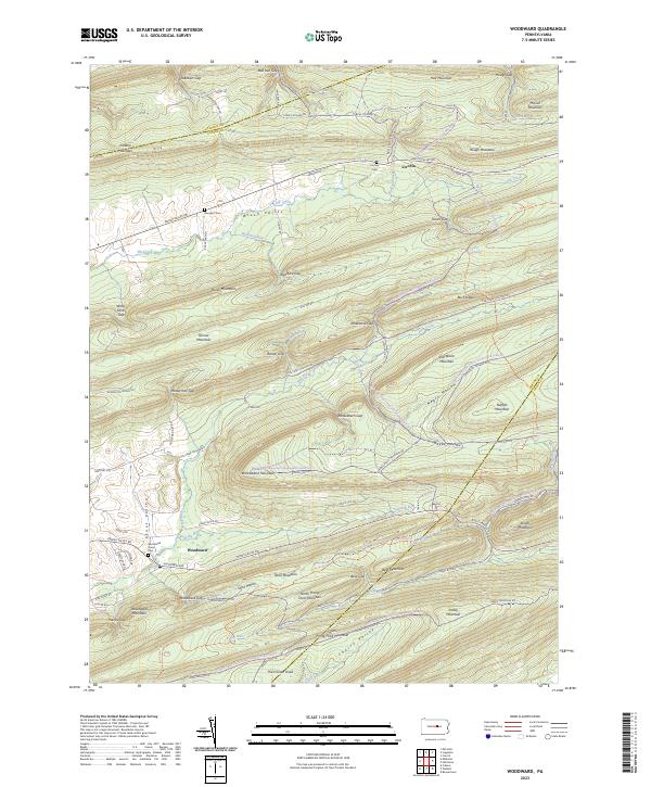 2023 Woodward2023 Print · USGSThe Central Pennsylvania ridges near Woodward and Livonia are shown in this recent survey, capturing the enduring geography of Penns Valley. Genealogists and local historians can locate Livonia Cem, Brungart Cem, and the industrial site at Cinder Pile Siding.
 - 2023 Map of Hartleton, 2023 Print
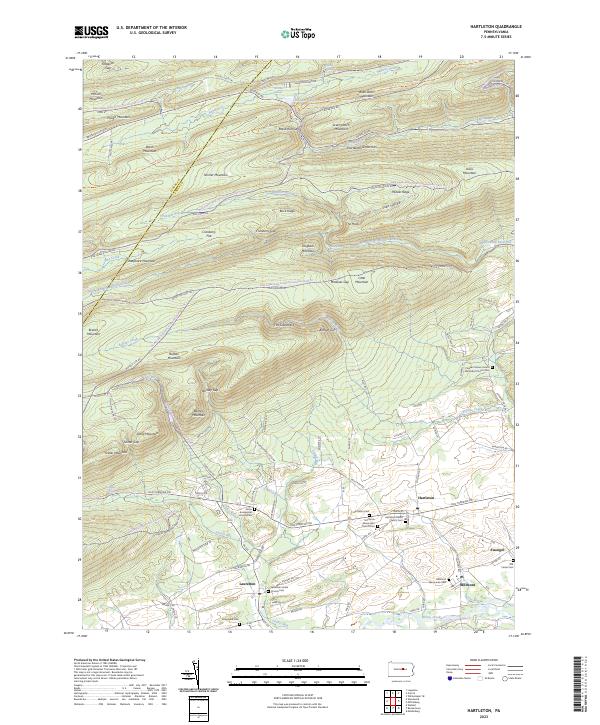 2023 Hartleton2023 Print · USGSThe Pennsylvania ridge-and-valley country near Hartleton and Laurelton is captured here in the early twenty-first century. Genealogists can locate family names at Hartleton Cem or Old Cedar Cem and trace the path of the Old Turnpike Rd.
 - 2023 Map of Carroll, 2023 Print
 2023 Carroll2023 Print · USGSThe high ridges and fertile valley floors of southern Clinton County are captured here in the 2020s. Genealogists and local historians can trace the remote settlements of Carroll and Eastville, locating historic burial grounds like Price Cem and Green Grove Cem.
End of results
Showing maps 1-6 of 6
Top cities near Miles Township
- Lock Haven historical maps
- Jersey Shore historical maps
- Decatur Township historical maps
- Lamar historical maps
- Mill Hall historical maps
- Avis historical maps
See more
Top neighborhoods of Miles Township
- Madisonburg historical maps
- Rebersburg historical maps
- Spring Bank historical maps
- Shakespeare Club historical maps
- Wolfs Store historical maps
- Rockville historical maps
See more
Frequently asked questions
- What are the different types of historical maps available for Miles Township?
- What is the oldest map of Miles Township?
- Where can I purchase historical maps of Miles Township for my home or office?
- Where can I download high-res historical maps of Miles Township?
- Are there historical topographic maps available for Miles Township?
- Is there historical aerial imagery available for Miles Township?
- Where are historical maps of Miles Township sourced from?