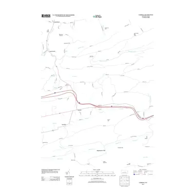
2013 Map of Carroll
USGS Topo · Published 2013About this map
Fishing Cr carves through this central Pennsylvania landscape, providing a geographic anchor for the small settlements of Carroll and Eastville. The terrain is defined by a series of dramatic gaps and ridges, including McMurrin Gap and Fryingpan Gap, which dictate the local road network and historic transit routes. This 2013 survey illustrates how development remains clustered in the lower elevations near water sources like Tea Spring and Big Rock Spring, while the surrounding heights of Nippenose Mountain and Naked Mountain remain largely dedicated to forestry and fire observation. Landmark structures such as the Rauchtown Lookout Tower and Sand Mountain Tower highlight the importance of high-ground vantage points in this heavily wooded region. Local history and genealogy interests are served by identifying specific named landmarks like the Shakespeare Club and Mount Blessing Camp, which speak to the social and recreational geography of the area.
Find a feature on this map
87 named features on this map. Tap any name to fly to it.
Don’t see what you’re looking for? This feature index may not catch every label — zoom into the map to look around manually.
Map Details
Editions of this 2013 Carroll Map
This is the sole edition of this map. No revisions or reprints were ever made.
Other maps of this area

1921 · Williamsport
USGS Topo · 1:48,000

1921 · Lock Haven
USGS Topo · 1:62,500

1923 · Lock Haven
USGS Topo · 1:62,500

1923 · Williamsport
USGS Topo · 1:62,500

1937 · Millheim
USGS Topo · 1:48,000

1938 · Mifflinburg
USGS Topo · 1:48,000

1941 · Millheim
USGS Topo · 1:62,500

1943 · Mifflinburg
USGS Topo · 1:62,500

1944 · Williamsport
USGS Topo · 1:62,500

1944 · Lock Haven
USGS Topo · 1:62,500
Featured Places
- Hartley Township, PA
- Washington Township, PA
- Carroll, Greene Township
- Castle Rocks, Crawford Township
- Crawford Township, PA