2020s Maps of Rush Township, Pennsylvania
Explore 9 historic maps of Rush Township from the 2020s. These maps offer a rare glimpse into what life looked like during the 2020s — showing old roads, neighborhoods, homes, and landmarks that have changed or disappeared over time.
Whether you're researching your family's past, planning a metal detecting trip, or studying how Rush Township's landscape evolved across the 2020s, these high-resolution maps are a powerful tool for exploring the history of this region.
- Focus on a specific era: All maps on this page are from the 2020s, giving you a focused view of this time period.
- See what’s changed: Compare century-old streets, trails, and buildings to today's modern landscape using overlays and satellite layers.
- Research with precision: Use these maps for genealogy, historical research, land use analysis, or educational projects.
- View, download, or print: Maps are fully viewable online in high resolution, and can be downloaded or printed for your own records.
Start exploring Rush Township's history through authentic maps from the 2020s. This is your window into the past.
Rush Township, PA maps
(9)- 2023 Map of Tipton, 2023 Print
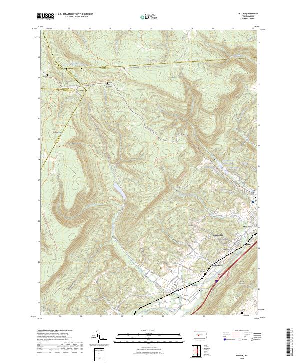 2023 Tipton2023 Print · USGSThe Little Juniata River valley in central Pennsylvania is shown here as it transitions from high ridges to developed lowlands. Genealogists and historians can locate several family burial sites and rural landmarks, including Jacker Burial Ground, Mount Zion Cem, and Grazierville.
 - 2023 Map of Houtzdale, 2023 Print
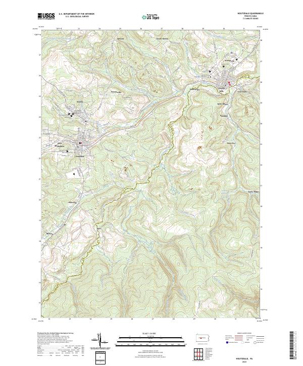 2023 Houtzdale2023 Print · USGSThe Moshannon Valley comes into focus in this contemporary mapping of the Clearfield and Centre County line. Researchers can trace the layout of legacy settlements and numerous burial grounds like Umbria Cemetery and the Saint Lawrence Cemetery.
 - 2023 Map of Karthaus, 2023 Print
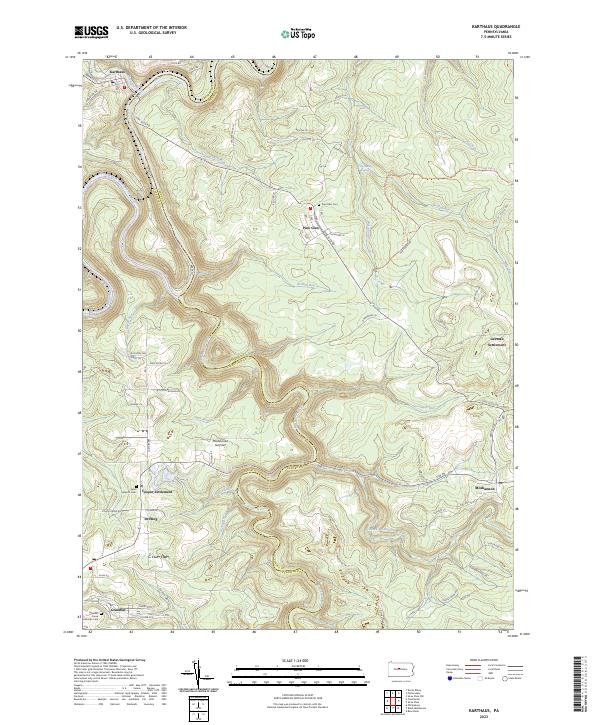 2023 Karthaus2023 Print · USGSThe Clearfield and Centre County borderlands come to life in this modern survey of the Susquehanna plateau. Genealogists can trace family footprints in German Settlement and Cooper Settlement or locate burials at Saint Severins Cem.
 - 2023 Map of Bear Knob, 2023 Print
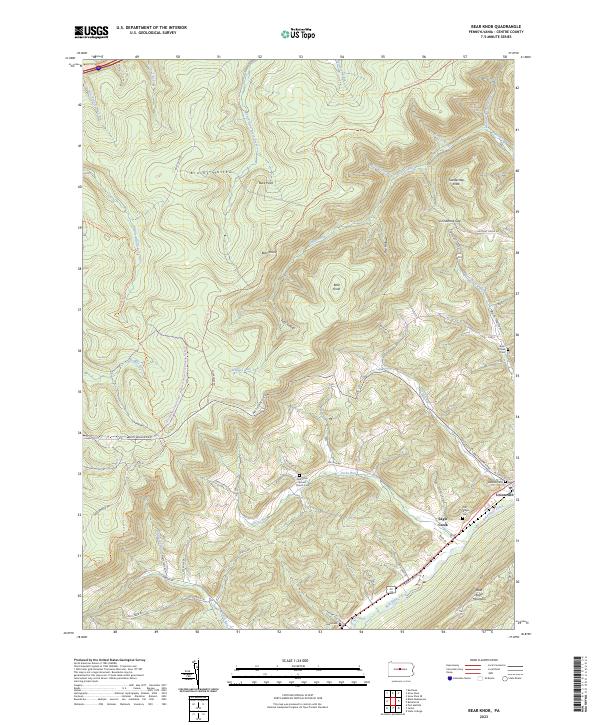 2023 Bear Knob2023 Print · USGSThe area around Unionville and Bald Eagle Mountain is shown here in its modern configuration, where river valleys meet the Allegheny Front. Genealogists can locate family sites at Unionville Cem, Dicks Run Advent Church Cem, and the high peak of Bear Knob.
 - 2023 Map of Black Moshannon, 2023 Print
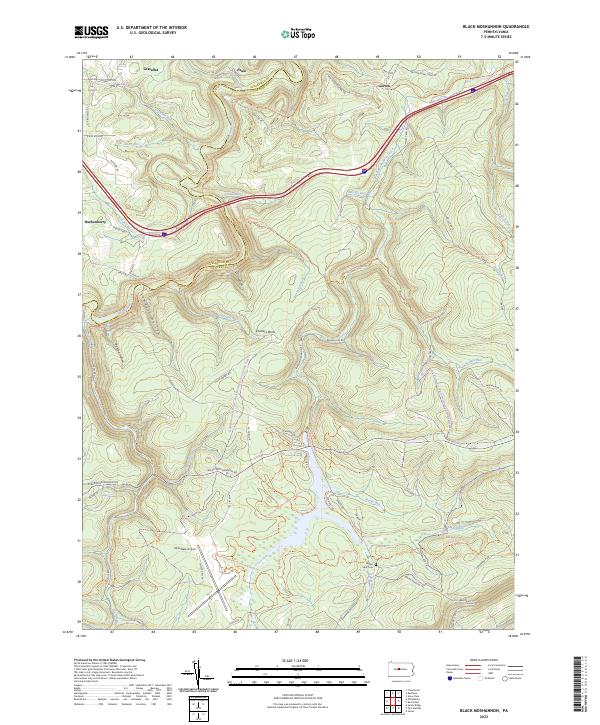 2023 Black Moshannon2023 Print · USGSThe high plateau of Centre County is shown here at the modern era, where former rail lines and timber paths have transitioned into a recreational landscape. Genealogists and historians can trace old settlements like Peale and Gorton or locate the Beaver Mills Cem near the waters of Black Moshannon Creek.
 - 2023 Map of Ramey, 2023 Print
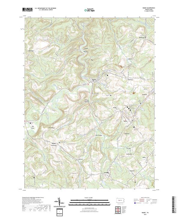 2023 Ramey2023 Print · USGSRamey and the southern Clearfield County countryside appear in meticulous detail during the early 2020s. Researchers can trace ancestral roots through an unusual density of burial sites including Saint Marys Cem, Saint Barbara Cem, and Crossroads Cem.
 - 2023 Map of Sandy Ridge, 2023 Print
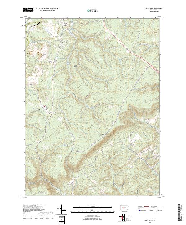 2023 Sandy Ridge2023 Print · USGSThe high ridges of Centre County come into focus during the early twenty-first century, showing a landscape shaped by narrow hollows and high plateaus. Researchers can trace local landmarks like Glass City, Mount Pleasant Cem, and the waters of Philipsburg Reservoir.
 - 2023 Map of Port Matilda, 2023 Print
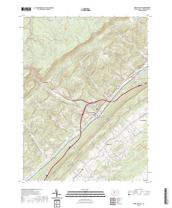 2023 Port Matilda2023 Print · USGSPort Matilda and the Bald Eagle Valley are shown here in the early twenty-first century, anchored by the intersection of major ridge-following highways. Researchers can trace family sites at Martha Furnace, Black Oak Cem, and Friends Cem.
 - 2023 Map of Philipsburg, 2023 Print
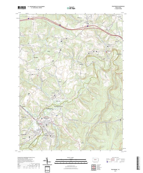 2023 Philipsburg2023 Print · USGSThe northern Pennsylvania coal country comes to life in this contemporary survey of the Philipsburg area. Genealogists and historians can trace family roots through numerous sites like Winburne Presbyterian Church Cem and the Sons of Israel Congregation Hebrew Cem.
End of results
Showing maps 1-9 of 9
Top cities near Rush Township
- Tyrone historical maps
- Philipsburg historical maps
- Warriors Mark Township historical maps
- Graham historical maps
- Bigler historical maps
- Osceola Mills historical maps
See more
Top neighborhoods of Rush Township
- Glass City historical maps
- Earnestville historical maps
- North Philipsburg historical maps
- New Town historical maps
- Casanova historical maps
- Spike Island historical maps
See more
Frequently asked questions
- What are the different types of historical maps available for Rush Township?
- What is the oldest map of Rush Township?
- Where can I purchase historical maps of Rush Township for my home or office?
- Where can I download high-res historical maps of Rush Township?
- Are there historical topographic maps available for Rush Township?
- Is there historical aerial imagery available for Rush Township?
- Where are historical maps of Rush Township sourced from?