Old Maps of Beccaria Township, Pennsylvania for Metal Detecting
Plan your next treasure hunt with 43 historic maps of Beccaria Township. Find old homesites, ghost towns, trails, and gathering spots that may be lost to time — perfect for identifying promising metal detecting locations.
- Locate forgotten sites: Uncover places like long-lost settlements, abandoned rail lines, or gathering spots.
- Plan better hunts: Use map overlays combined with LiDAR or satellite views to narrow in on historically rich areas.
- Made for detectorists: Thousands of hobbyists use these maps to discover relics, coins, and hidden history.
Use these historic maps to boost your research and find new opportunities beneath the surface of Beccaria Township.
Beccaria Township, PA maps
(43)- 1902 Map of Patton, 1955 Print
 1902 Patton1955 Print · USGSThe northern Cambria County coal and timber country is captured here at the turn of the century, as mountain railroads reached their peak influence. Researchers can trace historic industrial sites like Eckenrode Mill and early settlements including St Bonifacius and Patton.
 - 1903 Map of Curwensville
 1903 Curwensville1903 Print · USGSThe West Branch Susquehanna River region was a hub of timber and rail activity in the early twentieth century. Researchers can trace the development of riverside towns like Lumber City, locate the Wister Mine near Irvona, and follow the winding routes of the New York Central and Hudson River RR.4 unique versions available
 - 1903 Map of Houtzdale, 1959 Print
 1903 Houtzdale1959 Print · USGSClearfield County was a hub of rail and river activity at the turn of the century as industrial towns expanded along the Allegheny Mts. Researchers can trace the early layout of Houtzdale, find family-named post offices like Oshanter P.O. Mitchells, and follow the winding Clearfield Creek.
 - 1904 Map of Patton
 1904 Patton1904 Print · USGSCambria County at the start of the century is a network of rail lines and coal settlements, anchored by the growth of Patton. Genealogists can trace family roots through historic sites like St Bonifacius, Chest Springs, and the industrial Mitchell Mines.5 unique versions available
 - 1905 Map of Houtzdale
 1905 Houtzdale1905 Print · USGSHoutzdale and the surrounding Clearfield County coalfields are captured here during their industrial prime at the turn of the century. Genealogists and historians can trace rail-dependent settlements and local post offices like Kephart P.O., Belsena Mills, and Brisbin.5 unique versions available
 - 1920 Map of Altoona, 1954 Print
 1920 Altoona1954 Print · USGSThe industrial and rail-heavy corridor of the 1920s is on full display as the Pennsylvania RR cuts through the mountains. Genealogists and local historians can trace family roots through numerous country schools like Beech Grove School and lost settlements such as Wopsononock or Fostoria.6 unique versions available
 - 1922 Map of Altoona
 1922 Altoona1922 Print · USGSThe industrial hub of Altoona and the steep slopes of the Allegheny Front are captured here in the early 1920s. Researchers can trace the extensive rail operations of the Pennsylvania railroad and locate numerous vanished rural landmarks like the Richland School and Grandview Cemetery.8 unique versions available
 - 1939 Map of Curwensville, 1952 Print
 1939 Curwensville1952 Print · USGSClearfield County in the late 1930s is defined by a dense rail-and-river network where the West Branch of the Susquehanna meets Curwensville. Local historians can trace dozens of rural schoolhouses and family burial sites like Friends Cem and Glendale Sch.2 unique versions available
 - 1942 Map of Curwensville
 1942 Curwensville1942 Print · USGSClearfield County settlements and river-side industries are documented here in the early years of the war. Genealogists and historians can trace family roots through landmarks like Fruit Hill Ch, Friends Cem, and the Oakland Sch in the hills above the Susquehanna River.
 - 1943 Map of Punxsutawney
 1943 Punxsutawney1943 Print · USGSThe Pennsylvania coal country around the turn of the century and through the war years is captured in this detailed survey of Jefferson, Indiana, and Clearfield counties. Researchers can trace the rail-reliant economy through Findley Mills, Rossiter Junction, and landmarks like the St Lawrence Fire Tower.
 - 1945 Map of Ramey, 1955 Print
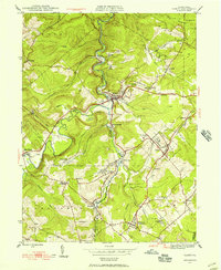 1945 Ramey1955 Print · USGSClearfield County's coal and rail corridors are captured here just as the post-war era began. Researchers can trace family roots and vanished landmarks through Madera, the Manor Hill Sch, and the Janesville Smithmill P O.4 unique versions available
 - 1947 Map of Ramey
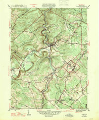 1947 Ramey1947 Print · USGSPost-war Clearfield County is captured here during a peak era of rail-driven mountain industry and rural settlement. Genealogists can trace family names at Hegarty Crossroads, find the Janesville Smithmill P O, or locate ancestors at Calvary Cem.2 unique versions available
 - 1953 Map of Pittsburgh
 1953 Pittsburgh1953 Print · USGSWestern Pennsylvania's industrial landscape at the start of the fifties shows the steel and rail corridors between Pittsburgh and Altoona. Trace family roots in river towns like Tarentum or follow the Pennsylvania Turnpike across Laurel Hill.
 - 1954 Map of Pittsburgh
 1954 Pittsburgh1954 Print · USGSWestern Pennsylvania in the early fifties remains a powerhouse of heavy industry and vital transit corridors. Genealogists and historians can trace the rail-and-river network connecting Pittsburgh, Johnstown, and Altoona via the Pennsylvania RR and the Lincoln Highway.2 unique versions available
 - 1958 Map of Pittsburgh
 1958 Pittsburgh1958 Print · USGSWestern Pennsylvania in the late fifties shows an industrial heartland defined by the confluence of the Allegheny River and Monongahela River. Researchers can trace the sprawling rail networks of the Pennsylvania RR and find established towns like Butler, Latrobe, and Windber.5 unique versions available
 - 1959 Map of Pittsburgh
 1959 Pittsburgh1959 Print · USGSWestern Pennsylvania in the late fifties is captured here at the height of its industrial era. Genealogists and historians can trace the riverfront growth of Pittsburgh, the rail works at Altoona, and the mountain gaps of Laurel Hill.
 - 1959 Map of Irvona, 1960 Print
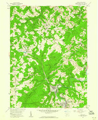 1959 Irvona1960 Print · USGSClearfield County's industrial and rural landscape is shown in the late fifties as coal mining and rail transport defined local life. Genealogists and historians can trace the foundations of Irvona, Coalport, and Ansonville, or locate family sites like Zion Ch and St Michaels Ch.5 unique versions available
 - 1961 Map of Coalport, 1963 Print
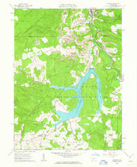 1961 Coalport1963 Print · USGSThe northern edge of the Allegheny Plateau comes into focus in the early sixties as industrial coal operations sit alongside a newly formed Glendale Lake. Trace the local rail-and-river economy through Coalport, Flinton, and numerous Strip Mines.7 unique versions available
 - 1963 Map of Blandburg, 1965 Print
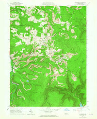 1963 Blandburg1965 Print · USGSThe coal and rail landscape of the Allegheny Front comes to life in the early 1960s, showing the intersection of industry and rural life. Trace family roots at Roseland Ch and Cambria Mills Cem, or locate mining heritage through the Tipple and Strip Mines near Blandburg.4 unique versions available
 - 1964 Map of Pittsburgh
 1964 Pittsburgh1964 Print · USGSWestern Pennsylvania in the late fifties and early sixties shows a landscape of powerful river industries and expanding highways. Genealogists and historians can trace the rail corridors of the Pennsylvania RR through industrial hubs like Johnstown, Altoona, and Nanty Glo.
 - 1984 Map of Tyrone, 1985 Print
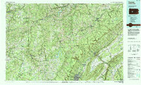 1984 Tyrone1985 Print · USGSCentral Pennsylvania in the mid-eighties shows a rugged landscape defined by the industry of Altoona and the ridges of the Appalachians. Genealogists and historians can trace the rail corridors of CONRAIL and locate vanished family homes near Glendale Lake or within Sinking Valley.
 - 1993 Map of Ramey, 1994 Print
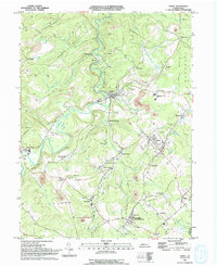 1993 Ramey1994 Print · USGSClearfield County's coal country is captured here in the early nineties, showing a landscape defined by industry and valley hamlets. Researchers can trace family roots at Janesville, Hegarty Crossroads, and the St Marys Cem.
 - 1998 Map of Coalport, 1999 Print
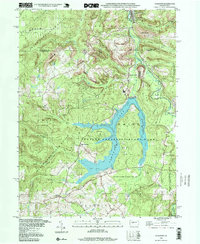 1998 Coalport1999 Print · USGSThe Clearfield and Cambria county borderlands are shown here in the late nineties, centered on the waters of Glendale Lake. Researchers can trace the legacy of local industry and transport through the Blain Run Railroad, an old railroad grade, and Coalport.
 - 2010 Map of Ramey, 2010 Print
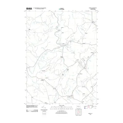 2010 Ramey2010 Print · USGSBeccaria Township and its surrounding boroughs are captured here at the start of the 2010s, showcasing a landscape defined by Clearfield Creek. Researchers can locate family roots at Saint Marys Cemetery or trace the development of crossroads communities like Janesville and Hegarty Crossroads.
 - 2010 Map of Irvona, 2010 Print
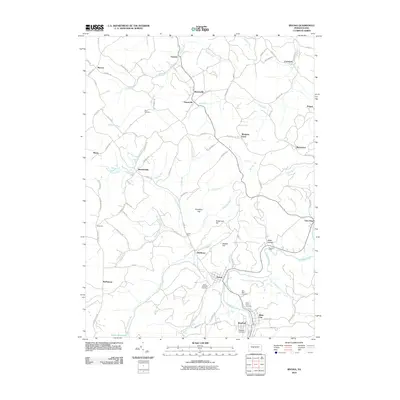 2010 Irvona2010 Print · USGSClearfield County's upland valleys and winding creeks are documented here in the late 2000s, showing a landscape of scattered rural hamlets and small-town centers. Researchers can locate family landmarks like Beccaria Mills, Zion Cemetery, and the closely clustered Saint Michaels and Saint Pauls cemeteries.
Showing maps 1-25 of 43
Top cities near Beccaria Township
- Altoona historical maps
- Curwensville historical maps
- Bellwood historical maps
- Patton historical maps
- Hastings historical maps
- Bigler historical maps
See more
Top neighborhoods of Beccaria Township
- Utahville historical maps
- New London historical maps
- Heverly historical maps
- Lyleville historical maps
- Blain City historical maps
- Diehltown historical maps
See more
Frequently asked questions
- What are the different types of historical maps available for Beccaria Township?
- What is the oldest map of Beccaria Township?
- Where can I purchase historical maps of Beccaria Township for my home or office?
- Where can I download high-res historical maps of Beccaria Township?
- Are there historical topographic maps available for Beccaria Township?
- Is there historical aerial imagery available for Beccaria Township?
- Where are historical maps of Beccaria Township sourced from?