1960s Maps of Clinton County, Pennsylvania
Explore 23 historic maps of Clinton County from the 1960s. These maps offer a rare glimpse into what life looked like during the 1960s — showing old roads, neighborhoods, homes, and landmarks that have changed or disappeared over time.
Whether you're researching your family's past, planning a metal detecting trip, or studying how Clinton County's landscape evolved across the 1960s, these high-resolution maps are a powerful tool for exploring the history of this region.
- Focus on a specific era: All maps on this page are from the 1960s, giving you a focused view of this time period.
- See what’s changed: Compare century-old streets, trails, and buildings to today's modern landscape using overlays and satellite layers.
- Research with precision: Use these maps for genealogy, historical research, land use analysis, or educational projects.
- View, download, or print: Maps are fully viewable online in high resolution, and can be downloaded or printed for your own records.
Start exploring Clinton County's history through authentic maps from the 1960s. This is your window into the past.
Clinton County, PA maps
(23)- 1960 Map of Williamsport
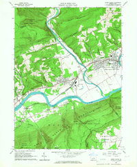
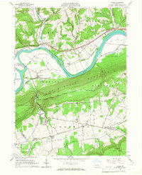
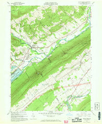
 1960 Williamsport1960 Print · USGSNorth-central Pennsylvania in the mid-twentieth century was a vital corridor of rail and river industry stretching from the New York line to the coal regions. Genealogists can trace the rail networks of the Pennsylvania RR and Lehigh Valley RR connecting towns like Williamsport, Towanda, and Lock Haven.
 - 1960 Map of Snow Shoe NW, 1962 Print
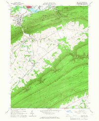
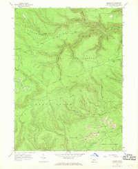
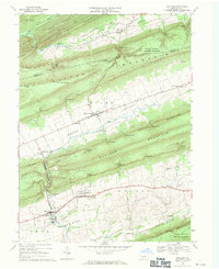
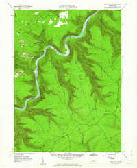 1960 Snow Shoe NW1962 Print · USGSThe West Branch of the Susquehanna winds through the high ridges of the Sproul State Forest at the start of the sixties. Genealogists and forest historians can trace the New York Central rail line, Nelson Cem, and the Panther Fire Tower.5 unique versions available
 - 1960 Map of Snow Shoe NE, 1962 Print
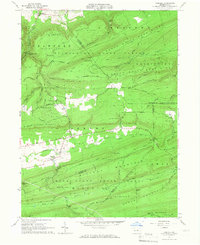
 1960 Snow Shoe NE1962 Print · USGSThe Clinton and Centre County borderlands in the early sixties reveal a landscape of deep hollows and remote wilderness camps. Researchers can trace the heritage of local outdoor life at sites like Ralpton Camp, Wildcat Camp, and the Bald Hill Hunting Club.3 unique versions available
 - 1960 Map of Snow Shoe SE, 1962 Print
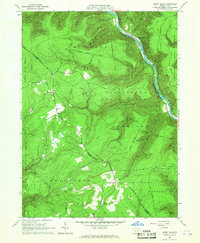
 1960 Snow Shoe SE1962 Print · USGSThe industrial and forest landscapes of central Pennsylvania are captured here at the start of the 1960s. Researchers can trace the path of the New York Central and Hudson River RR through the Hogback Tunnel or locate family roots at Summit Hill Cem and Orviston.4 unique versions available
 - 1961 Map of Harrisburg
 1961 Harrisburg1961 Print · USGSCentral Pennsylvania is shown at a mid-century peak of industrial and military activity, from the Susquehanna water gaps to the fertile Dutch Country. Genealogists and historians can trace the rail corridors of the Pennsylvania RR and find landmarks like Carlisle Barracks or the Anthracite Coal Fields.2 unique versions available
 - 1962 Map of Williamsport, 1966 Print
 1962 Williamsport1966 Print · USGSNorth-central Pennsylvania was a landscape of industrial river hubs and vast state woodlands in the early sixties. Researchers can trace the path of the Pennsylvania Railroad through Williamsport and explore the remote reaches of Bucktail State Park.5 unique versions available
 - 1964 Map of Harrisburg
 1964 Harrisburg1964 Print · USGSCentral Pennsylvania in the mid-fifties reveals a landscape shaped by ridge-and-valley geology and critical Cold War infrastructure. Researchers can trace the massive Indiantown Gap Military Reservation or the rail corridors of the Pennsylvania RR and Reading RR.
 - 1965 Map of Williamsport
 1965 Williamsport1965 Print · USGSNorth-central Pennsylvania in the mid-1960s is defined by the industrial river towns and vast timberlands of the Allegheny Plateau. Researchers can trace historic rail lines like the Erie Lackawanna and Reading as they thread through Williamsport, Lock Haven, and Jersey Shore.
 - 1965 Map of Loganton, 1966 Print
 1965 Loganton1966 Print · USGSCentral Pennsylvania's isolated Sugar Valley is seen here in the mid-1960s, showing a string of agricultural hamlets between forested ridges. Genealogists can locate family sites at Booneville, Greenburr, and the Old Schracktown Cem.3 unique versions available
 - 1965 Map of Mill Hall, 1966 Print
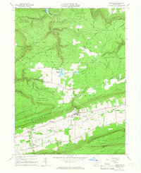
 1965 Mill Hall1966 Print · USGSCentral Pennsylvania’s valley and ridge landscape is captured here in the mid-1960s, showing a mix of industrial hubs and remote state forest. Trace local roots in Mill Hall, Salona, or Mackeyville, and locate family sites like Cedar Hill Cem and the Lamar Sch.3 unique versions available
 - 1965 Map of Carroll, 1967 Print
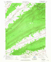
 1965 Carroll1967 Print · USGSCentral Pennsylvania's ridge-and-valley terrain is captured here in the mid-1960s, showing the isolated communities of Carroll and Eastville. Researchers can locate family sites at the Sugar Valley Ch Cem or trace the old paths through McMurrin Gap and past the Mt Union Ch.4 unique versions available
 - 1965 Map of Jersey Shore, 1967 Print
 1965 Jersey Shore1967 Print · USGSThe river-and-rail corridor near Jersey Shore is captured here in the mid-1960s, showing the intersection of heavy industry and state forest lands. Researchers can trace the New York Central through Avis Yard or locate family sites at Garman Ch and Jersey Shore Cemetery.4 unique versions available
 - 1965 Map of Jersey Mills, 1967 Print
 1965 Jersey Mills1967 Print · USGSLycoming and Clinton Counties are shown in the mid-sixties as timber and rail defined life along the river. Researchers can trace the New York Central line through the Pine Creek Gorge and find family landmarks like Haneyville Ch and Springer Corners.3 unique versions available
 - 1965 Map of Linden, 1967 Print
 1965 Linden1967 Print · USGSLycoming County in the mid-1960s reveals a landscape shaped by the steep slopes of Bald Eagle Mountain and the busy river corridor. Genealogists and local historians can trace family locations near Antes Fort, find old schools like the Missionary Ch Sch, and locate family plots at the Fort Antes Cem.2 unique versions available
 - 1965 Map of Lock Haven, 1967 Print
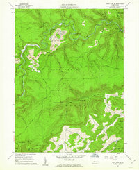
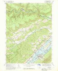
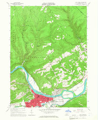 1965 Lock Haven1967 Print · USGSLock Haven and its surrounding river valley are captured here in the mid-sixties, showing a landscape shaped by rail, river, and academia. Researchers can trace the Pennsylvania Canal, find family plots at St Marys Cem, or locate the campus of Lock Haven State College.5 unique versions available
 - 1966 Map of Williamsport
 1966 Williamsport1966 Print · USGSThe Susquehanna Valley was a hub of transit and industry in the mid-seventies, where the river's West Branch connected major college towns and timberlands. Researchers can trace historical rail lines like the Reading or locate regional landmarks from Jersey Shore to Ricketts Glen State Park.
 - 1966 Map of Madisonburg, 1968 Print
 1966 Madisonburg1968 Print · USGSCentre County at the height of the mid-sixties reveals a landscape of high ridges and agricultural valleys. Genealogists and historians can trace family locations near Madisonburg, the site of Penns Cave, and rural landmarks like St Marks Cem Ch.4 unique versions available
 - 1966 Map of Farrandsville, 1969 Print
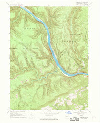 1966 Farrandsville1969 Print · USGSThe West Branch Susquehanna River corridor in the 1960s reveals a landscape of industrial transit and remote ridges. Genealogists can locate the riverside settlements of Farrandsville and Riverview, as well as Peoples Ch and upland strip mines.2 unique versions available
 - 1967 Map of Beech Creek, 1968 Print
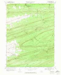
 1967 Beech Creek1968 Print · USGSClinton and Centre counties are captured in the late sixties during the creation of the Blanchard Reservoir. Genealogists and historians can trace family plots at Hays-Fearon Cem and explore community landmarks like Beech Creek Station and Liberty Ch.3 unique versions available
 - 1967 Map of Howard NW, 1968 Print
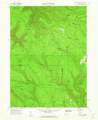
 1967 Howard NW1968 Print · USGSClinton County’s deep woods and mining heritage are documented here in the late sixties, showing the remote highlands of Sproul State Forest. Researchers can trace old resource extraction routes and forest clearings like Eagleton Fields and several hillside Strip Mines.3 unique versions available
 - 1967 Map of Howard, 1969 Print
 1967 Howard1969 Print · USGSCentral Pennsylvania in the late sixties shows the intersection of the new Eagle Creek Reservoir and old mountain settlements. Local historians can trace the foundations of Howard and Orviston alongside remote sites like Schencks Cem and Highland Ch.3 unique versions available
 - 1968 Map of Woodward, 1971 Print
 1968 Woodward1971 Print · USGSPennsylvania’s central ridges are captured here in the late sixties, showing a landscape of state forest lands and narrow valley gaps. Researchers can locate small communities like Woodward and Livonia, or trace old paths and natural features such as Horse Path Spring and Wolfs Store Gap.3 unique versions available
 - 1968 Map of Millheim, 1971 Print
 1968 Millheim1971 Print · USGSIn the late 1960s, these Pennsylvania valleys remained a landscape of tight-knit agricultural villages and steep forested ridges. Genealogists and historians can trace family locations through Aaronsburg and Millheim, finding landmarks like Woodward Cave and Salem Ch.4 unique versions available
End of results
Showing maps 1-23 of 23
Top cities of Clinton County
- Lock Haven historical maps
- Mill Hall historical maps
- Avis historical maps
- Flemington historical maps
- Castanea Township historical maps
- Beech Creek historical maps
See more
Frequently asked questions
- What are the different types of historical maps available for Clinton County?
- What is the oldest map of Clinton County?
- Where can I purchase historical maps of Clinton County for my home or office?
- Where can I download high-res historical maps of Clinton County?
- Are there historical topographic maps available for Clinton County?
- Is there historical aerial imagery available for Clinton County?
- Where are historical maps of Clinton County sourced from?