1930s Maps of Clinton County, Pennsylvania
Explore 4 historic maps of Clinton County from the 1930s. These maps offer a rare glimpse into what life looked like during the 1930s — showing old roads, neighborhoods, homes, and landmarks that have changed or disappeared over time.
Whether you're researching your family's past, planning a metal detecting trip, or studying how Clinton County's landscape evolved across the 1930s, these high-resolution maps are a powerful tool for exploring the history of this region.
- Focus on a specific era: All maps on this page are from the 1930s, giving you a focused view of this time period.
- See what’s changed: Compare century-old streets, trails, and buildings to today's modern landscape using overlays and satellite layers.
- Research with precision: Use these maps for genealogy, historical research, land use analysis, or educational projects.
- View, download, or print: Maps are fully viewable online in high resolution, and can be downloaded or printed for your own records.
Start exploring Clinton County's history through authentic maps from the 1930s. This is your window into the past.
Clinton County, PA maps
(4)- 1931 Map of Show Shoe
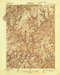
 1931 Show Shoe1931 Print · USGSThe Pennsylvania coalfields and river valleys are captured here in the early 1930s, showing a rugged landscape defined by mountain camps and mining towns. Genealogists can trace family roots through industrial settlements like Clarence and Snow Shoe or locate old schools such as Cherry Run Sch.3 unique versions available
 - 1932 Map of Karthaus
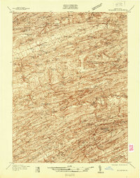
 1932 Karthaus1932 Print · USGSThe Susquehanna’s West Branch winds through Clearfield and Centre Counties in the late 1920s, a landscape shaped by the rail and timber industries. Genealogists can trace family names through dozens of rural schools and churches like Mignot Sch and Fairview Ch.3 unique versions available
 - 1937 Map of Waterville
 1937 Waterville1937 Print · USGSThe Pine Creek valley and its logging railroad corridors come alive in this late 1930s survey of Lycoming County. Researchers can trace the era of the Civilian Conservation Corps at CCC Camp No 129 or locate family roots at English Center, Cammal, and Okome.5 unique versions available
 - 1937 Map of Millheim
 1937 Millheim1937 Print · USGSThe Seven Mountains region of central Pennsylvania is shown here in the late thirties, when rural valleys were tied together by narrow gaps. Researchers can locate family landmarks like Wolfs Chapel, Lose Sch, and vanished stopovers such as Wolfs Store.
End of results
Showing maps 1-4 of 4
Top cities of Clinton County
- Lock Haven historical maps
- Mill Hall historical maps
- Avis historical maps
- Flemington historical maps
- Castanea Township historical maps
- Beech Creek historical maps
See more
Frequently asked questions
- What are the different types of historical maps available for Clinton County?
- What is the oldest map of Clinton County?
- Where can I purchase historical maps of Clinton County for my home or office?
- Where can I download high-res historical maps of Clinton County?
- Are there historical topographic maps available for Clinton County?
- Is there historical aerial imagery available for Clinton County?
- Where are historical maps of Clinton County sourced from?