2020s Maps of Spring Creek Township, Pennsylvania
Explore 4 historic maps of Spring Creek Township from the 2020s. These maps offer a rare glimpse into what life looked like during the 2020s — showing old roads, neighborhoods, homes, and landmarks that have changed or disappeared over time.
Whether you're researching your family's past, planning a metal detecting trip, or studying how Spring Creek Township's landscape evolved across the 2020s, these high-resolution maps are a powerful tool for exploring the history of this region.
- Focus on a specific era: All maps on this page are from the 2020s, giving you a focused view of this time period.
- See what’s changed: Compare century-old streets, trails, and buildings to today's modern landscape using overlays and satellite layers.
- Research with precision: Use these maps for genealogy, historical research, land use analysis, or educational projects.
- View, download, or print: Maps are fully viewable online in high resolution, and can be downloaded or printed for your own records.
Start exploring Spring Creek Township's history through authentic maps from the 2020s. This is your window into the past.
Spring Creek Township, PA maps
(4)- 2023 Map of Carman, 2023 Print
 2023 Carman2023 Print · USGSThe Elk and Jefferson county border comes into focus in this recent survey, centered on the Clarion River and Little Toby Creek valleys. Researchers can trace the legacy of old mountain settlements and cemeteries like Saint Tobias Cemetery and Croyland.
 - 2023 Map of Portland Mills, 2023 Print
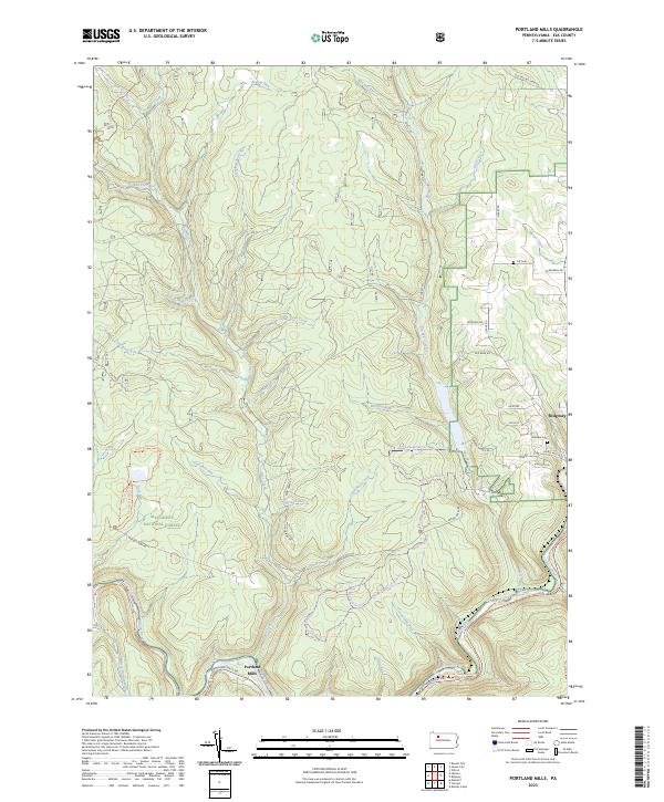 2023 Portland Mills2023 Print · USGSElk County’s deep forest and river valleys are captured here in the modern era, showing the intersection of local industry and recreation. Genealogists and hikers can trace family sites like Ott Cem or explore the extensive Laurel Mill Ski Trl and Historical Path Trl.
 - 2023 Map of Hallton, 2023 Print
 2023 Hallton2023 Print · USGSThe deep river valleys of Elk and Forest counties are documented in this recent survey. Local historians can trace riverside settlements like Hallton and Arroyo, or find old family sites near the Maxwell Run Cem.
 - 2023 Map of Munderf, 2023 Print
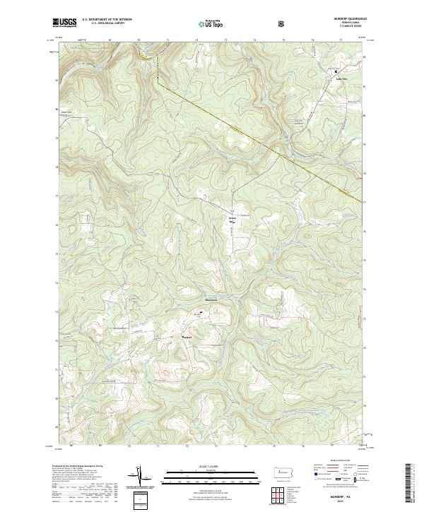 2023 Munderf2023 Print · USGSJefferson County highlands at the start of the 2020s show a landscape of deep valleys and small settlements. Researchers can locate family sites near Munderf Cem, trace the waters of North Fork Redbank Creek, or explore the rural layout of Blowtown.
End of results
Showing maps 1-4 of 4
Top cities near Spring Creek Township
- Sandy Township historical maps
- Ridgway historical maps
- Brookville historical maps
- Johnsonburg historical maps
- Brockway historical maps
- Warsaw Township historical maps
See more
Top neighborhoods of Spring Creek Township
- Arroyo historical maps
- Beuhler Corner historical maps
- Hallton historical maps
- Croyland historical maps
- Portland Mills historical maps
- Lake City historical maps
See more
Frequently asked questions
- What are the different types of historical maps available for Spring Creek Township?
- What is the oldest map of Spring Creek Township?
- Where can I purchase historical maps of Spring Creek Township for my home or office?
- Where can I download high-res historical maps of Spring Creek Township?
- Are there historical topographic maps available for Spring Creek Township?
- Is there historical aerial imagery available for Spring Creek Township?
- Where are historical maps of Spring Creek Township sourced from?