2020s Maps of Fayette County, Pennsylvania
Explore 29 historic maps of Fayette County from the 2020s. These maps offer a rare glimpse into what life looked like during the 2020s — showing old roads, neighborhoods, homes, and landmarks that have changed or disappeared over time.
Whether you're researching your family's past, planning a metal detecting trip, or studying how Fayette County's landscape evolved across the 2020s, these high-resolution maps are a powerful tool for exploring the history of this region.
- Focus on a specific era: All maps on this page are from the 2020s, giving you a focused view of this time period.
- See what’s changed: Compare century-old streets, trails, and buildings to today's modern landscape using overlays and satellite layers.
- Research with precision: Use these maps for genealogy, historical research, land use analysis, or educational projects.
- View, download, or print: Maps are fully viewable online in high resolution, and can be downloaded or printed for your own records.
Start exploring Fayette County's history through authentic maps from the 2020s. This is your window into the past.
Fayette County, PA maps
(29)- 2023 Map of Mather, 2023 Print
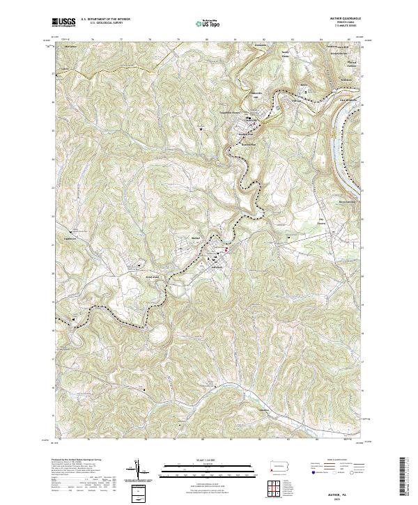 2023 Mather2023 Print · USGSThe Monongahela River valley and the Tenmile Creek forks define this southwestern Pennsylvania landscape in the twenty-first century. Researchers can trace family history through local landmarks like Moredock Cem, Rices Landing, and the Greene County Airport.
 - 2023 Map of Smithton, 2023 Print
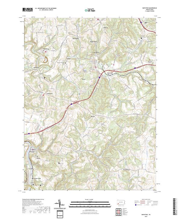 2023 Smithton2023 Print · USGSWestmoreland County at the start of the 2020s shows a complex network of small settlements and riverfront communities along the Youghiogheny River. Genealogy researchers can trace family landmarks and rural congregations at Saint Paul Seanor Cem and Sewickley Presbyterian Church.
 - 2023 Map of Brownfield, 2023 Print
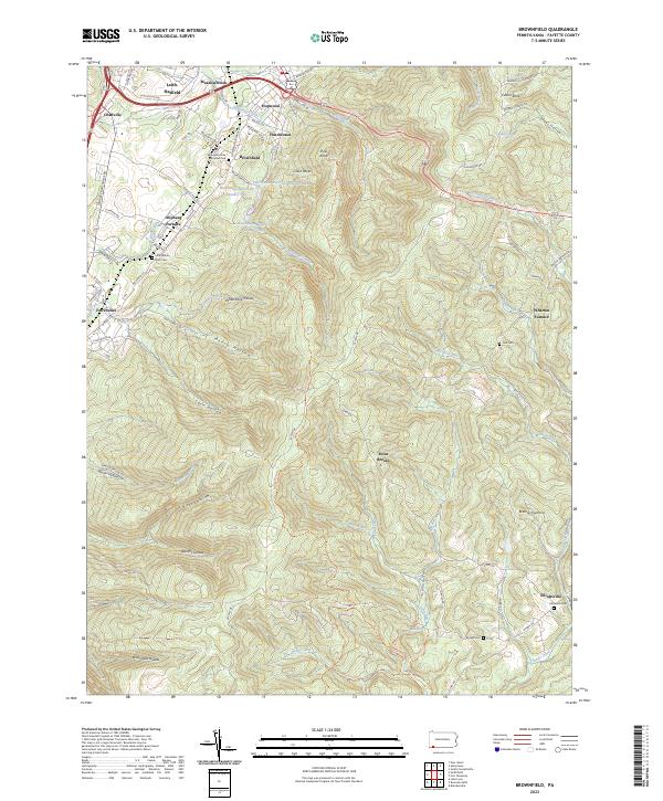 2023 Brownfield2023 Print · USGSModern Fayette County still bears the footprint of its industrial past, from the early ironworks at Wharton Furnace to the quiet hollows of the ridge. Trace family roots at Little White Rock Cem or explore the terrain around Hopwood and Elliottsville.
 - 2023 Map of Confluence, 2023 Print
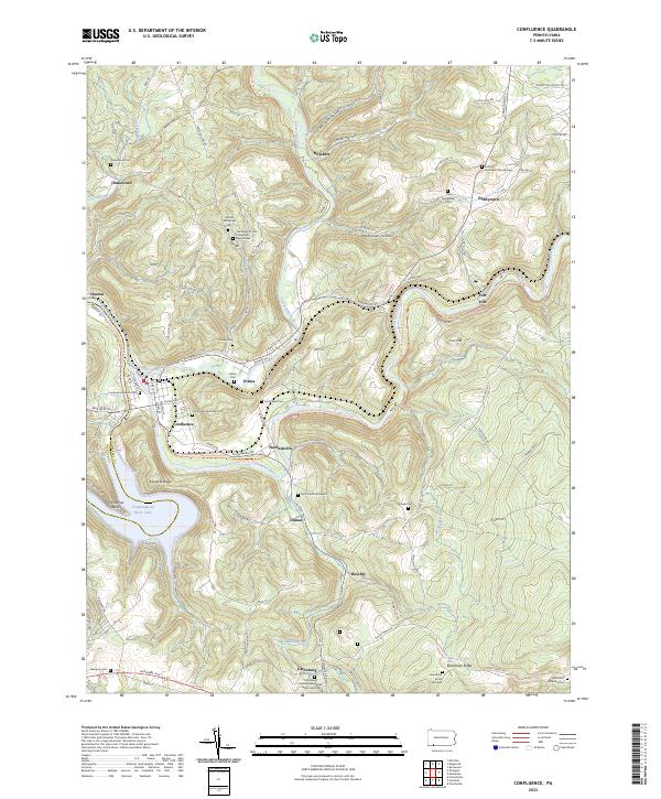 2023 Confluence2023 Print · USGSThe river valleys of Somerset County meet at the turn of the Youghiogheny, where high ridges overlook old river-town settlements. Genealogists can trace family lines at the Old Jersey Church Turkeyfoot Baptist Cemetery, McClintock Graveyard, and Boardman Burial Grounds.
 - 2023 Map of Kingwood, 2023 Print
 2023 Kingwood2023 Print · USGSSomerset County's ridge-and-valley landscape is documented here in the early twenty-first century, showing the enduring rural character of Laurel Hill. Genealogists can trace deep local roots through family landmarks like the John Younkin Family Graveyard and Schrock Family Cem.
 - 2023 Map of South Connellsville, 2023 Print
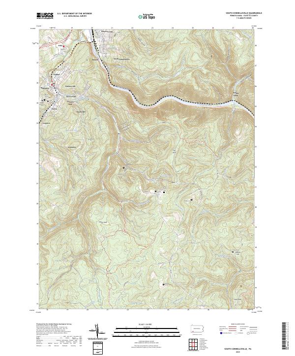 2023 South Connellsville2023 Print · USGSFayette County's river-carved landscape is shown in contemporary detail, tracing the path of the Youghiogheny River and its rail corridors. Genealogists can locate family landmarks like the Hay Family Cem and the Tharp Cem, or trace early settlements at Irishtown and Pechin.
 - 2023 Map of Carmichaels, 2023 Print
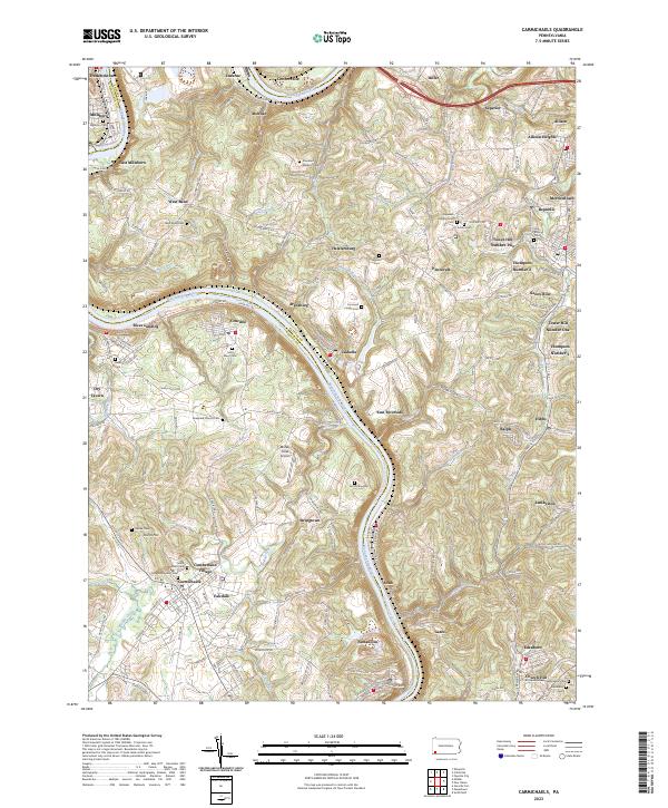 2023 Carmichaels2023 Print · USGSThe Monongahela River valley comes alive in this contemporary view of its historic coal towns and riverside landings. Genealogists and researchers can trace family lines through Greene Academy Cem or explore the layouts of Rices Landing and Crucible.
 - 2023 Map of Smithfield, 2023 Print
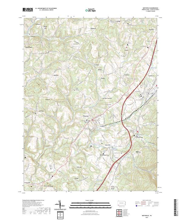 2023 Smithfield2023 Print · USGSSouthwestern Pennsylvania's rolling uplands are revealed in this detailed look at Fayette County's crossroads. Researchers can trace family lineage across dozens of burial grounds like the Mount Moriah Baptist Cem and Saint Joseph's Roman Catholic Cem.
 - 2023 Map of Lake Lynn, 2023 Print
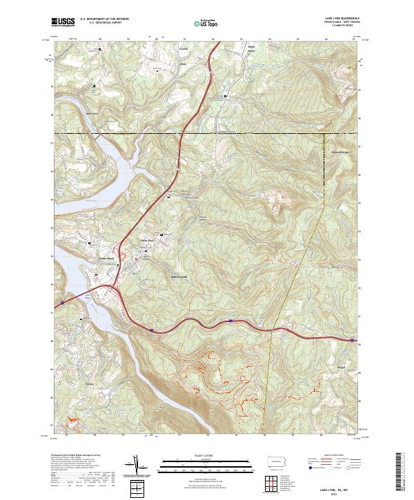 2023 Lake Lynn2023 Print · USGSThe Pennsylvania and West Virginia borderlands come alive on this map, showing the storied landscape surrounding Cheat Lake and the Cheat River. Genealogists and local historians can locate many family-named landmarks and burial sites, including the Baker Family Cem, Ices Ferry, and Gans.
 - 2023 Map of Fort Necessity, 2023 Print
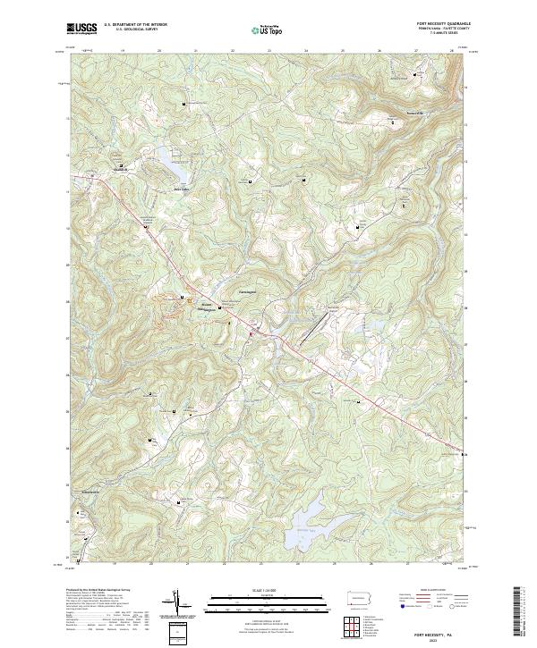 2023 Fort Necessity2023 Print · USGSFayette County’s colonial frontier is preserved here in modern detail, centered on the French and Indian War grounds of the 1750s. Genealogists can trace family lineage through numerous rural burial sites like the Cromwell Family Cem and the General Edward Braddock Gravesite.
 - 2023 Map of New Salem, 2023 Print
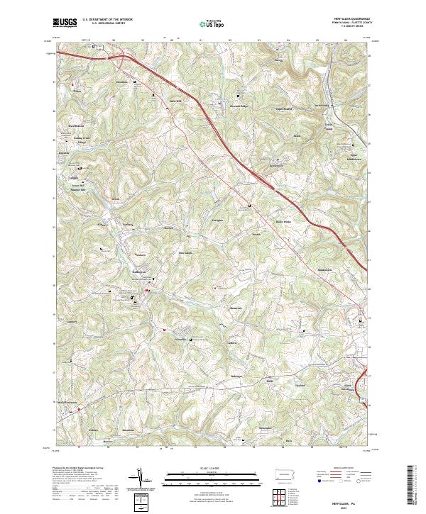 2023 New Salem2023 Print · USGSThe coal-country landscape near New Salem comes into focus in this recent survey. Genealogists can locate family burial sites at Saint Mary's Cem or Salem View Cem and trace the small residential clusters of Upper Peanut and Keisterville.
 - 2023 Map of Uniontown, 2023 Print
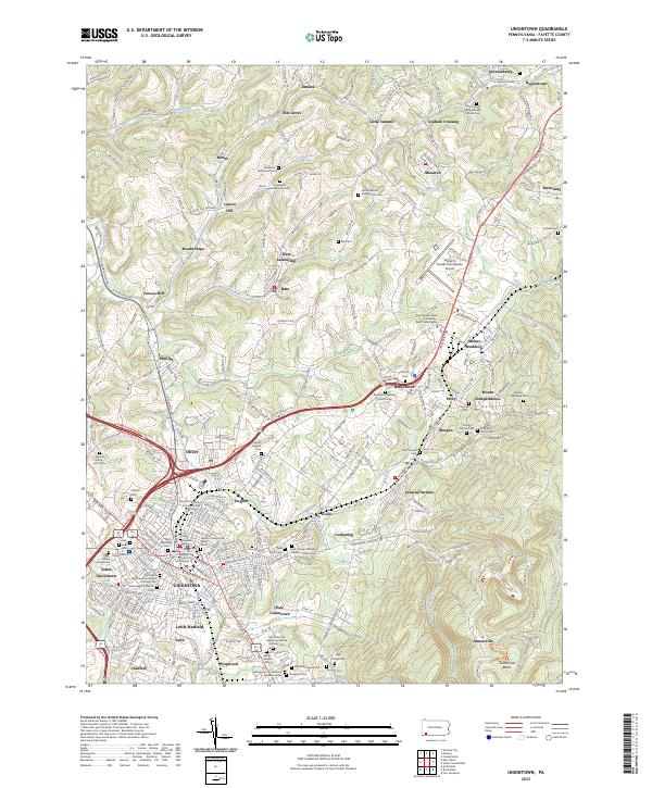 2023 Uniontown2023 Print · USGSThe Fayette County seat and its surrounding coal-patch heritage are captured here in the 2020s. Genealogists can trace family names through dozens of sites like Old Laurel Hill Presbyterian Cem and the Zaring-Matthews Cem.
 - 2023 Map of Masontown, 2023 Print
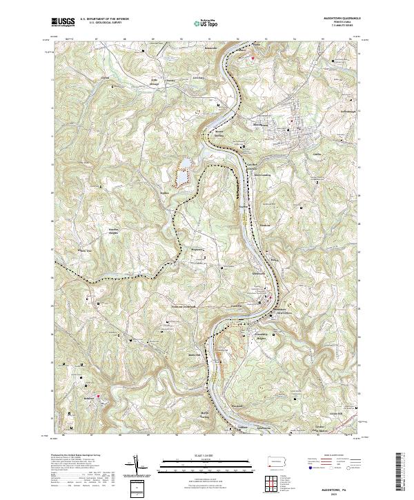 2023 Masontown2023 Print · USGSThe Monongahela River valley comes alive in this contemporary survey of the Fayette and Greene county border. Genealogists can trace family heritage through Sophia's Grave, Swearingen's Fort Burial Site, and the Friendship Hill National Historic Site.
 - 2023 Map of Mill Run, 2023 Print
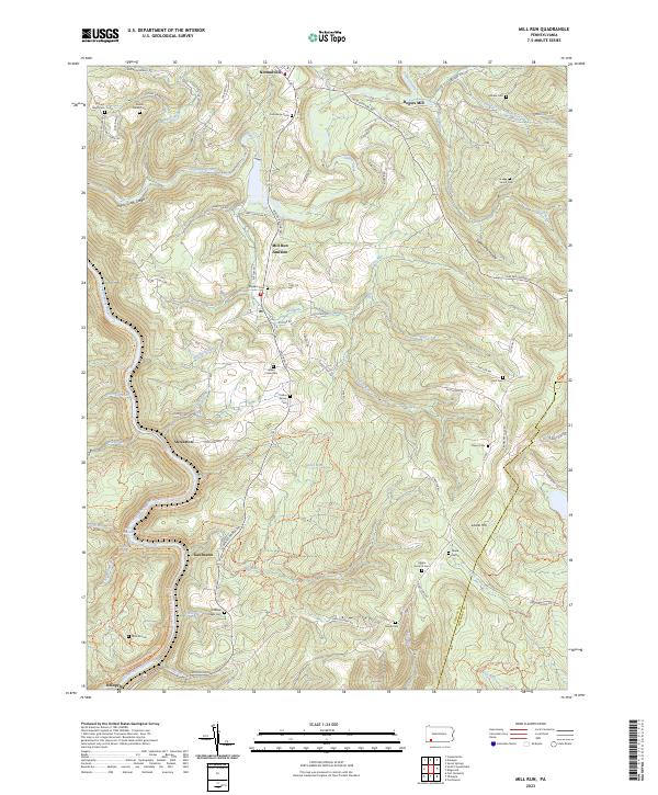 2023 Mill Run2023 Print · USGSFayette County ridge country is captured here in the 2020s, showing the deeply carved river corridors and highland settlements. Genealogists can locate family burial grounds like the Grimm Family Cem and Collins Family Cem near Normalville.
 - 2023 Map of Ohiopyle, 2023 Print
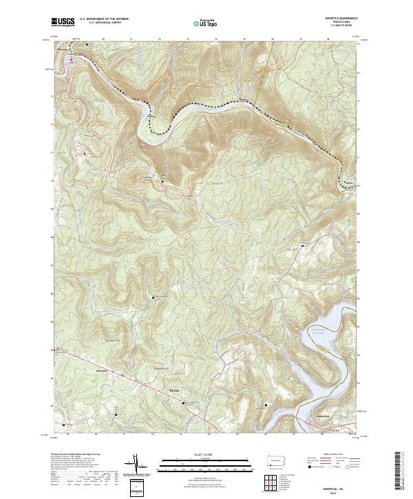 2023 Ohiopyle2023 Print · USGSThe Pennsylvania highlands between Fayette and Somerset counties are shown here in modern detail. Trace family history through numerous small burial sites like Tressler Farm Cemetery and Bird-Burd Cemetery or locate the historic National Pike.
 - 2023 Map of Dawson, 2023 Print
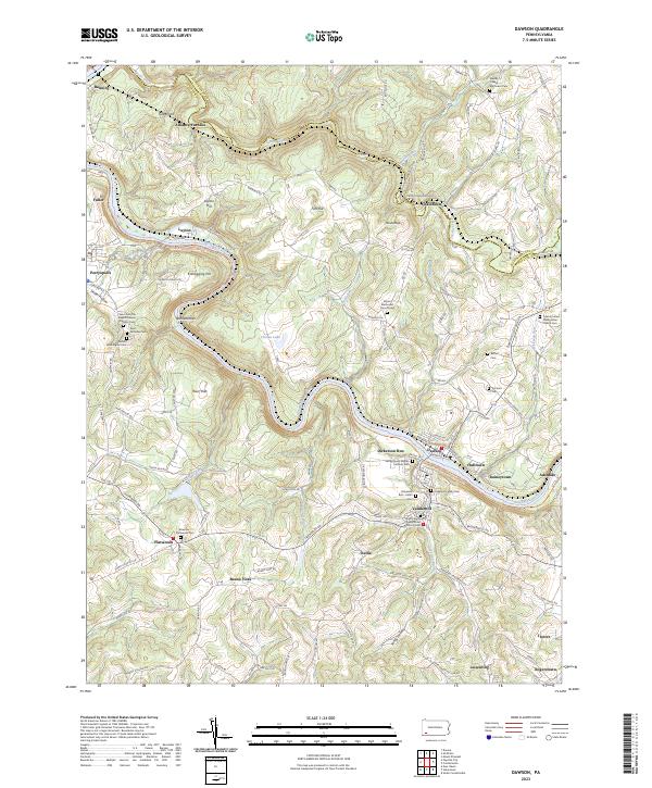 2023 Dawson2023 Print · USGSThe Youghiogheny River corridor in Fayette County comes alive in this contemporary survey of its historic river towns and industrial roots. Researchers can trace genealogical ties at the Dickerson Family Cem or explore early industry at the Alliance Furnace and Kilndigging Hill.
 - 2023 Map of Mammoth, 2023 Print
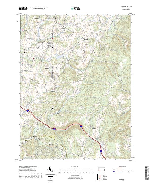 2023 Mammoth2023 Print · USGSWestmoreland and Fayette counties are captured here in the early 2020s, revealing a landscape defined by small valley settlements and high ridges. Genealogists can trace family roots through numerous burial sites like Lobingier Cem, Fairview Cem, and Hays Cem.
 - 2023 Map of California, 2023 Print
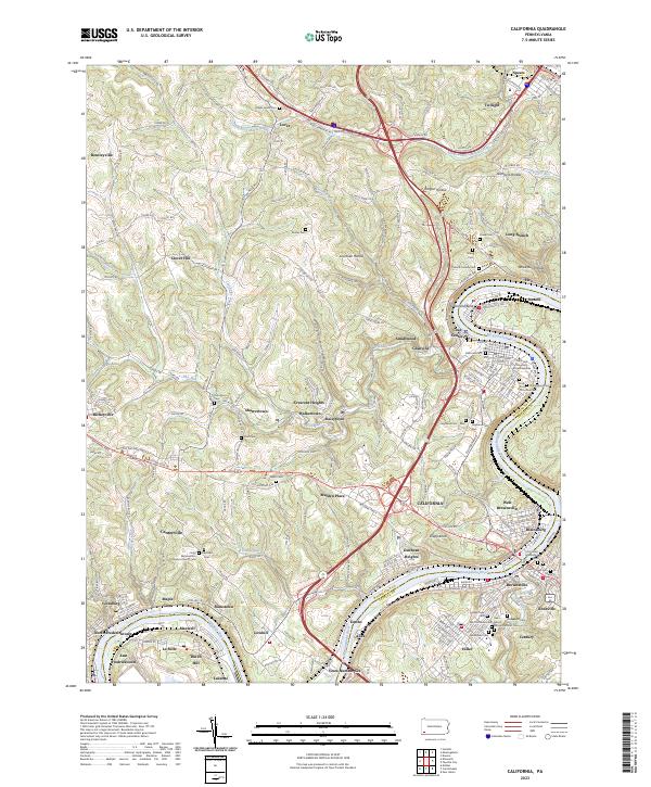 2023 California2023 Print · USGSThe Monongahela River valley comes to life in this detailed record of Washington and Fayette Counties during the early 21st century. Researchers can trace ancestral sites through dozens of local burial grounds like California Cem or explore the riverfront legacy of Coal Center and West Brownsville.
 - 2023 Map of Fayette City, 2023 Print
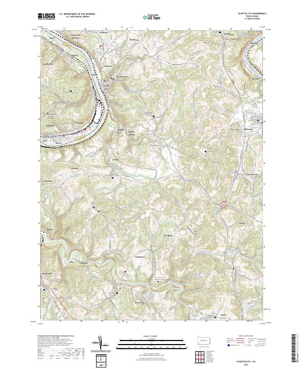 2023 Fayette City2023 Print · USGSFayette and Washington counties meet along the Monongahela River valley during a period of modern transition. Local historians can trace numerous pioneer burial sites and family plots, including the Providence Meeting House Cem, Havely Cem, and the riverside rail corridor of the Wheeling-Pitts RR.
 - 2023 Map of Seven Springs, 2023 Print
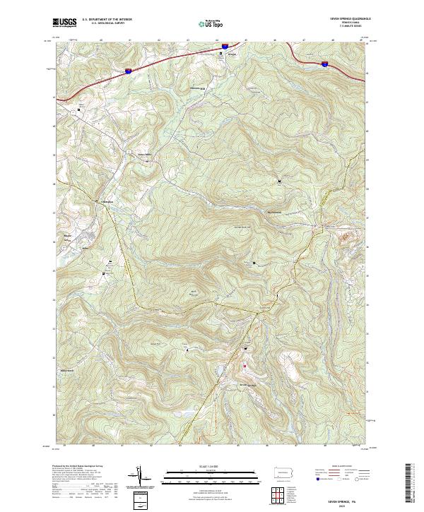 2023 Seven Springs2023 Print · USGSSeven Springs and the tri-county borders of Somerset, Westmoreland, and Fayette counties are captured here in the twenty-first century. Researchers can trace family sites like Franklin Lutheran Cem and Walnut Hill Cem or locate Horners Mill and Jones Mills.
 - 2023 Map of Donegal, 2023 Print
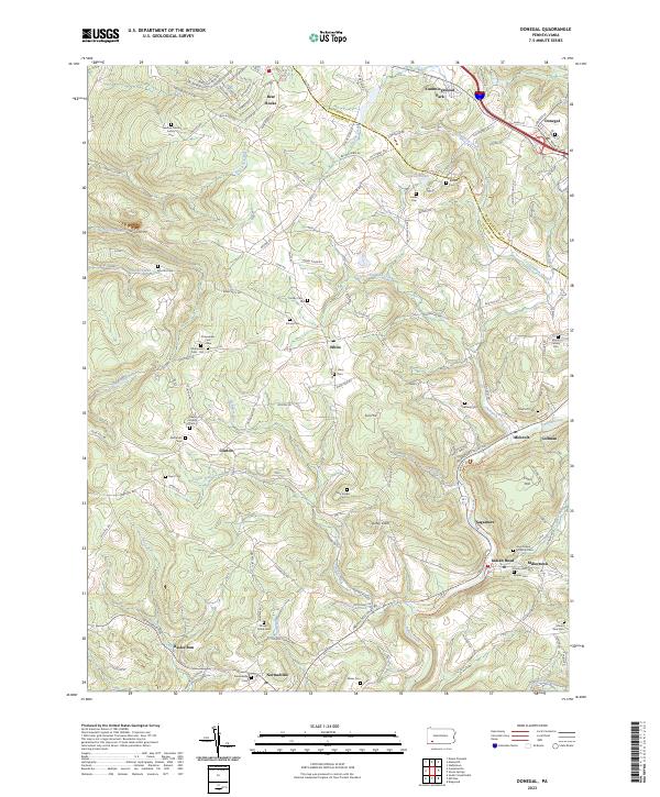 2023 Donegal2023 Print · USGSThe Laurel Highlands at the Westmoreland and Fayette border come into focus in this recent survey of the Indian Creek valley. Researchers can trace numerous family-named landmarks and burial grounds like the Keefer Family Cem and Stouffer Cem near Indian Head.
 - 2023 Map of Connellsville, 2023 Print
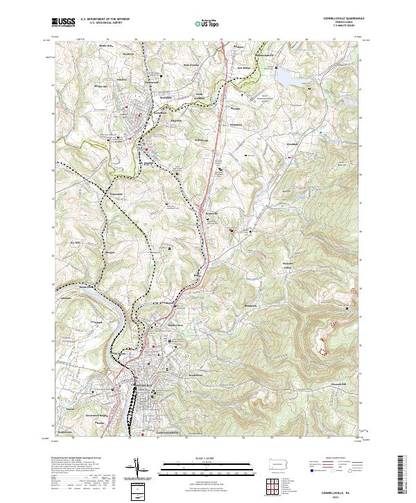 2023 Connellsville2023 Print · USGSWestern Pennsylvania’s industrial river valley and coal-country settlements are documented here in recent detail. Researchers can trace family sites from Scottdale to Connellsville, including Hill Grove Cem, Holy Trinity Roman Catholic Cem, and the Southwest Pennsylvania RR.
 - 2023 Map of Donora, 2023 Print
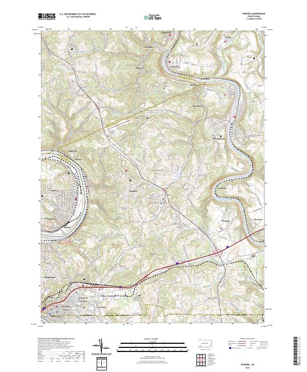 2023 Donora2023 Print · USGSThe industrial river valleys of Washington and Westmoreland counties are shown here in the early twenty-first century. Researchers can trace family sites at Round Hill Cem, the Plummer School, and many churches from Donora to West Newton.
 - 2023 Map of Mount Pleasant, 2023 Print
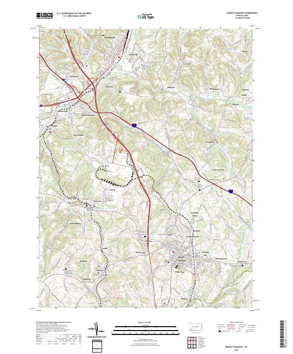 2023 Mount Pleasant2023 Print · USGSCentral Westmoreland County is shown in the 2020s, a landscape defined by its mining heritage and transport links. Genealogists can trace family burial sites at Middle Presbyterian Cem or old mining communities like Standard Shaft and Morewood.
 - 2023 Map of Monongahela, 2023 Print
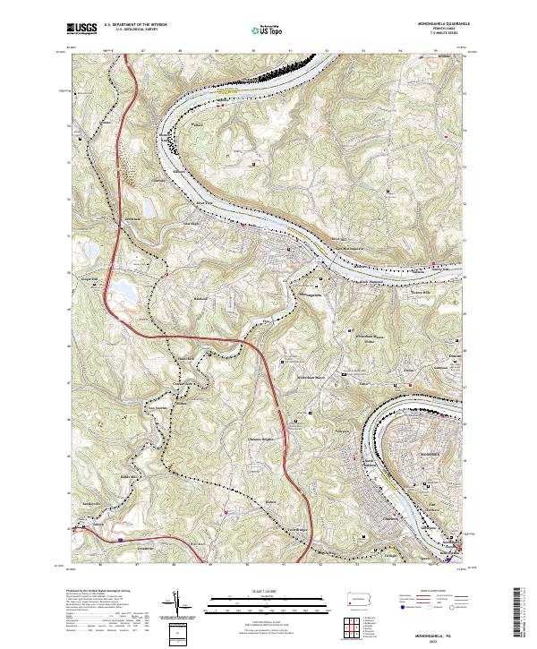 2023 Monongahela2023 Print · USGSThe Monongahela River valley shows its industrial character and deep family roots in the 2020s. Genealogists can trace decades of history through dozens of sites like the Horseshoe Bottom Presbyterian Church Cem and Sholom Cem.
Showing maps 1-25 of 29
Top cities of Fayette County
- Uniontown historical maps
- Connellsville historical maps
- Luzerne Township historical maps
- Masontown historical maps
- Springhill Township historical maps
- South Connellsville historical maps
See more
Frequently asked questions
- What are the different types of historical maps available for Fayette County?
- What is the oldest map of Fayette County?
- Where can I purchase historical maps of Fayette County for my home or office?
- Where can I download high-res historical maps of Fayette County?
- Are there historical topographic maps available for Fayette County?
- Is there historical aerial imagery available for Fayette County?
- Where are historical maps of Fayette County sourced from?