Old Maps of Monroe County, Pennsylvania for Hiking & Exploration
Hike through history with 240 historic maps of Monroe County. Explore old trails, ghost towns, and forgotten backroads — perfect for outdoor adventurers and local explorers.
- Rediscover forgotten places: Map out old mining camps, roads, and footpaths that no longer exist on modern maps.
- Layer with modern tools: Combine with LiDAR or satellite views to plan hikes through historical terrain.
- Made for exploration: Popular among hikers, overlanders, and local history lovers.
Use these maps to find adventure and explore the hidden past of Monroe County.
Monroe County, PA maps
(240)- 1891 Map of Wallpack
 1891 Wallpack1891 Print · USGSThe Delaware River valley and Kittatinny Mountain ridges define this late nineteenth-century borderland between Pennsylvania and New Jersey. Genealogists can locate historic river crossings like Dingmans Ferry and trace early rail lines including the Paulins Kill Railroad.
 - 1891 Map of Delaware Water Gap
 1891 Delaware Water Gap1891 Print · USGSThe Delaware River corridor was a bustling industrial and transport hub in the late nineteenth century. Genealogists and historians can trace the region's slate mining roots at the Old Bangor Slate Quarry or locate historic river crossings like Myeres Ferry and Hartzells Ferry.
 - 1893 Map of Delaware Water Gap
 1893 Delaware Water Gap1893 Print · USGSThe Delaware River borderlands between Pennsylvania and New Jersey are captured here in the late nineteenth century as the slate industry and railroads transformed the valley. Researchers can locate the Old Bangor Slate Quarry, trace the river crossings at Myeres Ferry, and explore old stops like Stone Church P. O.12 unique versions available
 - 1893 Map of Wallpack
 1893 Wallpack1893 Print · USGSThe Delaware River valley and Kittatinny Mountain are captured here during the late nineteenth century, showing a landscape defined by ferries and early rail. You can trace old river crossings like Smiths Ferry or locate the rural post office at Peters Valley Bevans P.O. and the rail stop at Emmons Station.8 unique versions available
 - 1914 Map of Wind Gap, 1956 Print
 1914 Wind Gap1956 Print · USGSNorthampton and Monroe Counties are captured here just before the First World War, dominated by the industrial rail corridor at Wind Gap. Genealogists can locate dozens of named schools like Michael Valley School and early quarries at Chapman Quarries.
 - 1916 Map of Wind Gap
 1916 Wind Gap1916 Print · USGSThe Pocono foothills and Blue Mountain ridge are captured here at the height of the steam-rail era. Genealogists can trace family names through dozens of rural landmarks like St. Joseph School, Haynes Mill, and the busy rail junction at Wind Gap.7 unique versions available
 - 1919 Map of Pocono
 1919 Pocono1919 Print · USGSMonroe County was a critical military and rail corridor at the close of the Great War. Researchers can trace the massive Tobyhanna Military Reservation and the early rail-centered footprints of Mount Pocono, Tannerville, and Cresco.
 - 1921 Map of Pocono, 1962 Print
 1921 Pocono1962 Print · USGSThe Pocono Mountains at the start of the 1920s reveal a landscape of military training grounds, remote mountain schools, and early summer resorts. Trace the rail lines of the Wilkes-Barre and Eastern RR or locate rural landmarks like Cherry Lane Church and Beaver Brook School.
 - 1922 Map of Mauch Chunk, 1952 Print
 1922 Mauch Chunk1952 Print · USGSThe industrial Lehigh Valley thrives in the early 1920s, dominated by the winding river and two major competing railroad lines. Genealogists can locate old rural landmarks like the Larrytown Poor Farm, Indian Hills School, and the busy rail hub of Mauch Chunk.2 unique versions available
 - 1922 Map of Stoddartsville, 1958 Print
 1922 Stoddartsville1958 Print · USGSThe Pennsylvania Poconos at the turn of the century show a landscape of high timber ridges and early mountain resorts. Genealogists and hikers can trace the original paths to Stoddartsville, identify the old Fayette School, or follow the Wilkes-Barre and Eastern rail line.2 unique versions available
 - 1923 Map of Pocono
 1923 Pocono1923 Print · USGSMonroe County was evolving into a mountain retreat in the early twenties, connected by the Delaware Lackawanna and Western RR. Researchers can trace early resort life at Lake Naomi, find rural schools like Butz School, and locate the expansive Artillery Reservation.5 unique versions available
 - 1924 Map of Bushkill
 1924 Bushkill1924 Print · USGSThe Pennsylvania and New Jersey borderlands come to life in the mid-twenties, showing a landscape of small school districts and traditional river crossings. Researchers can locate family landmarks like Marshall Falls, trace the Delaware Lackawanna and Western rail line, and find old sites like Smoky Hill School.
 - 1924 Map of Stoddartsville
 1924 Stoddartsville1924 Print · USGSUpper Carbon and Monroe counties are shown in the early twenties as a landscape of timbered hills and headwater streams. Genealogists can locate old rural landmarks like Bradys Switch, the Leonardsville settlement, and the Locust Ridge School.5 unique versions available
 - 1924 Map of Mauch Chunk
 1924 Mauch Chunk1924 Print · USGSCarbon County in the early twenties is a landscape of industrial power and rural mountain life, dominated by the winding Lehigh River. Genealogists and historians can trace family roots through numerous small schools like Lentz School and old settlements from Mauch Chunk to Palmerton.4 unique versions available
 - 1935 Map of Hawley, 1955 Print
 1935 Hawley1955 Print · USGSThe Pocono Mountains and the massive shoreline of Lake Wallenpaupack dominate this mid-century survey of northeastern Pennsylvania. Local historians can trace the Erie rail line through Hawley and Rowland or locate the High Knob Fire Tower and rural Blooming Grove School.2 unique versions available
 - 1936 Map of Delaware Water Gap
 1936 Delaware Water Gap1936 Print · USGSThe Delaware River valley thrived in the mid-thirties as a critical junction for coal-hauling railroads and mountain tourism. Local historians can trace family roots through numerous rural landmarks like Spoke Factory Sch, Ross Cem, and Slateford Junction.4 unique versions available
 - 1938 Map of Hawley
 1938 Hawley1938 Print · USGSThe Pocono Mountains and the southern reaches of the Lackawaxen River appear here in the late thirties. Genealogists and local historians can trace the rural communities of Blooming Grove and Greeley or locate the Paupack Ch and numerous family-named swamps.3 unique versions available
 - 1941 Map of Delaware Water Gap
 1941 Delaware Water Gap1941 Print · USGSThe Delaware River valley is captured here in the early 1940s, showing the borderlands of Pennsylvania and New Jersey. Genealogists can trace family names through dozens of rural landmarks like Three Church Hill, Brass Castle, and the Stone Church PO.
 - 1942 Map of Delaware Water Gap
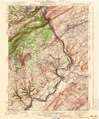 1942 Delaware Water Gap1942 Print · USGSThe Delaware River gorge and its surrounding ridges come into focus during the early war years, highlighting a critical rail and river junction. Trace local history through family-named landmarks like Miller Ch, rural Quaker Plain Sch, and the unique name of Manunka Chunk.3 unique versions available
 - 1943 Map of Bushkill
 1943 Bushkill1943 Print · USGSMonroe County and the Delaware River valley are captured in the early 1940s during a time of rural persistence and local industry. Genealogists and historians can locate family landmarks like Dimicks Ferry, St Thomas Chapel, and the vanished sites of Craig Meadows.2 unique versions available
 - 1943 Map of Portland
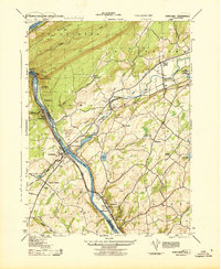 1943 Portland1943 Print · USGSThe Delaware River valley was a bustling corridor of rail and river transit during the early years of the Second World War. Researchers can trace the paths of several major railroads, locate family sites like the Fairview Cemetery, and find old infrastructure such as the Myers Ferry and Hainesburg RR Sta.2 unique versions available
 - 1943 Map of Scranton
 1943 Scranton1943 Print · USGSNortheastern Pennsylvania’s coal and rail corridor comes to life in the 1940s, showcasing the dense urban industrial centers of the Wyoming Valley. Genealogists can locate family landmarks like the Fayette School and Locust Ridge School or trace the early paths of the DL & W and Erie railroads.
 - 1943 Map of Mauch Chunk
 1943 Mauch Chunk1943 Print · USGSThe Lehigh River corridor is captured here during the mid-forties, showing the vital rail and industry centers of Carbon County. Genealogists and researchers can trace dozens of rural schoolhouses and family-named landmarks like the Larrytown Poor Farm, St Pauls Ch, and Three O'clock Spring.
 - 1943 Map of Wind Gap
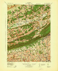 1943 Wind Gap1943 Print · USGSThe Pennsylvania countryside near the Monroe and Northampton county line is captured here during the wartime era. Researchers can trace the path of the Lehigh and New England railroad through the Wind Gap pass or locate local landmarks like St Joseph Sch and Ross Common.
 - 1943 Map of Stoddartsville
 1943 Stoddartsville1943 Print · USGSThe Pocono Plateau at the height of the Second World War shows a landscape defined by river valleys and developing recreation preserves. Genealogists and local historians can trace rural schoolhouses and small settlements like Stoddartsville, Albrightsville, and the Fishery Sch.
Showing maps 1-25 of 240
Top cities of Monroe County
- East Stroudsburg historical maps
- Stroudsburg historical maps
- Mount Pocono historical maps
- Delaware Water Gap historical maps
Frequently asked questions
- What are the different types of historical maps available for Monroe County?
- What is the oldest map of Monroe County?
- Where can I purchase historical maps of Monroe County for my home or office?
- Where can I download high-res historical maps of Monroe County?
- Are there historical topographic maps available for Monroe County?
- Is there historical aerial imagery available for Monroe County?
- Where are historical maps of Monroe County sourced from?