1940s Maps of Abbeville, South Carolina
Explore 3 historic maps of Abbeville from the 1940s. These maps offer a rare glimpse into what life looked like during the 1940s — showing old roads, neighborhoods, homes, and landmarks that have changed or disappeared over time.
Whether you're researching your family's past, planning a metal detecting trip, or studying how Abbeville's landscape evolved across the 1940s, these high-resolution maps are a powerful tool for exploring the history of this region.
- Focus on a specific era: All maps on this page are from the 1940s, giving you a focused view of this time period.
- See what’s changed: Compare century-old streets, trails, and buildings to today's modern landscape using overlays and satellite layers.
- Research with precision: Use these maps for genealogy, historical research, land use analysis, or educational projects.
- View, download, or print: Maps are fully viewable online in high resolution, and can be downloaded or printed for your own records.
Start exploring Abbeville's history through authentic maps from the 1940s. This is your window into the past.
Abbeville, SC maps
(3)- 1948 Map of Abbeville East
 1948 Abbeville East1948 Print · USGSAbbeville and its eastern rural fringes are documented here in the late 1940s before the continued growth of the national forest. Genealogists and local historians can trace family-named sites like Aiken Cem, the County Training Sch, and Millers Mill.
 - 1948 Map of Abbeville West, 1976 Print
 1948 Abbeville West1976 Print · USGSAbbeville and its western rural surroundings are captured in the late 1940s, showing a landscape of small schools and country churches. Local researchers can locate historic family burial sites at Old Zion Cem and trace the path of the Seaboard Air Line railroad.
 - 1949 Map of Abbeville
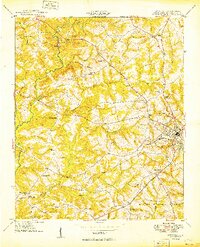 1949 Abbeville1949 Print · USGSAbbeville and its surrounding Piedmont countryside are captured here in the late 1940s, centered on the Seaboard Air Line railway. Genealogists and local historians can trace the locations of numerous rural landmarks, including Old Zion Cem, Upper Long Cane Ch, and Watts.2 unique versions available
End of results
Showing maps 1-3 of 3
Top cities near Abbeville
- Greenwood historical maps
- Calhoun Falls historical maps
- Due West historical maps
- Donalds historical maps
- Hodges historical maps
- Troy historical maps
Frequently asked questions
- What are the different types of historical maps available for Abbeville?
- What is the oldest map of Abbeville?
- Where can I purchase historical maps of Abbeville for my home or office?
- Where can I download high-res historical maps of Abbeville?
- Are there historical topographic maps available for Abbeville?
- Is there historical aerial imagery available for Abbeville?
- Where are historical maps of Abbeville sourced from?