Old Maps of Calhoun County, South Carolina for Academic Research
Study the evolution of Calhoun County with 136 high-resolution historic maps. Whether you're teaching, researching, or modeling changes in land use, these maps provide essential visual documentation of urban, environmental, and geographic change.
- Analyze long-term change: Track patterns in development, transportation, and natural features.
- Ideal for environmental or urban studies: Support academic projects with primary historical map data.
- Use in the classroom or lab: Educators and researchers rely on these maps to bring historical context to life.
These maps are a powerful tool for teaching, research, and visualizing how Calhoun County has changed over the decades.
Calhoun County, SC maps
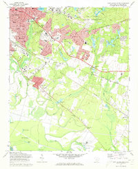
(136)- 1920 Map of Bowman
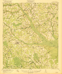
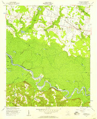
 1920 Bowman1920 Print · USGSIn the early twentieth century, this part of the South Carolina Lowcountry was a landscape of remote settlements and small-scale industry. Genealogists can trace family footprints through numerous community landmarks like Boghette Cem, Livingston Mill, and the Shady Grove Camp Ground.
 - 1921 Map of Bowman
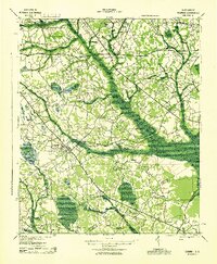
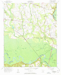
 1921 Bowman1921 Print · USGSIn the early 1920s, the rural community of Bowman was a bustling intersection of country schools and swamp-fed drainage. Genealogists can trace family footprints through dozens of landmarks like Rochette Cemetery, the Campmeeting Grounds, and Livingston Mill.4 unique versions available
 - 1943 Map of Bowman
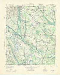
 1943 Bowman1943 Print · USGSThe rural Lowcountry of the 1940s is captured here in detail, showcasing the agrarian life of Orangeburg County. Genealogists can trace family footprints through numerous local landmarks like Bochette Cem, Dawkins Chapel, and Stephens Sch.
 - 1943 Map of Orangeburg
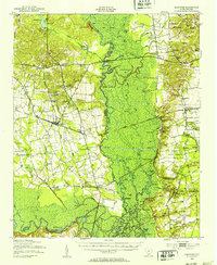
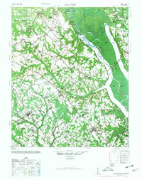
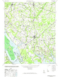
 1943 Orangeburg1943 Print · USGSCoastal plain settlements and river forks define the South Carolina lowcountry during the early war years. Genealogists can trace family landmarks like Bochette Cem, Hunters Chapel Zion Ch, and unique sites like the Indian Field Camp Grounds.
 - 1943 Map of Eastover, 1953 Print
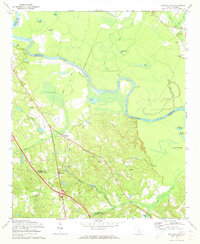
 1943 Eastover1953 Print · USGSIn the early 1940s, the rural landscapes of Richland and Sumter counties centered on the river junctions and thriving rail lines. Genealogists can trace family landmarks like Good Hope Ch and Bethel Sch or follow the path of the Kings Highway.
 - 1944 Map of Edmund, 1966 Print
 1944 Edmund1966 Print · USGSLexington County and the southern fringes of Columbia are shown in detail during the final years of World War II. Researchers can locate family landmarks like Saxe Gotha Sch, the Columbia Air Base, and Huckabaas Millpond.
 - 1946 Map of Elloree
 1946 Elloree1946 Print · USGSCoastal plain settlements and rising reservoir waters define this mid-1940s landscape in the Santee River basin. Genealogists and historians can trace the foundations of Langsynt Plantation, locate numerous rural churches like Mizpah Ch, or study the rail corridor through Lone Star.2 unique versions available
 - 1946 Map of Woodford
 1946 Woodford1946 Print · USGSThe mid-century rural landscape of Orangeburg and Lexington Counties is captured here as the Edisto River basin supported a network of small mill towns. Genealogists can trace family connections to numerous local landmarks like Kings Grove Ch, Darian Sch, and Pooles Millpond.3 unique versions available
 - 1946 Map of St. Matthews
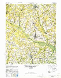
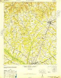 1946 St. Matthews1946 Print · USGSSouth Carolina’s agricultural heartland is documented here in the mid-forties as the rail lines connected rural crossroads to the county seat. Genealogists can trace family landmarks and community centers like Bethlehem Church, Hammond Crossroads, and the historic Old Ninety-Six Road.2 unique versions available
 - 1948 Map of Hopkins
 1948 Hopkins1948 Print · USGSRichland and Calhoun counties are captured here just after the war, showing the expansion of federal military sites into the rural South Carolina landscape. Genealogists can locate family-named landmarks like Coughmans Pond and dozens of country schools including Lower Richland High Sch and Hopkins Sch.3 unique versions available
 - 1953 Map of Saylors Lake, 1957 Print
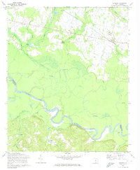
 1953 Saylors Lake1957 Print · USGSThe Congaree River bottomlands and Calhoun County hills are captured here in the early fifties, showing a rural landscape of family cemeteries and country churches. Genealogists can trace sites like Kaigler Cemetery, Heyward School, and Sandy Run Church.
 - 1953 Map of Fort Jackson South, 1957 Print
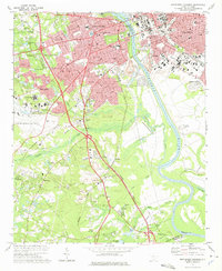
 1953 Fort Jackson South1957 Print · USGSMid-century Richland County emerges as a landscape of suburban growth and military activity just outside the state capital. Genealogists and local historians can trace rural communities like Lykesland and Hopkins alongside institutional landmarks like Rock Hill School and Zion Chapel No 2.
 - 1953 Map of Gadsden, 1957 Print
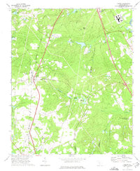
 1953 Gadsden1957 Print · USGSThe rural lowcountry of Richland and Calhoun Counties comes into focus in the early fifties, following the Congaree River. Genealogists can trace old family sites near Gadsden, Weston, and local landmarks like Zion Pilgrim Church and the Clayton School.
 - 1953 Map of Wateree, 1957 Print
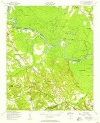
 1953 Wateree1957 Print · USGSRichland and Calhoun counties meet here in the early fifties at the confluence of the Congaree and Wateree rivers. Trace the old rail junctions at Kingville and find local history at Joyner Cemetery, Stoney Hill School, and Mount Olive Church.4 unique versions available
 - 1954 Map of Augusta
 1954 Augusta1954 Print · USGSThe Savannah River valley and South Carolina Midlands are captured here during a period of post-war growth. Researchers can trace the rail-and-river economy through the Southern RR corridor and locate historic settlements like Aiken, Orangeburg, and Sumter.
 - 1957 Map of Augusta, 1966 Print
 1957 Augusta1966 Print · USGSThe Savannah River and Santee basins are captured here during a period of massive military and industrial expansion in the late fifties. Genealogists can trace family footprints across Four Hole Swamp or near the Savannah River Plant.3 unique versions available
 - 1958 Map of Augusta
 1958 Augusta1958 Print · USGSThe borderlands between Georgia and South Carolina come alive in the 1950s, showing the early footprint of the Savannah River Plant. Genealogists and historians can trace rail-dependent towns and rural landmarks from Orangeburg to the Fort Jackson Military Reservation.
 - 1961 Map of Augusta
 1961 Augusta1961 Print · USGSThe South Carolina lowcountry and CSRA appear here in the early sixties, during a period of massive military and industrial growth. Researchers can trace the development of the Savannah River Plant or locate legacy landmarks like Nelson Ferry and Magnolia Cemetery.2 unique versions available
 - 1962 Map of Augusta
 1962 Augusta1962 Print · USGSThe South Carolina and Georgia borderlands are seen here in the early sixties, showing the rise of the Savannah River Plant and the expansion of Fort Jackson. Researchers can trace old rail lines like the Southern Railway and find landmarks such as St. Pauls Church or the Santee Canal.
 - 1971 Map of Summerton
 1971 Summerton1971 Print · USGSThe Clarendon County countryside comes alive in this mid-century survey, showing the transition from the Poinsett forest to the shores of Lake Marion. Genealogists can trace family roots through numerous local landmarks like Wells Sch, St Pauls Ch, and the historic Fort Watson.2 unique versions available
 - 1972 Map of Saylors Lake, 1973 Print
 1972 Saylors Lake1973 Print · USGSThe Congaree River valley in the early 1970s reveals a landscape of oxbow lakes and rural settlements along the Calhoun and Lexington county lines. Genealogists can locate numerous local landmarks like Sandy Run Ch, Oak Grove Cem, and Mt Zion Ch.2 unique versions available
 - 1972 Map of Fort Jackson South, 1973 Print
 1972 Fort Jackson South1973 Print · USGSRichland County undergoes significant postwar expansion in the early seventies as the capital city grows toward the military boundary. Genealogists and historians can trace local landmarks like Greenlawn Memorial Park, Zion Chapel No 2 Ch, and the rail stops at Lykes and Hopkins.3 unique versions available
 - 1972 Map of Gadsden, 1974 Print
 1972 Gadsden1974 Print · USGSRichland and Calhoun counties are defined by the winding Congaree River in this early 1970s survey. Genealogists and local historians can locate many rural landmarks including Mt Moriah Ch, Gadsden Sch, and the SOUTHERN railroad line.3 unique versions available
 - 1972 Map of Southwest Columbia, 1975 Print
 1972 Southwest Columbia1975 Print · USGSGreater Columbia in the early seventies shows a landscape of rapid suburban expansion balanced against the industrial Congaree riverfront. Researchers can trace the mid-century layout of the Columbia Metropolitan Airport, the Columbia Speedway, and local landmarks like Mt Pisgah Ch.2 unique versions available
 - 1972 Map of Gaston, 1975 Print
 1972 Gaston1975 Print · USGSThe rural midlands of South Carolina are captured here in the early seventies as the local economy shifted from traditional millponds to modern infrastructure. Genealogists can locate family landmarks like Sandy Run Academy, Travis Academy, and Little Zion Ch along the Seaboard Coast Line corridor.2 unique versions available
Showing maps 1-25 of 136
Top cities of Calhoun County
Frequently asked questions
- What are the different types of historical maps available for Calhoun County?
- What is the oldest map of Calhoun County?
- Where can I purchase historical maps of Calhoun County for my home or office?
- Where can I download high-res historical maps of Calhoun County?
- Are there historical topographic maps available for Calhoun County?
- Is there historical aerial imagery available for Calhoun County?
- Where are historical maps of Calhoun County sourced from?