1960s Maps of Charleston County, South Carolina
Explore 14 historic maps of Charleston County from the 1960s. These maps offer a rare glimpse into what life looked like during the 1960s — showing old roads, neighborhoods, homes, and landmarks that have changed or disappeared over time.
Whether you're researching your family's past, planning a metal detecting trip, or studying how Charleston County's landscape evolved across the 1960s, these high-resolution maps are a powerful tool for exploring the history of this region.
- Focus on a specific era: All maps on this page are from the 1960s, giving you a focused view of this time period.
- See what’s changed: Compare century-old streets, trails, and buildings to today's modern landscape using overlays and satellite layers.
- Research with precision: Use these maps for genealogy, historical research, land use analysis, or educational projects.
- View, download, or print: Maps are fully viewable online in high resolution, and can be downloaded or printed for your own records.
Start exploring Charleston County's history through authentic maps from the 1960s. This is your window into the past.
Charleston County, SC maps
(14)- 1960 Map of Savannah
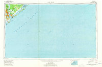
 1960 Savannah1960 Print · USGSCoastal Georgia and the South Carolina Lowcountry are captured in the late fifties, showcasing the intricate web of islands and tidal rivers before modern expansion. Researchers can trace the rail lines of the Atlantic Coast Line or locate sites like Parris Island, Beaufort, and the Tybee Lighthouse.
 - 1960 Map of Bennetts Point, 1964 Print
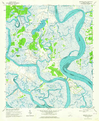 1960 Bennetts Point1964 Print · USGSThe South Carolina Lowcountry is captured in the early 1960s, showing the intersection of the Ashepoo and Edisto rivers. Genealogists and historians can trace coastal settlements like Bennetts Point, locate the Bennetts Point Sch, and explore the marshes of Jehossee Island.3 unique versions available
 - 1960 Map of Ravenel, 1964 Print
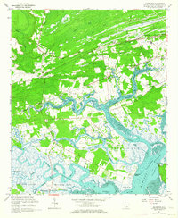
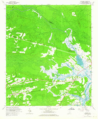 1960 Ravenel1964 Print · USGSCoastal South Carolina's Lowcountry is captured here in the early 1960s, showing a landscape defined by rail lines and tidal swamps. Researchers can locate family landmarks like Miley Hill Sch, St Pauls Ch Cem, and the crossing at Rantowles.4 unique versions available
 - 1960 Map of Fenwick, 1964 Print
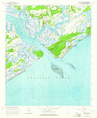
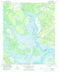 1960 Fenwick1964 Print · USGSThe Charleston and Colleton county line follows the winding Edisto River in this early 1960s survey of the South Carolina Lowcountry. Genealogists and local historians can trace family locations near Willtown Bluff, Airy Hall, and several rural churches like Shiloh Ch.2 unique versions available
 - 1960 Map of Wadmalaw Island, 1964 Print
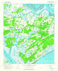
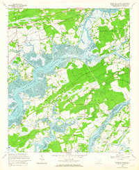 1960 Wadmalaw Island1964 Print · USGSCoastal South Carolina in the early sixties reveals a landscape of tidal islands and rail-connected settlements before modern development. Genealogists can trace family roots through numerous local landmarks like Wadmalaw Sch, St Marys Ch, and Chaplin Cem.2 unique versions available
 - 1960 Map of Adams Run, 1964 Print
 1960 Adams Run1964 Print · USGSThe South Carolina Lowcountry is captured here in the early sixties, showing a tidal landscape of river junctions and rural hamlets. Genealogists and historians can trace family locations through numerous landmarks like Prices Cem, Baptist Hill, and St Pauls Sch & Ch.3 unique versions available
 - 1960 Map of Rockville, 1964 Print
 1960 Rockville1964 Print · USGSThe South Carolina Lowcountry remains a world of winding tidal creeks and quiet island settlements during the early 1960s. Genealogists and local historians can trace the foundations of Rockville and Rockland or locate St Johns Ch and the coastal landmarks of Seabrook Island.4 unique versions available
 - 1960 Map of Edisto Island, 1965 Print
 1960 Edisto Island1965 Print · USGSEdisto Island and the surrounding South Carolina Lowcountry are captured in the early sixties, showing a landscape shaped by tidal creeks and coastal tradition. Genealogists can locate community anchors like Greater Calvary Ch, Bethlehem Ch, and the settlement at Freedman.3 unique versions available
 - 1961 Map of Augusta
 1961 Augusta1961 Print · USGSThe South Carolina lowcountry and CSRA appear here in the early sixties, during a period of massive military and industrial growth. Researchers can trace the development of the Savannah River Plant or locate legacy landmarks like Nelson Ferry and Magnolia Cemetery.2 unique versions available
 - 1961 Map of Savannah
 1961 Savannah1961 Print · USGSThe Georgia and South Carolina Lowcountry comes alive in this mid-century survey of coastal marshes, barrier islands, and river networks. Genealogists and historians can trace the paths of the Seaboard Air Line RR, locate family sites near Isle of Hope, or study the grounds of Fort Stewart Military Reservation.2 unique versions available
 - 1962 Map of Augusta
 1962 Augusta1962 Print · USGSThe South Carolina and Georgia borderlands are seen here in the early sixties, showing the rise of the Savannah River Plant and the expansion of Fort Jackson. Researchers can trace old rail lines like the Southern Railway and find landmarks such as St. Pauls Church or the Santee Canal.
 - 1967 Map of Georgetown
 1967 Georgetown1967 Print · USGSThe South Carolina Lowcountry and Grand Strand meet in the late sixties, showcasing a coastal landscape transitioning from river-based industry to seaside tourism. Researchers can trace the Intracoastal Waterway past Georgetown or locate historical sites like Fort Fisher and Murrells Inlet.
 - 1968 Map of James Island
 1968 James Island1968 Print · USGSThe South Carolina Lowcountry in the late sixties shows a transition between its historic coastal defenses and modern expansion. Trace the harbor landscape from Charleston to the barrier islands, finding landmarks like Fort Sumter, Fort Moultrie, and Carolina Skyways.
 - 1969 Map of James Island, 1971 Print
 1969 James Island1971 Print · USGSThe South Carolina coast and Charleston Harbor are documented here in the late sixties, showing a landscape defined by naval history and barrier island growth. Genealogists and historians can trace the footprint of Scanlonville, Folly Beach, and the historic Ft Moultrie.2 unique versions available
End of results
Showing maps 1-14 of 14
Top cities of Charleston County
- Mount Pleasant historical maps
- Hollywood historical maps
- Isle of Palms historical maps
- Ravenel historical maps
- Folly Beach historical maps
- Seabrook Island historical maps
See more
Frequently asked questions
- What are the different types of historical maps available for Charleston County?
- What is the oldest map of Charleston County?
- Where can I purchase historical maps of Charleston County for my home or office?
- Where can I download high-res historical maps of Charleston County?
- Are there historical topographic maps available for Charleston County?
- Is there historical aerial imagery available for Charleston County?
- Where are historical maps of Charleston County sourced from?