Old Maps of Fairfield County, South Carolina for Genealogy
Trace your family roots with 143 historic maps of Fairfield County. These high-res maps reveal old neighborhoods, homesites, landmarks, and streets — helping you uncover where your ancestors lived and how the area evolved over time.
- Explore historic neighborhoods: Identify where your relatives may have lived in the 1800s or 1900s.
- Compare maps over time: Trace the changes in streets, buildings, and landmarks for multi-generational research.
- Perfect for genealogy & ancestry research: Used by family historians and researchers to map out lineage and migration.
These maps are an incredible resource for exploring your personal connection to Fairfield County's past.
Fairfield County, SC maps
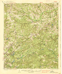
(143)- 1904 Map of Columbia
 1904 Columbia1904 Print · USGSRichland and Fairfield counties at the turn of the century are defined by their river-and-rail corridors and rural church communities. Genealogists can trace family footprints across Broad River ferries, the Southern R.R., and landmarks like The Old Brick Church or Winnsboro.2 unique versions available
 - 1935 Map of Killian
 1935 Killian1935 Print · USGSRichland County at the height of the mid-1930s is a landscape of rural schoolhouses and growing military infrastructure. Genealogists can trace family landmarks like Kelley Cem, Bookman Mill, and dozens of local churches including Roundtop Ch.2 unique versions available
 - 1937 Map of Killian
 1937 Killian1937 Print · USGSRichland and Kershaw counties in the mid-1930s show a landscape of growing military installations and rural community life. Genealogists can trace family names through dozens of landmarks like Bookmans Mill, Sand Level Sch, and Union Baptist Ch.4 unique versions available
 - 1941 Map of Spartanburg
 1941 Spartanburg1941 Print · USGSSouth Carolina’s Piedmont and Sandhills regions are shown here during the mid-century peak of the rail era. Researchers can trace the sprawling Fort Jackson Military Reservation and the industrial growth of hubs like Spartanburg and Rock Hill.
 - 1942 Map of Camden
 1942 Camden1942 Print · USGSMid-century South Carolina comes into focus along the Wateree River as the region's rail and agricultural networks reached their peak. Genealogists and historians can trace old community hubs like Boykin Mill, Friends Neck Ch, and the grounds of the Sand Hill Experimental Station.
 - 1947 Map of Richtex, 1969 Print
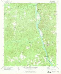
 1947 Richtex1969 Print · USGSRichland and Fairfield counties meet along the Broad River in the late 1940s, showing a landscape of river-bend settlements and rural rail stops. Local historians can locate numerous small-community landmarks like Zion Pilgrim Ch, the Leitner Grove Sch & Cem, and the river crossing at Ashley Bridge.
 - 1949 Map of Richtex
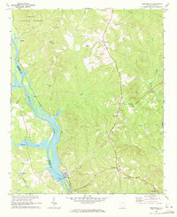
 1949 Richtex1949 Print · USGSMid-century Fairfield and Richland counties are captured here along the banks of the Broad River just after the war. Local historians can trace family roots through numerous landmarks like Haltiwanger Cem, Wallaceville Sch, and the riverside stop at Richtex.
 - 1949 Map of Irmo NE
 1949 Irmo NE1949 Print · USGSThe border of Richland and Fairfield counties is captured here in the late 1940s, showing a rural landscape of scattered homesteads and community schools. Researchers can locate family landmarks and early congregations including Taylor Chapel Ch, St Andrews Ch, and the Wirick Cem.
 - 1953 Map of Blythewood, 1957 Print
 1953 Blythewood1957 Print · USGSMid-century Richland County is captured here at a time when rural schoolhouses and local rail lines still shaped the community north of Columbia. Genealogists can trace family footprints at Browns Cemetery or follow the SOUTHERN railroad through Blythewood and Killian.
 - 1953 Map of Spartanburg, 1966 Print
 1953 Spartanburg1966 Print · USGSMid-century South Carolina comes into focus through this survey of the Piedmont and the Sand Hills at a time of significant reservoir expansion. Researchers can trace the legacy of industrial transit and resource extraction from the Haile Gold Mine to the rail hubs of the Seaboard Air Line.4 unique versions available
 - 1960 Map of Spartanburg
 1960 Spartanburg1960 Print · USGSThe South Carolina Piedmont and North Carolina borderlands come alive in this mid-century survey of the region between Spartanburg and Columbia. Researchers can trace the Seaboard Air Line railroad and explore landmarks like Anderson Quarry, Lake Murray, and Mount Croghan.2 unique versions available
 - 1963 Map of Spartanburg
 1963 Spartanburg1963 Print · USGSMid-century South Carolina comes alive in this survey, showing the rail-linked corridor between the Upstate and the Midlands. Genealogists can trace family lands near old hubs like Union and Lancaster, or along the banks of the Broad River and Pee Dee River.
 - 1964 Map of Spartanburg
 1964 Spartanburg1964 Print · USGSMid-century South Carolina comes alive in this survey of the Piedmont and Upcountry, stretching from the Blue Ridge foothills to the Sandhills. Genealogists and historians can trace the rail-and-river economy through Monarch Mills, Glenn Springs, and the Southern Railway corridor.
 - 1968 Map of Blackstock, 1973 Print
 1968 Blackstock1973 Print · USGSThe borderlands of Chester and Fairfield Counties are shown here in the late sixties as the SOUTHERN rail line still connects rural hubs. Genealogists can trace local roots through numerous country sanctuaries like Armenia Ch and the crossroads at Blackstock.2 unique versions available
 - 1969 Map of Great Falls, 1971 Print
 1969 Great Falls1971 Print · USGSGreat Falls and the Catawba River corridor are captured here in the late sixties as the region’s industrial and hydroelectric network matured. Genealogists and local historians can trace family locations near Beckhamville, Mitford, and rural sanctuaries like Heath Chapel.
 - 1969 Map of Lebanon, 1972 Print
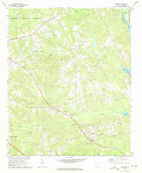
 1969 Lebanon1972 Print · USGSFairfield County's rural landscape is captured here in the late sixties, showing a community built around the Little River and its many tributaries. Researchers can trace family sites near Lebanon, the Old Stone Church Cem, and the Southern railroad line.
 - 1969 Map of Pomaria, 1972 Print
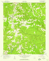
 1969 Pomaria1972 Print · USGSThe rural landscapes of Newberry County are captured here in the late sixties, centered on the railroad town of Pomaria. Genealogists and local historians can trace family locations through numerous sites like Taylors Crossroads, Germany Sch, and Stone Cem.
 - 1969 Map of Blair, 1972 Print
 1969 Blair1972 Print · USGSThe riverfront and timberlands of Newberry and Fairfield counties are captured here in the late sixties as the Southern railroad winds through the Sumter National Forest. Genealogists can trace rural communities like Maybinton and Glymphville alongside historic congregations at Ebenezer Ch and Mt Pleasant Ch.2 unique versions available
 - 1969 Map of Jenkinsville, 1972 Print
 1969 Jenkinsville1972 Print · USGSFairfield and Newberry counties are captured here in the late sixties as the river-and-rail economy shaped rural life along the Broad River. Genealogists can trace family roots through numerous local landmarks like Old Brick Ch, White Hall Sch, and the Parr Shoals Dam.2 unique versions available
 - 1969 Map of Salem Crossroads, 1972 Print
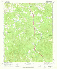
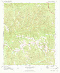
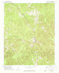 1969 Salem Crossroads1972 Print · USGSFairfield County's rural character is preserved in this late 1960s study of a landscape defined by forest and family faith. Genealogists can trace local roots through sites like Feaster Cem and Zion Hopewell Ch near Salem Crossroads.
 - 1969 Map of Winnsboro, 1973 Print
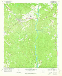
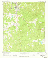
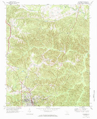 1969 Winnsboro1973 Print · USGSFairfield County in the late sixties reveals a network of rural church communities and railroad stops centered around the town of Winnsboro. Genealogists and researchers can trace local family landmarks such as St Johns Ch, White Oak, and the Cason Cem.2 unique versions available
 - 1969 Map of Stover, 1973 Print
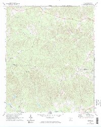 1969 Stover1973 Print · USGSThe rural Piedmont landscape near the Chester and Fairfield County line is captured here in the late sixties. Researchers can find generational landmarks including Gold Mine Cem, Aimwell Ch Cem, and the small community of Stover.2 unique versions available
 - 1969 Map of Rion, 1973 Print
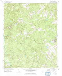 1969 Rion1973 Print · USGSFairfield County in the late sixties reveals a landscape shaped by granite quarrying and a high density of rural congregations. Researchers can trace the Rockton and Rion line, locate the Kelly Miller Sch, and find family-named sites like Milling Crossroads.
 - 1969 Map of Carlisle, 1973 Print
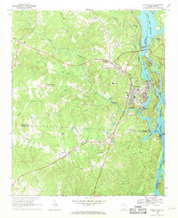
 1969 Carlisle1973 Print · USGSCarlisle and the Broad River valley are shown here in the late sixties at the crossroads of two major railroads. Genealogists and historians can trace family locations near Hill Cem, the settlement of Tuckertown, and the St Lukes Ch.2 unique versions available
 - 1969 Map of Winnsboro Mills, 1973 Print
 1969 Winnsboro Mills1973 Print · USGSFairfield County in the late sixties reveals a landscape shaped by textile production and rural rail lines. Genealogists and local historians can trace family locations near Winnsboro Mills, Simpson, and numerous country churches like New Haven Ch or Shiloh Ch.2 unique versions available
Showing maps 1-25 of 143
Top cities of Fairfield County
Frequently asked questions
- What are the different types of historical maps available for Fairfield County?
- What is the oldest map of Fairfield County?
- Where can I purchase historical maps of Fairfield County for my home or office?
- Where can I download high-res historical maps of Fairfield County?
- Are there historical topographic maps available for Fairfield County?
- Is there historical aerial imagery available for Fairfield County?
- Where are historical maps of Fairfield County sourced from?